SUMMARY
This is AI generated summarization, which may have errors. For context, always refer to the full article.
MANILA, Philippines – The Philippine government earmarked a total of P202 billion in its 2016 budget to finance road projects. Will these roads help improve the lives of Filipinos? Will they make economic growth more inclusive?
How do you make sure that every single centavo of this sum will help communities access better schools, jobs, health services?
In a highly decentralized country like the Philippines, getting quality and updated information on where roads exist and where they don’t, the state of these roads, much less whether road projects are well planned, prioritized or are implemented right can be challenging. (WATCH: Rappler Talk: What roads matter to you? #OpenRoads)
The numbers are staggering: the entire Philippine road network spans over 216,016 kilometers (km) of roads. Of this vast network, three-quarters remain unpaved. In Northern Mindanao alone, there are 242 on-going road projects according to data from the Department of Public Works and Highways (DPWH). (READ: #TheLeaderIWant: Cebu youth identify roads that matter to them)
It does not help that jurisdiction over roads in the Philippines is so fragmented: with national government responsible for only 15 percent of the entire road network and responsibility over the rest of it (85 percent) resting on local government units: 81 provinces, around 1,600 cities and municipalities and some 42,000 barangays.
Bulk of unpaved roads are supposedly managed by these local government units. There is no central system at the moment that helps the public see the entire Philippine road network at a glance.
How do we fix this problem?
Citizen feedback is key to improving the quality of roads in the country.
When communities demand accountability and transparency over road projects, government officials and leaders are obligated to provide better information and, eventually, better infrastructure. Here are some things you can do:
1. Join the conversation on #OpenRoads on Twitter, Facebook and Instagram
Talk about the roads that matter to you and to your community. Are these roads in bad shape or are they infrastructure we can take pride in? Is your local government or local engineering district implementing road projects properly? Do you think additional roads should be built to better link critical facilities in your community? If funds are not enough to pave the entire network, what projects should be prioritized? (READ: #OpenRoads: Share photos of roads that matter to you)
Follow the instructions below:
- If you have photos or videos of the road that matters to you, share it with us!
- Tell us why this road matters and use #OpenRoads.
- Make sure your precise location services are turned on. This could be found by clicking the pin icon below.
- Post on your social media account. Make sure your posts are public!
- On Twitter, Facebook or Instagram, get your friends involved by tweeting the infographic below.
- Twitter posts with exact location will be mapped on the Agos Alert Map embedded on this story page.

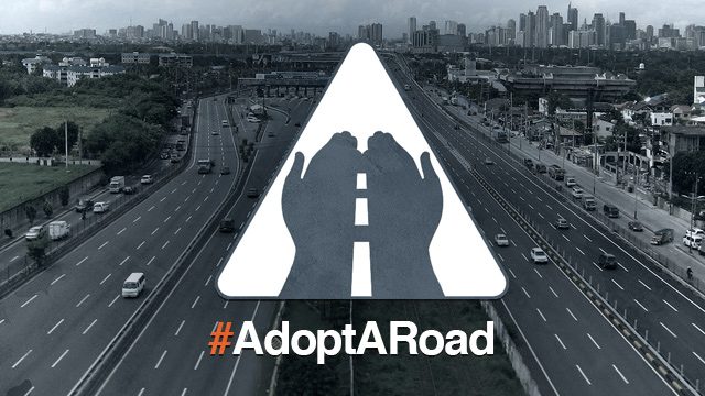
2. #AdoptARoad
Adopting roads that matter to you and to your community means that you commit to monitor these roads by posting about them regularly on Twitter, Facebook or Instagram. (Instructions on how to monitor is also found below.)
Start with sections of roads that you use every day. To adopt a road, fill up the form below with the start and end point of the road section you are adopting, your name, and contact information:
3. Learn more about how roads connect your community to vital services
Working together with the World Bank through its Open Roads initiative, Rappler has assembled information on how roads connect communities to critical facilities such as health facilities, airports, and fishports. You can access these information as well on a special link on the Agos Alert map also embedded on this page.
The map below shows the national roads around Region X. These are identified with the lines in red.
Overlayed on the map are health facilities around the country:
The map also above shows fish ports (pins in green) around the country:
Airports around the Philippines are marked as blue pins:
4. Get your community involved!
Get other members of your community involved in adopting roads that matter, mapping your local road network and talking about what roads will benefit the most people on Twitter, Facebook and Instagram.
Help us sustain the conversation by following Rappler and Move.PH on Facebook by joining facebook.com/groups/openroadsph
Have more questions about this initiative? Email openroads@rappler.com. – Rappler.com
What roads need to be properly maintained or built in order to promote development in poor communities within the country? Let us know. Take photos, turn on precise location and tweet using #OpenRoads!
Learn more about how you can help improve road conditions in the Philippines:
- Rappler Talk: What roads matter to you?
- #TheLeaderIWant: Cebu youth identify roads that matter to them
- #OpenRoads: Share photos of roads that matter to you
- How open data help build better roads, communities
*$1 = P47.19
The #OpenRoads campaign is a partnership between Rappler and the World Bank Group. The World Bank supports the development of the OpenRoads platform, which gathers and provides information on national and local road programs.
Add a comment
How does this make you feel?
There are no comments yet. Add your comment to start the conversation.