SUMMARY
This is AI generated summarization, which may have errors. For context, always refer to the full article.
ANTIQUE, Philippines – Due to its geographical location, the Philippines enjoys a tropical rainforest climate all over the country dominated by a dry and wet or rainy season.
Heavy rains are brought by the summer monsoon to most parts of the archipelago from May to October while the winter monsoon brings cooler and drier air from December to February.
But some studies assert that the Philippines actually undergoes three seasons annually: June to October is the wet and rainy season, November to February is the cool but dry season, and March to May is the hot and dry season.
Since the country is sitting astride the typhoon belt, it suffers an annual onslaught of dangerous storms from July through October. These storms usually devastate the regions of Bicol, Eastern Visayas, Northern and Eastern Luzon.
This brings into question the definition of the term “new normal” in relation to climate patterns and the changing normal in the Philippine temperature and rainfall.
A disaster prone country
In the past decade, the Philippines has severely suffered from natural disasters. It is not a surprise since the country is also situated along the Pacific Ring of Fire.
In December 2011, Typhoon Sendong (Washi), claimed the lives of about 1,200 Filipinos in Mindanao specifically in Cagayan de Oro. It devastated 7 regions in the southern Philippines with more than P2 billion in damages.
Typhoon Pablo (Bopha) devastated Mindanao in December 2012 killing more than 1,000 people with about 800 missing. It left around $1 billion in damages and displaced more than half a million people.
The 7.2 Bohol Earthquake in October 2013 left 222 reported deaths, 8 missing and 976 injured. Although it affected the entire Central Visayas region, particularly Bohol and Cebu, the quake was felt in the whole Visayas area and some provinces in southern Mindanao.
Three weeks after the Bohol Earthquake, Super Typhoon Yolanda (Haiyan) devastated the Visayas area. It laid waste to Samar, Leyte and the surrounding provinces in November 2013. Known as the most powerful typhoon in Philippine history, it left 6,201 people dead, 1,785 missing and more than 28,000 injured.
The new normal
According to Dr Rosa Perez of the Manila Observatory, normal literally means standard, usual, typical or expected. In the context of climate normal, it means the standard, usual, and typical effects of the climate whose patterns are expected or somehow predictable.
Climate Normal refers to the three-decade averages of climatological variables including temperature and precipitation. It is produced once every 10 years and the 1981 – 2010 period dataset is the most recent of climate normals.
The pre-industrial period was said to be the old normal which was characterized by a more stable and predictable climate pattern.
Climate change is amplifying extreme weather events regionally, thus, the new normal is characterized by heavy precipitation episodes, severe flooding, heat waves, wild fires, searing droughts, and more intense tropical cyclones. (READ: Small islands, big problems: Poverty, isolation increase vulnerability)
The year 2014 was the warmest year on record, with an average global temperature of 0.69˚C above the 20th century average.
“This is not a problem which can be solved by one person or country alone but we need the concerted efforts of all key players in the society. Increased temperature in the Philippines is .69, thus, the Philippines is not yet there,” presented Perez.
The changing normal
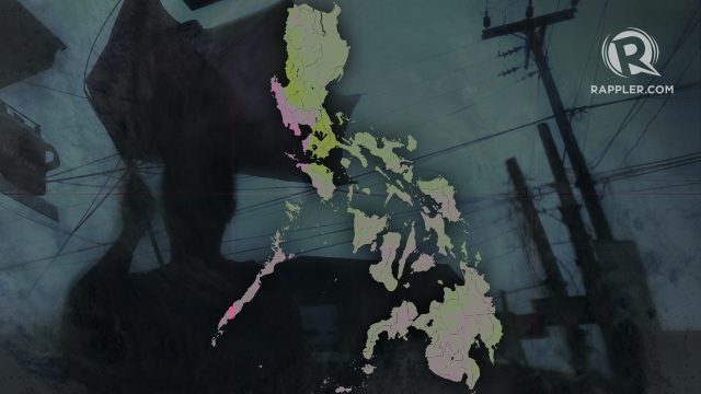
According to data from the Manila Observatory, the changing normal projects that there will be seasonal rainfall and temperature change as well as extreme temperature rainfall events in the Philippines.
“Actually what I presented is the worst case scenario. There is a window of opportunity for a more sustainable future,” Perez said.
“We need to first understand what is happening now, as we are detecting these changes, we need to address them and correct whatever is wrong with the development pathway,” she added.
In seasonal rainfall change, generally, there is reduction in rainfall in most parts of the country during the summer, and too much rain during the wet period.
Seasonal temperature change means all areas of the country will get warmer, more so in the relatively warmer summer months.
Extreme temperature events include hot temperatures which will continue to be more frequent in the future (>35˚C).
For extreme rainfall events, heavy daily rainfall will continue to become more frequent. Extreme rainfall is projected to increase in Luzon and Visayas only, while the number of dry days is expected to increase in all parts of the country by 2020.
“We suffer from the effects of climate change despite lower greenhouse effect production. Is it correct to say that the effect should rightly be felt by other nations who are great producers of greenhouse gases?,” asked Delvi Balasbas, DRR Officer of Concepcion, Iloilo.
Perez, however, warned against looking at who produces what or pointing fingers to any country or group.
Instead, there is a “need to work together and set aside differences.”
Stronger typhoons
In June 2015, the Philippine Atmospheric, Geophysical and Astronomical Services Administration (PAGASA) warned the country to prepare for stronger cyclones this year due to the El Niño phenomenon.
The abnormal warming and the rising temperature of the sea during El Niño may trigger intense cyclones and cause the erratic behavior of the tropical cyclones.
It was estimated that at least 11 to 16 tropical cyclones will enter the Philippine Area of Responsibility (PAR) between June to December this year.
In May 2015, PAGASA confirmed the revision of the storm warning system to include Public Storm Warning Signal (PSWS) No. 5 in the classification due to the increasing intensity of tropical cyclones affecting the Philippines.
In the past, PAGASA only used to consider Signal No. 3 as the strongest.
“Don’t be scared, we are still very far. Climate and non-climate factors are inseparable. We need to collect all our efforts to counter the effects of climate change,” Perez said. – Rappler.com
Anthony Mondragon holds a degree in Journalism from West Visayas State University and is taking up a Masters’ Degree in Mass Communication from the same university. He currently works as the Knowledge Management Coordinator for the Antique Federation of Non-Government Organizations (AFON), Inc.
Add a comment
How does this make you feel?
There are no comments yet. Add your comment to start the conversation.