SUMMARY
This is AI generated summarization, which may have errors. For context, always refer to the full article.

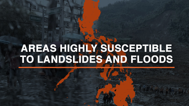
MANILA, Philippines – Residents of certain communities in Aurora, Isabela, and Cagayan should prepare for possible floods and landslides caused by Tropical Storm Chedeng (Maysak), the National Disaster Risk Reduction and Management Council (NDRRMC) warned on Saturday, April 4.
At a briefing held at the NDRRMC Conference Center, the Mines and Geosciences Bureau (MGB) identified areas prone to floods and landslides within the path of Chedeng. These areas were determined by mapping the topography or elevation of the land, as well as the slope of the mountain sides.
Learn how to use hazard maps. According to the MGB, the following areas in Aurora are “highly susceptible” to flooding and landslides.
- Click on the areas below to see which are vulnerable to flooding and landslides.
- To collapse the list, click on the name of the area again or the arrow at the right.
Flooding
- Zabali
- Calabuanan
- Obligacion
- Reserva
- Sabang
- Buhangin
- Barangay V (Pob.)
- Pingit
Landslide
- Zabali
- Sabang
- Pingit
Flooding
- Ditinagyan
- Dibacong
- Calabgan
- Dibet
- Cozo
- Esteves
- Calangcuasan
- Calantas
- Esperanza
- Marikit
- Tabas
- Culat
- Lual
- Tinib
- Calabuanan
- Barangay 2 (Pob.)
- Barangay 6 (Pob.)
- Barangay 4 (Pob.)
- Barangay 1 (Pob.)
- Barangay 8 (Pob.)
- Barangay 7 (Pob.)
- Barangay 3 (Pob.)
- Barangay 5 (Pob.)
Flooding
- Dikabasan
- Dilaguidi
- Diagyan
- Lawang
- Ura
- Manggitahan
- Esperanza
- Diniog
- Dimaseset
Landslide
- Manggitahan
- Dimaseset
- Dicabasan
- Dilaguidi
- Diagyan
- Lawang
- Diniog
- Esperanza
- Masagana (Pob.)
- Ura
Flooding
- Digumased (Pob.)
- Dibulo
- Dimaluade
Landslide
- Ayod
- Digumased (Pob.)
- Dibulo
- Bucal Norte
- Dimaluade
- Bucal Sur
Flooding
- Dicabisagan East (Pob.)
- Dicabisagan West (Pob.)
- Dimalicu-licu
- Dimatican
- Maligaya
- Dialaoyao
- Culasi
Landslide
- Dimasari
- Didiyan
- Diddadungan
- Villa Robles
- Bisag
- Alomanay
- Dicabisagan West (Pob.)
- Dimalicu-licu
- Dialaoyao
- Culasi
Flooding
- Bagay
- Caggay
- Capatan
- Caritan Norte
- Caritan Sur
- Centro 10
- Centro 11
- Centro 12
- Linao East
- Pallua Norte
- Pallua Sur
- Ugac Sur
Flooding
- Agaman Norte
- Agaman Sur
- Alba
- Annayatan
- Asassi
- Awallan
- Bagunot
- Barsat East
- Barsat West
- Bitag Grande
- Bunugan
- C. Versoza
- Canagatan
- Carupian
- Catugay
- Dabbac Grande
Landslide
- Alba
- Barsat West
- Bitag Grandle
- Bitag Piqueno
- Bunugan
- C. Versoza
- Canagatan
- Carupian
- J. Pallagao
- Mabini
- Mocag
- Nangalinan
- San Miguel
- Santa Margarita
- Taytay
- Tunel
Flooding
- Abra
- Aguiguican
- Bangatan Ngagan
- Baracoit
- Cabayu
- Calaoagan Bassit
- Calaoagan Dackel
- Capiddigan
- Casicallan Norte
- Casicallan Sur
- Newagac
- Palagao Norte
- Palagao Sur
- Pina Este
- Pina Weste
- Santa Maria
- Takiki
- Tubungan Este
- Tubungan Weste
- Centro Norte
- Centro Sur
- Cullit
- Cumao
- Cunig
- Dummum
- Guising
- L Adviento
- Langgan
- Mabuno
- Nabaccayan
Flooding
- Alimoan
- Bacsay Cataraoan Norte
- Bacsay Cataraoan Sur
- Bacsay Mapulapula
- Bilibigao
- Buenavista
- Cadcadir East
- Cadcadir West
- Mabnang
- Malilitao
- Pasta East
- San Antonio
- San Vicente
- Santiago
- Tabugan
- Union
- Centro I
- Centro IV
- Centro V
- Centro VI
- Dibalio
- Kilkiling
- Lablabig
- Luzon
- Magdalena
- Nagbasaran
- Pinas
- San Isidro
- Santa Maria
- Santo Tomas
- Taggat Norte
Landslide
- Buenavista
- Centro VIII
- San Isidro
- Cabayu
- San Carlos
- T Elizaga
- Capisayan Norte
- Centro Sure
- Mabuno
- Pina Weste
The MGB presented color-coded hazard maps to highlight the level of susceptibility for floods and landslides in the above areas. These hazard maps can also be found on the Project Agos Alert Map.
Residents in these areas are advised to be alert and evacuate to a safe zone, if necessary.
Learn more about hazard maps here. – Rappler.com
Add a comment
How does this make you feel?
There are no comments yet. Add your comment to start the conversation.