SUMMARY
This is AI generated summarization, which may have errors. For context, always refer to the full article.
MANILA, Philippines – (3rd UPDATE) More than a week after Typhoon Nona (international name Melor) hit the country, a section of the Marikina-Infanta Road – also known as Marcos Highway or Marifanta Road – remains impassable because of a landslide.
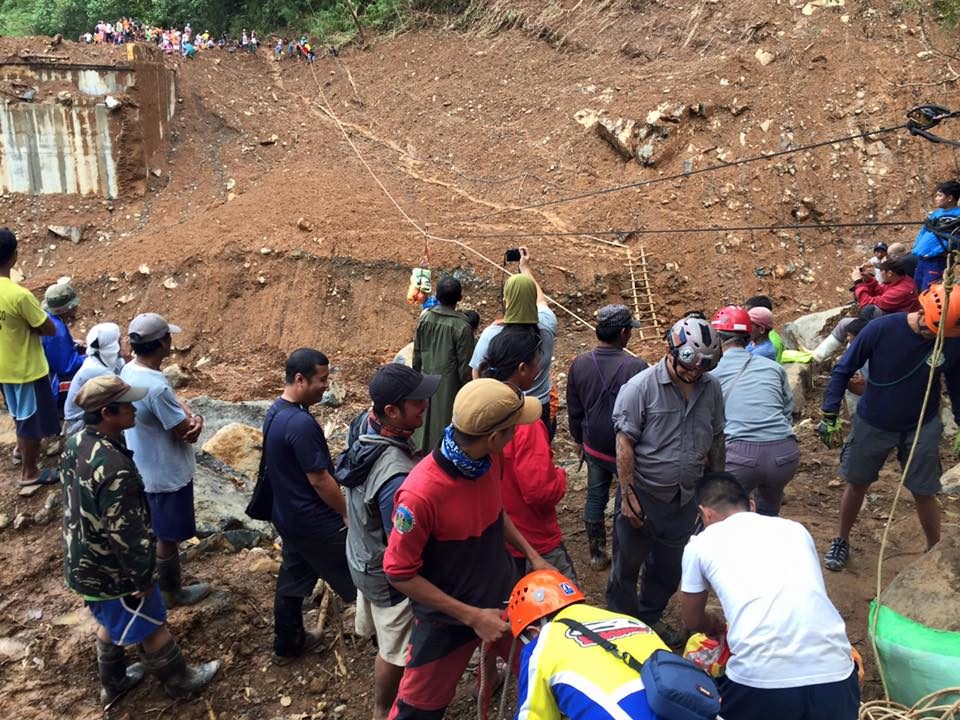
Images from the Riders Anti-Crime & Emergency Response (RACER) group taken on December 31 showed roads that had collapsed or were blocked by debris.
The pictures listed 18 landslides from the 97th to a little past the 107th kilometer mark of the Marikina-Infanta Road. A bridge at 107.1 kilometers had also fallen.
According to Jonjon Guarin, RACER Secretary-General, the road from the 108th kilometer to the 132nd was affected by major landslides as well.
A video taken on December 27 from Amin Hamsa, a member of RACER, showed a hole where the 97th kilometer of the Marikina-Infanta Road once was. The caption on Hamsa’s video said a 10-kilometer stretch was damaged.
Severe damage
Hamsa appealed for help, saying relief could not reach the towns relying on the national highway.
Lt. Col. Christopher Tampus, Commander of the 1st Infantry Battalion in Infanta, said the damage to the Marikina-Infanta Road was severe. The landslide had caused the road to collapse, meaning repairs would be extensive.
Tampus, however, could not yet give an estimated timeframe as to when the repair will be finished. He explained it would be difficult to begin operations if rains continued.
According to Tampus, relief was delivered to the towns using a helicopter. He said they have estimated 50 families to be affected by Nona.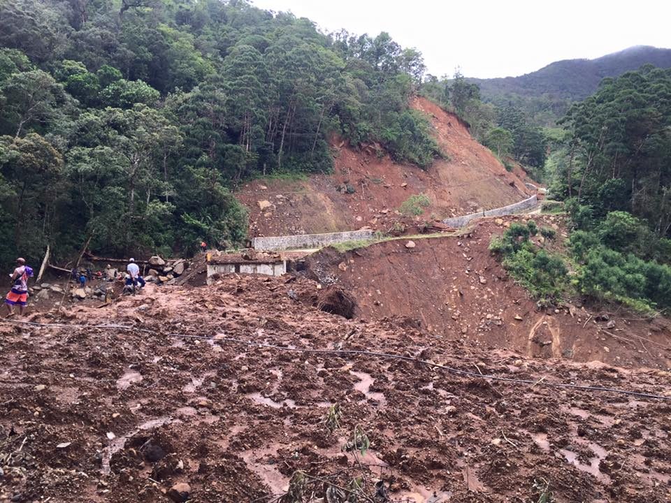
For the meantime, Tampus said residents were advised to avoid the road because of the possibility of further landslides. Instead, people in Infanta can go through Real, then Famy, before going to Tanay or Laguna.
Herbert Zapata, Operations Officer of the Office of Civil Defense (OCD) Region IV-A, said clearing operations are ongoing. He added that the DPWH Regional Office is the lead agency for the highway incident. The Marikina-Infanta Road is a national road.
Separate incident
On the night of December 16, a vehicle traveling along the National Road in Barangay Magsaysay – 14 to 15 kilometers away from Infanta’s center – was hit by a landslide. The car was overturned, killing one passenger, Lt. Michelle Mae Dilos Delariarte.
The other three passengers were able to escape through the window, said Tampus.
In their last report on December 24, the NDRRMC counted 22 bridges and 14 roads that were still impassable. – with reports from Lou Gepuela and Aika Rey/Rappler.com
What roads need to be properly maintained or built in order to promote development in poor communities within the country? Let us know. Take photos, turn on precise location and tweet using #OpenRoads!
Learn more about how you can help improve road conditions in the Philippines:
- #OpenRoads: Adopt roads that matter to you
- 5 iconic roads in the Philippines
- #TheLeaderIWant: Cebu youth identify roads that matter to them
- #OpenRoads: Share photos of roads that matter to you
- How open data help build better roads, communities
The #OpenRoads campaign is done in partnership with the World Bank Group.
Add a comment
How does this make you feel?
There are no comments yet. Add your comment to start the conversation.