SUMMARY
This is AI generated summarization, which may have errors. For context, always refer to the full article.
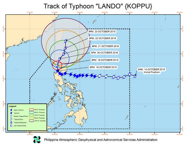
MANILA, Philippines – The state weather bureau on Sunday evening, October 18, said Typhoon Lando (Koppu) continues to move slowly toward the Ilocos and Cordillera regions, and is seen to exit the Philippines’ landmass earlier than expected.
In its 11 pm bulletin on Sunday, the Philippine Atmospheric, Geophysical, and Astronomical Services Administration (PAGASA) raised storm warning signals in the following areas:
SIGNAL NO. 3 – Winds of 121-170 km/h expected in 18 hours
- Benguet
- Ilocos Sur
- La Union
- Ilocos Norte
- Abra
SIGNAL NO. 2 – Winds of 61-120 km/h expected in 24 hours
- Pangasinan
- Zambales
- Nueva Vizcaya
- Ifugao
- Mountain Province
- Kalinga
- Apayao
- Tarlac
SIGNAL NO. 1 – Winds of 30-60 km/h expected in 36 hours
- Bataan
- Pampanga
- Bulacan
- Nueva Ecija
- Northern Quezon
- Quirino
- Aurora
- Isabela
- Cagayan, including Calayan and Babuyan Group of Islands
- Batanes
- Metro Manila
PAGASA also said Lando is likely to exit the Philippines’ landmass in the afternoon or evening of Tuesday, October 20. It is likely to leave the landmass from Ilocos Norte or Cagayan.
PAGASA said Lando now packs maximum sustained winds of 130 km/h near the center and gustiness of up to 160 km/h.
It is seen to move north-northwest at 5 km/h.
Officials said Lando has killed a 14-year-old boy and forced 23,000 others to flee their homes.
It has also prompted local governments to implement measures such as Manila’s “no-walk zone” along Manila Bay. – Rappler.com
Add a comment
How does this make you feel?
There are no comments yet. Add your comment to start the conversation.