SUMMARY
This is AI generated summarization, which may have errors. For context, always refer to the full article.
What’s the weather like in your area? Report the situation through Rappler’s Agos or tweet us at @rapplerdotcom.
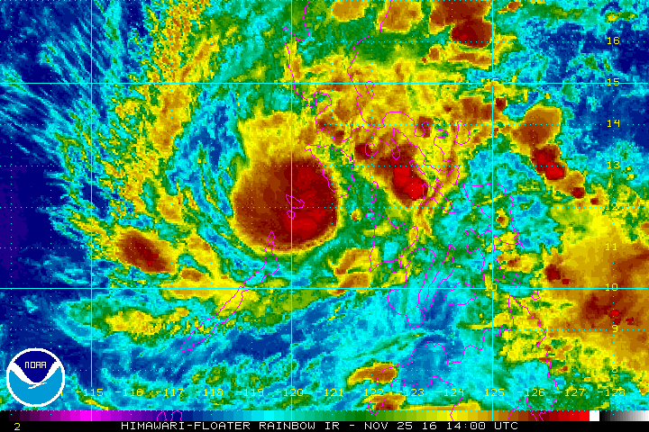
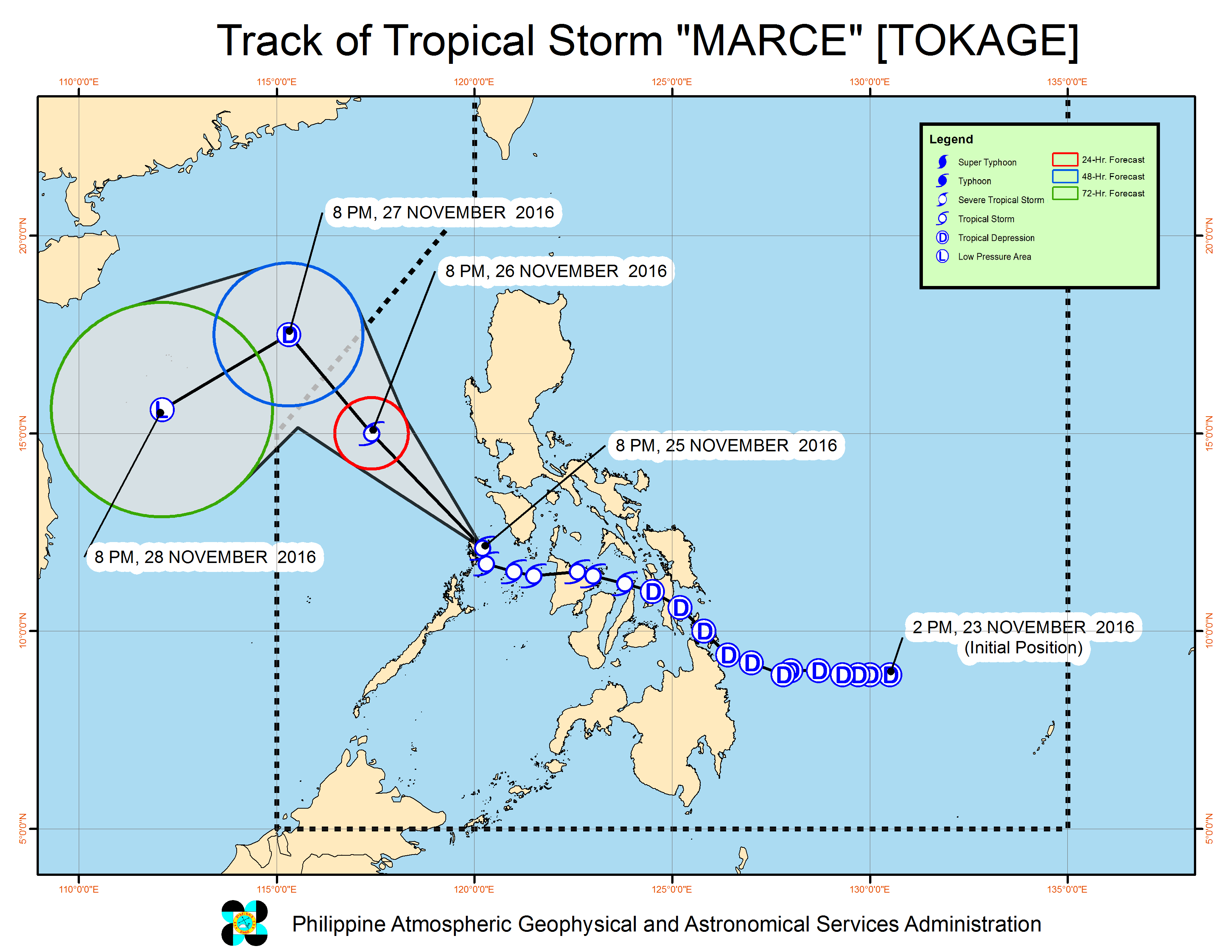
MANILA, Philippines – Tropical Storm Marce (Tokage) maintained its strength as it continued to cross the Calamian Group of Islands late Friday evening, November 25.
In its bulletin issued 11 pm on Friday, state weather bureau PAGASA said Marce was already in the vicinity of Busuanga, Palawan. It is moving northwest at 17 kilometers per hour (km/h).
The tropical storm still has maximum winds of up to 65 km/h and gustiness of up to 100 km/h.
Marce has made landfall 5 times – in Surigao del Norte; Abuyog, Leyte; Daanbantayan, Cebu; Carles, Iloilo; and the Calamian Group of Islands.
Signal number 2 is still raised in Calamian, while signal number 1 remains up over Occidental Mindoro and northern Palawan.
Moderate to heavy rainfall is expected within the 300-km diameter of the tropical storm.
Those in areas under signal numbers 1 and 2, as well as the Bicol Region and the provinces of Aurora and Quezon, should also watch out for possible floods and landslides.
Sea travel remains risky in the northern and eastern seaboards of Northern Luzon and the seaboards of Central Luzon and Southern Luzon.
Marce is expected to leave the Philippine Area of Responsibility (PAR) on Sunday, November 27.
– Rappler.com
Add a comment
How does this make you feel?
There are no comments yet. Add your comment to start the conversation.