SUMMARY
This is AI generated summarization, which may have errors. For context, always refer to the full article.
What’s the weather like in your area? Report the situation through Rappler’s Agos or tweet us at @rapplerdotcom.
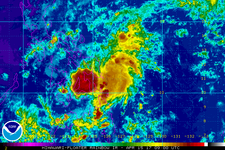
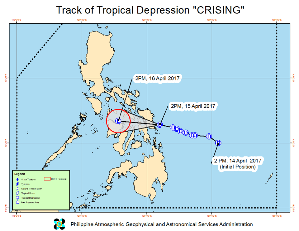
MANILA, Philippines (UPDATED) – State weather bureau PAGASA said Tropical Depression Crising made landfall in Hernani, Eastern Samar at 6:30 pm on Black Saturday, April 15.
In an earlier bulletin issued 5 pm, state weather bureau PAGASA said Crising still has maximum winds of 45 kilometers per hour (km/h), but its gustiness increased to up to 62 km/h from the previous 55 km/h.
As expected, the tropical depression became smaller as it approached land. Fewer areas remain under signal number 1:
- northern part of Cebu
- Northern Samar
- Eastern Samar
- Samar
- Biliran
- Leyte
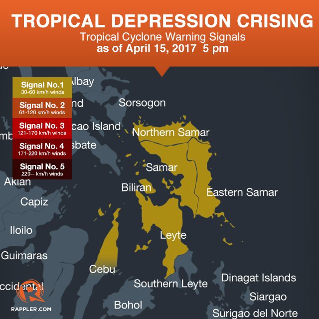
Though Crising now has a smaller 150-km diameter, moderate to heavy rain may still trigger flash floods and landslides in areas under signal number 1. Residents and Holy Week travelers in the tropical depression’s path are advised to stay on alert.
After hitting Hernani, Crising is expected to weaken into a low pressure area (LPA) within 3 to 6 hours, or on Saturday night. As an LPA, it will then cross the rest of the Visayas, where it will bring light to moderate rain.
“Kahit low pressure area, mag-ingat pa rin po tayo,” said PAGASA forecaster Aldczar Aurelio in a press briefing late Saturday afternoon.
(Even if it weakens into a low pressure area, we should still take precautions.)
Meanwhile, Aurelio added that there will be isolated thunderstorms in Caraga, Calabarzon, and Bicol. Metro Manila will have generally good weather. – Rappler.com
Add a comment
How does this make you feel?
There are no comments yet. Add your comment to start the conversation.