SUMMARY
This is AI generated summarization, which may have errors. For context, always refer to the full article.
What’s the weather like in your area? Report the situation through Rappler’s Agos or tweet us at @rapplerdotcom.
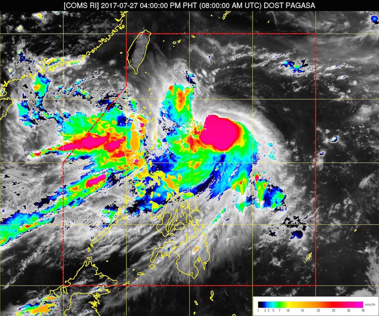
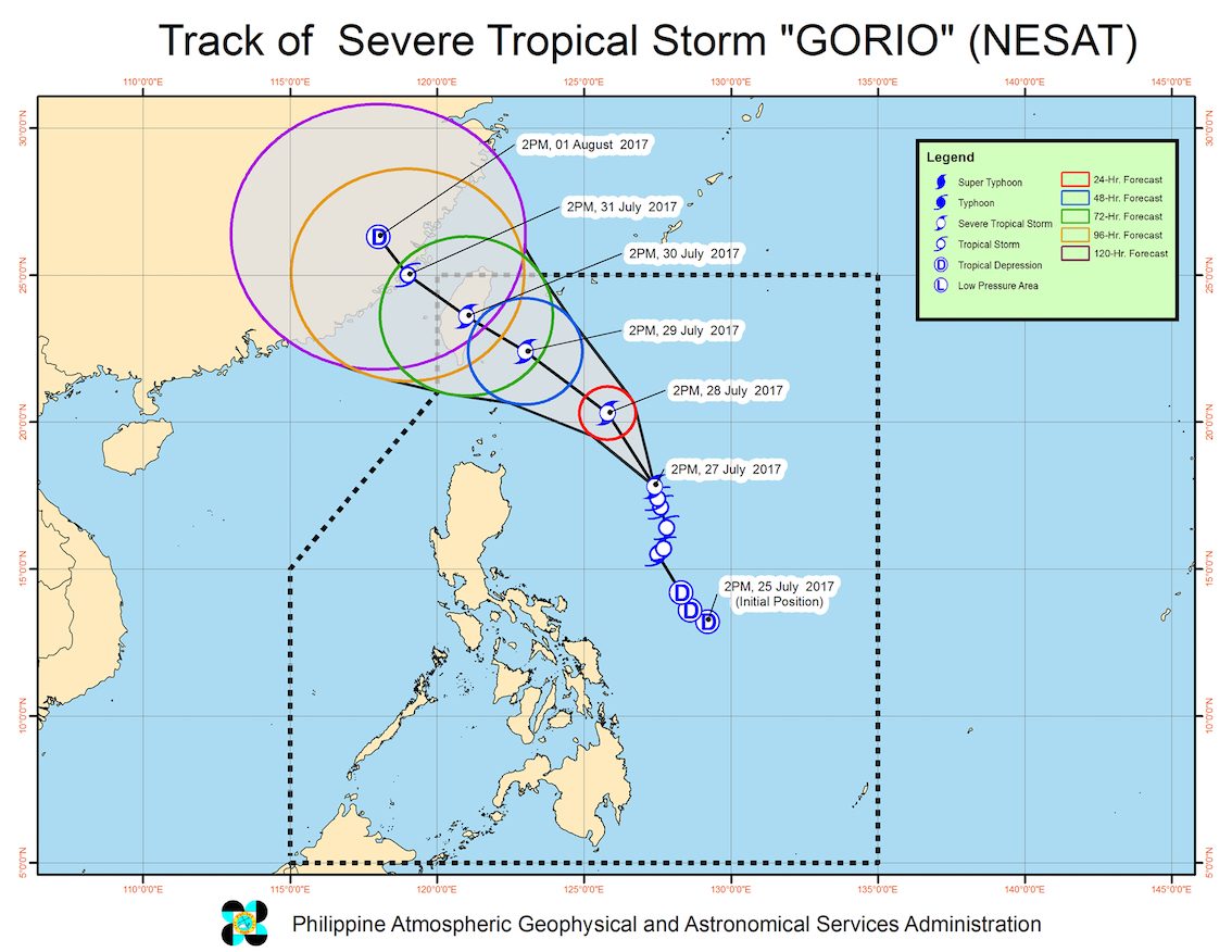
MANILA, Philippines – Tropical Storm Gorio (Nesat) intensified into a severe tropical storm on Thursday afternoon, July 27.
In a bulletin issued 5 pm on Thursday, state weather bureau PAGASA said Gorio now has maximum winds of 90 kilometers per hour (km/h) and gustiness of up to 115 km/h.
After Gorio strengthened, the province of Batanes was placed under signal number 1.
The severe tropical storm was last spotted 585 kilometers east northeast of Casiguran, Aurora, moving northwest at a slightly faster 13 km/h.
It is still enhancing the southwest monsoon, which will bring more moderate to heavy rain to the western part of Luzon, including Metro Manila. There’s also light to moderate rain over the rest of Luzon and the Visayas.
“Since lumakas pa si bagyong Gorio, possible na mas lumakas din ang paghatak niya ng hanging habagat, which may cause the same scenario katulad ng naranasan natin kanina… but hindi po natin ine-expect ‘yung maghapon talaga na continuous na pag-ulan [bukas]. Maaaring morning ay maulan tayo hanggang tanghali, then puwede pong tumila ng hapon and then ulan ulit,” said PAGASA forecaster Loriedin de la Cruz in a news briefing on Thursday afternoon.
(Since Gorio has strengthened further, it’s possible it will pull the southwest monsoon even more, which may cause the same scenario that we experienced earlier today… but we don’t expect continuous rain all day [tomorrow]. It’s possible that it’ll be rainy in the morning until noontime, stop in the afternoon, and then be rainy again in the evening.)
Coastal waters in the western part of Luzon will continue to be moderate to rough.
“Paalala po natin sa ating mga coastal travelers or sea travelers na ang ating wave height ay umaabot from 1.25 to 4 meters, and [this would be] dangerous to small sea vessels,” De La Cruz said.
(We’d like to advise our coastal travelers or sea travelers that the wave height will reach 1.25 to 4 meters, and [this would be] dangerous to small sea vessels.)
PAGASA earlier warned that Gorio will continue enhancing the southwest monsoon until the end of the week. This means heavier monsoon rain, and higher chances of flash floods and landslides.
The severe tropical storm is expected to leave the Philippine Area of Responsibility (PAR) early Monday, July 31.
The heavy monsoon rain has disrupted classes and work in Metro Manila, Central Luzon, and Calabarzon. Floods have also hit low-lying areas. (READ: PAGASA on Metro Manila class suspensions: Don’t compare cities) – Rappler.com
Add a comment
How does this make you feel?
There are no comments yet. Add your comment to start the conversation.