SUMMARY
This is AI generated summarization, which may have errors. For context, always refer to the full article.
What’s the weather like in your area? Report the situation through Rappler’s Agos or tweet us at @rapplerdotcom.
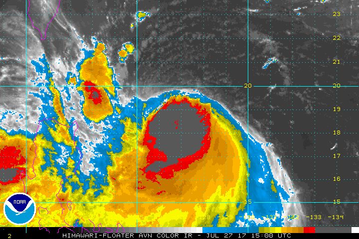
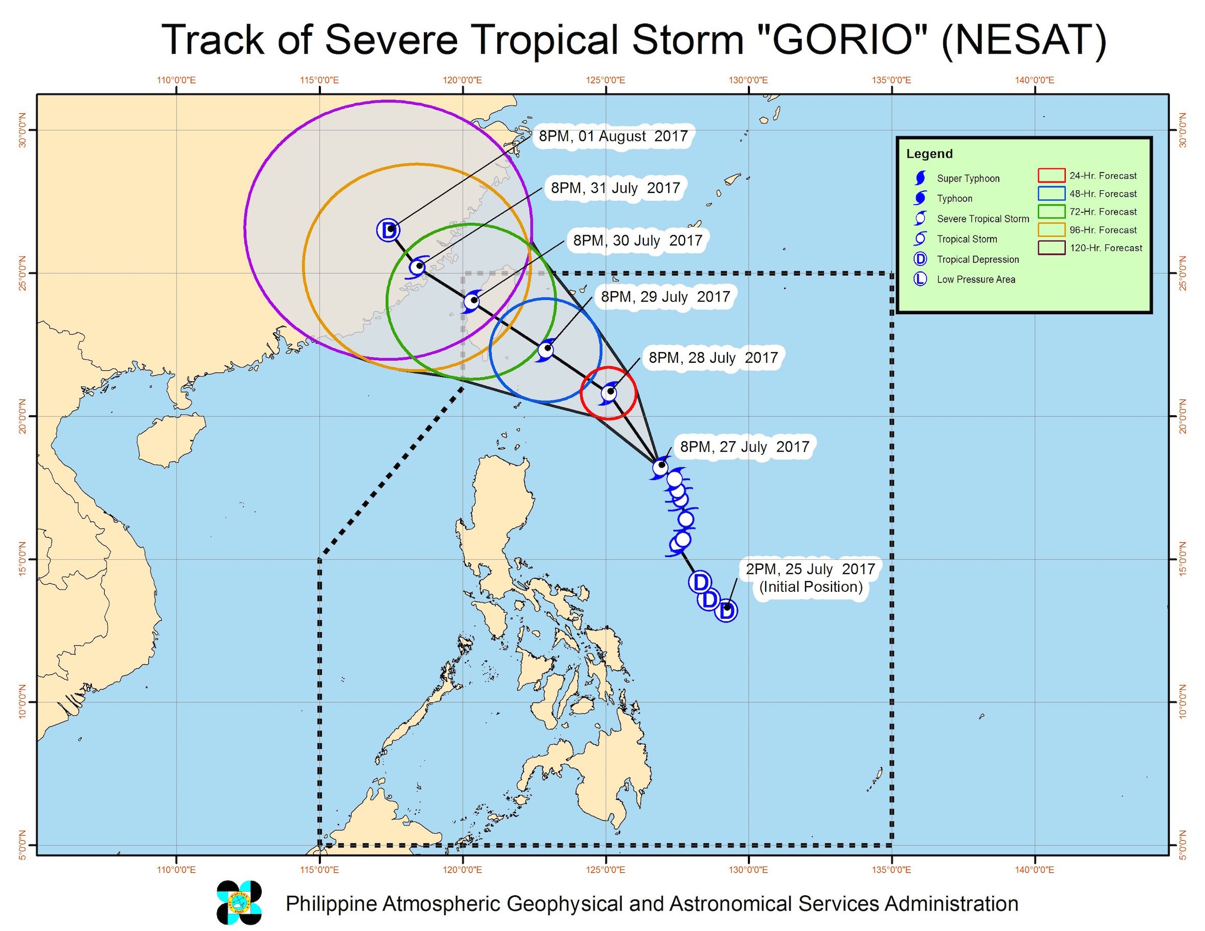
MANILA, Philippines – The province of Batanes remained under signal number 1 as Severe Tropical Storm Gorio (Nesat) maintained its strength late Thursday night, July 27.
In a bulletin issued past 11 pm on Thursday, state weather bureau PAGASA said Gorio still has maximum winds of 90 kilometers per hour (km/h) and gustiness of up to 115 km/h.
The severe tropical storm was last spotted 555 kilometers east of Tuguegarao City, Cagayan, moving northwest at a slightly faster 15 km/h.
Gorio and a tropical depression located outside the Philippine Area of Responsibility (PAR) are both enhancing the southwest monsoon.
The enhanced southwest monsoon will bring more moderate to heavy rain to Luzon and Western Visayas.
“Ang epekto ho ng southwest monsoon, mga pag-ulan concentrated ‘yan bandang madaling araw hanggang umaga, tapos may mga pagkakataon na ito’y titila katulad ng naranasan natin ngayon. Pagdating ng gabi may mga pag-ulan pa rin,” said PAGASA forecaster Obet Badrina in a news briefing late Thursday night.
(The southwest monsoon will bring rain that’s concentrated mostly before dawn until morning, then there will be brief periods of no rain, such as what we experienced today. But come evening, it’ll rain again.)
Badrina also reminded the public not to let their guard down, since flash floods and landslides are still possible.
“Dahil tuloy-tuloy ang mga pag-ulan na nararanasan natin, lumalaki ‘yung mga posibilidad ng biglaang pagbaha or flash floods at mga pagguho ng lupa,” he said.
(Since we’re experiencing continuous periods of rain, there’s a bigger possibility that we could have flash floods or landslides.)
Coastal waters in the western part of Luzon will also continue to be moderate to rough, with waves 1.25 meters to 4 meters high.
PAGASA earlier warned that Gorio will continue enhancing the southwest monsoon until the end of the week.
The severe tropical storm is expected to leave PAR late Sunday, July 30.
The heavy monsoon rain has prompted class and work suspensions in Metro Manila, Central Luzon, and Calabarzon for the 3rd straight day on Friday, July 28. – Rappler.com
Add a comment
How does this make you feel?
There are no comments yet. Add your comment to start the conversation.