SUMMARY
This is AI generated summarization, which may have errors. For context, always refer to the full article.
What’s the weather like in your area? Report the situation through Rappler’s Agos or tweet us at @rapplerdotcom.
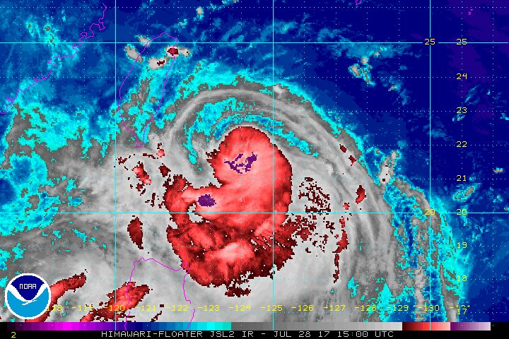
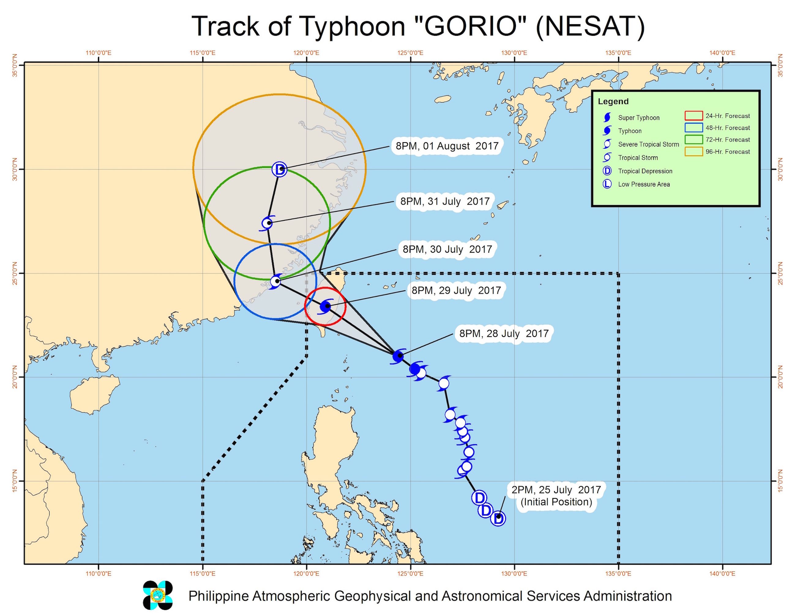
MANILA, Philippines – Typhoon Gorio (Nesat) intensified further and slightly accelerated late Friday evening, July 28.
In a bulletin issued 11 pm on Friday, state weather bureau PAGASA said Gorio now has maximum winds of 130 kilometers per hour (km/h) and gustiness of up to 160 km/h.
The typhoon is already 255 kilometers east northeast of Basco, Batanes, now moving northwest at a slightly faster 17 km/h from the previous 15 km/h.
Batanes remains under signal number 2, while the Babuyan Group of Islands is still under signal number 1.
Aside from Gorio, PAGASA continues to monitor a tropical depression located outside the Philippine Area of Responsibility (PAR), at 560 kilometers west of Laoag City, Ilocos Norte. This weather disturbance is unlikely to enter PAR.
“Maliit ‘yung tsansa na itong tropical depression ay pumasok pa ng Philippine Area of Responsibility. Ang nakikita nga nating scenario habang kumikilos si Gorio pa-hilagang-kanluran, andito lang [outside PAR] itong tropical depression. Once na lumabas na itong si Gorio, sasama na rin itong tropical depression sa kanya,” said PAGASA forecaster Obet Badrina in a news briefing late Friday evening.
(There’s only a slim chance that the tropical depression will enter the Philippine Area of Responsibility. The scenario we’re seeing is that while Gorio is moving northwest, the tropical depression will just stay outside PAR. Once Gorio leaves PAR, the tropical depression could go with it.)
Both the tropical depression and Gorio, however, will continue to enhance the southwest monsoon on Saturday, July 29.
Monsoon rain which may trigger flash floods and landslides will continue in Metro Manila, Ilocos, Central Luzon, Calabarzon, and Mimaropa.
The rest of Luzon, meanwhile, should expect more light to moderate rain and thunderstorms.
“Bukas (Saturday) uulanin pa rin tayo… Hangga’t maaari kung wala naman kayong gagawin [sa labas], sa bahay na lang muna,” Badrina said. (We’ll have a rainy Saturday… If possible, just stay home if you don’t have anything pressing to attend to elsewhere.)
Fishing boats and other small seacraft are also advised not to venture out into the seaboards of Northern Luzon and the western seaboard of Central Luzon. Larger sea vessels should watch out for big waves.
Badrina added that Gorio could intensify further as it moves toward Taiwan, where it might make landfall by Saturday night.
“Inaasahan nating lalakas pa si Bagyong Gorio… [pero] hindi na siguro ito magiging super typhoon given na sandali na lang ito dadaan sa katubigan,” he said. (We expect Typhoon Gorio to strengthen again… [but] it will probably not become a super typhoon since its remaining time over water will be short.)
Gorio will then leave PAR on Sunday, July 30. Once it exits, areas experiencing heavy monsoon rains now will gradually begin seeing better weather.
Several areas and schools have again suspended classes for Saturday. – Rappler.com
Add a comment
How does this make you feel?
There are no comments yet. Add your comment to start the conversation.