SUMMARY
This is AI generated summarization, which may have errors. For context, always refer to the full article.
What’s the weather like in your area? Report the situation through Rappler’s Agos or tweet us at @rapplerdotcom.
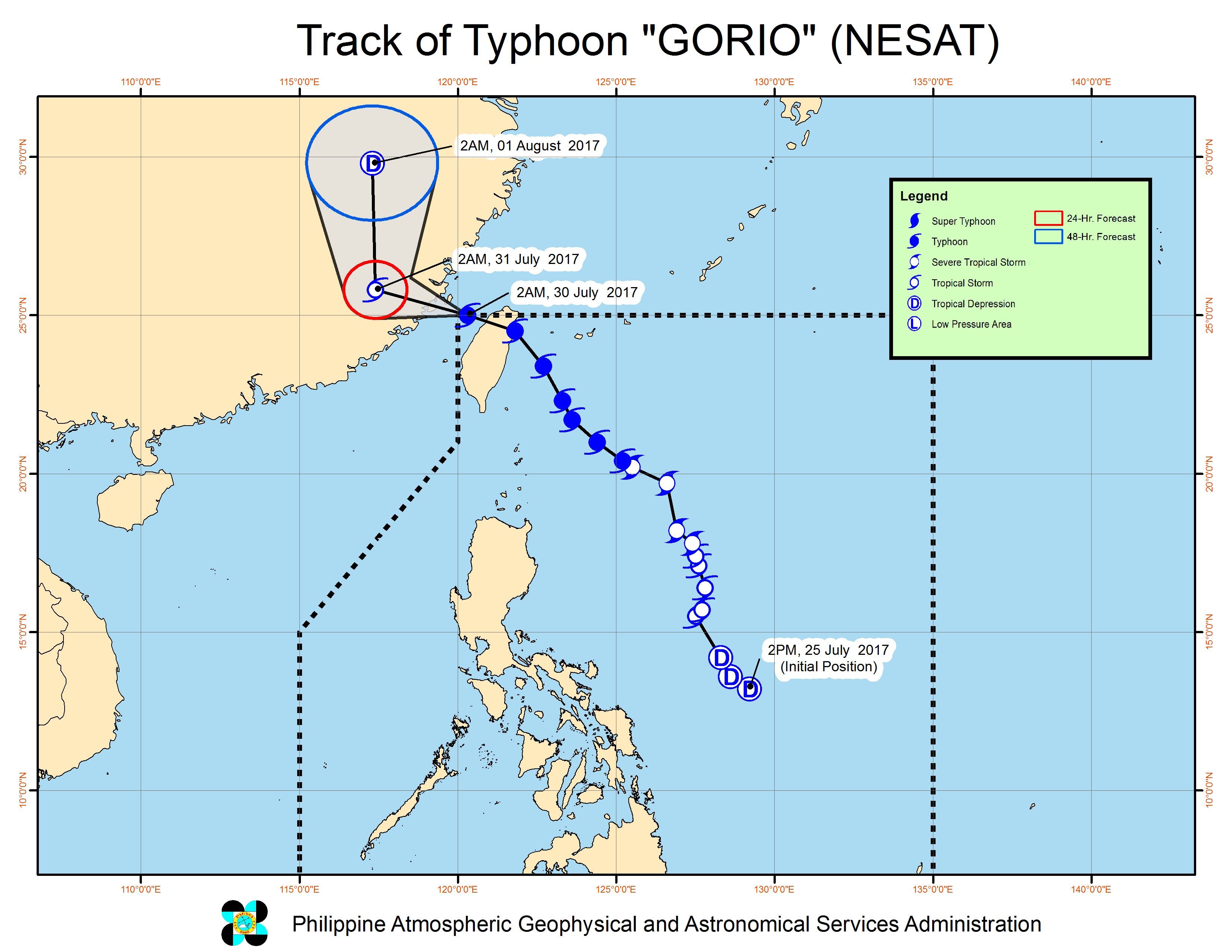
MANILA, Philippines – Typhoon Gorio (Nesat) left the Philippine Area of Responsibility (PAR) before dawn on Sunday, July 30, after making landfall in Taiwan on Saturday evening, July 29. Taiwan is still within PAR.
In a bulletin issued 5 am on Sunday, Philippine weather bureau PAGASA said Gorio is already 555 kilometers north northwest of Basco, Batanes, moving west northwest at 15 kilometers per hour (km/h).
The typhoon slightly weakened as it left PAR, with maximum winds of 140 km/h and gustiness of up to 190 km/h.
Meanwhile, PAGASA is still monitoring Tropical Storm Haitang, which is expected to enter the northwestern boundary of PAR within the day and will be named Huaning. It is already 385 kilometers west southwest of Basco, Batanes, moving northeast at a slightly faster 22 km/h from the previous 20 km/h.
In a bulletin issued 5:30 am on Sunday, PAGASA said Haitang is now posing a threat to extreme Northern Luzon. The tropical storm maintained its strength, with maximum winds of 65 km/h and gustiness of up to 80 km/h.
Batanes is already under signal number 1 due to Haitang.
The tropical storm also continues to enhance the southwest monsoon, which will bring moderate to heavy rain to the western parts of Northern Luzon and Central Luzon. These areas should watch out for possible floods and landslides.
PAGASA also warned that sea travel is risky in the seaboards of Northern Luzon and the western seaboard of Central Luzon. Fishing boats and other small seacraft are advised not to venture out into these areas, while large sea vessels should watch out for big waves.
– Rappler.com
Add a comment
How does this make you feel?
There are no comments yet. Add your comment to start the conversation.