SUMMARY
This is AI generated summarization, which may have errors. For context, always refer to the full article.
What’s the weather like in your area? Report the situation through Rappler’s Agos or tweet us at @rapplerdotcom.
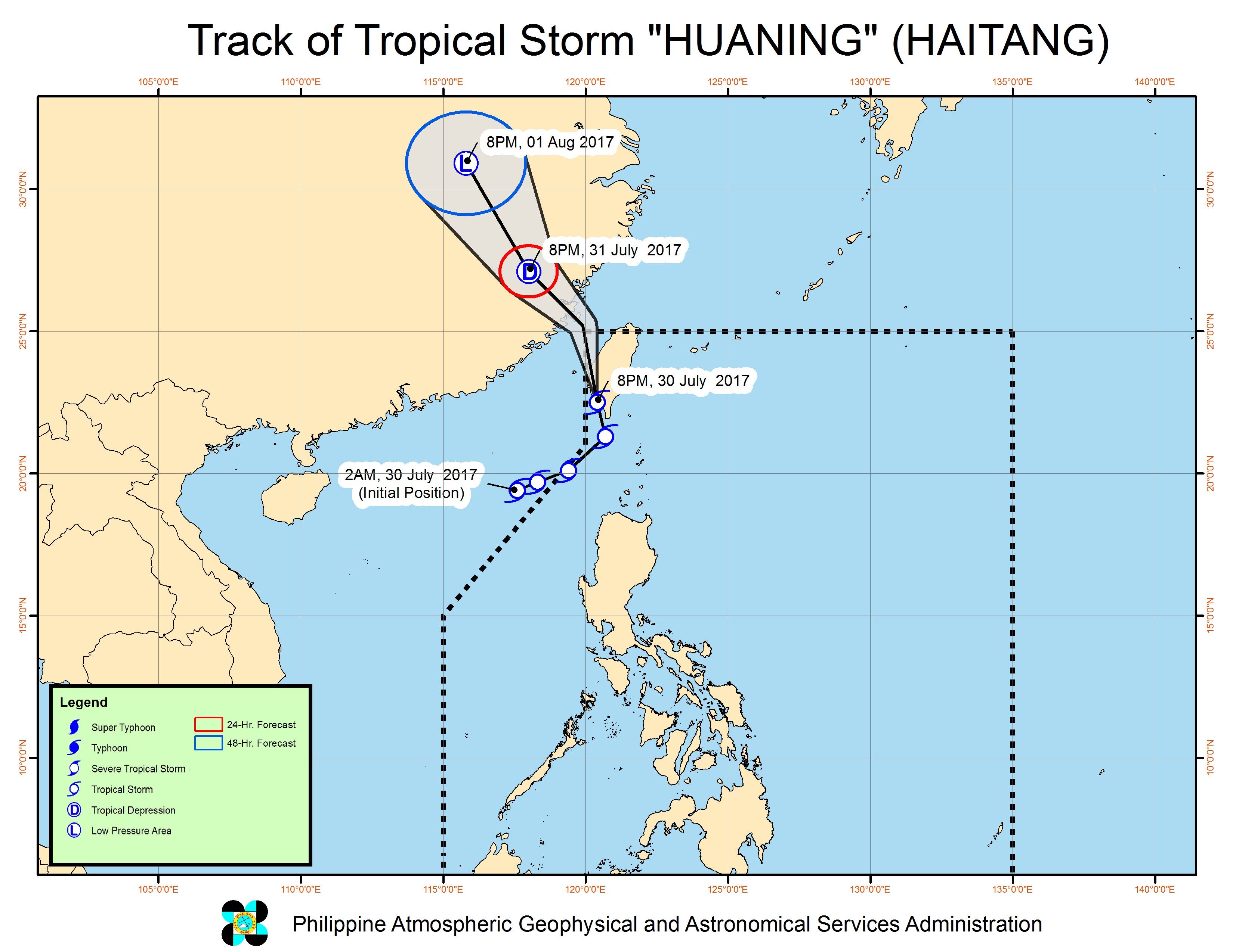
MANILA, Philippines – Tropical Storm Huaning (Haitang) made landfall in southern Taiwan on Sunday evening, July 30, as it continues to enhance the southwest monsoon in the Philippines.
In a bulletin issued 11 pm on Sunday, state weather bureau PAGASA said Huaning is already 290 kilometers northwest of Basco, Batanes, moving north northwest at 24 kilometers per hour (km/h).
Huaning slightly strengthened as it hit Taiwan and now has maximum winds of 85 km/h and gustiness of up to 120 km/h.
Signal number 1 remains raised over the Philippine province of Batanes.
The tropical storm also continues to enhance the southwest monsoon, which will bring moderate to heavy rain to the western parts of Northern Luzon and Central Luzon. Flash floods and landslides are possible in Ilocos, Cordillera, Zambales, and Bataan.
Some affected areas have suspended classes for Monday, July 31.
PAGASA also warned that sea travel remains risky in the seaboards of Northern Luzon and the western seaboard of Central Luzon. Fishing boats and other small seacraft are advised not to venture out into these areas, while large sea vessels should watch out for big waves.
Huaning is expected to leave PAR on Monday morning.
Its entry into PAR on Sunday morning came just hours after Typhoon Gorio (Nesat) left. Gorio did not make landfall in the Philippines, but it enhanced the southwest monsoon, which triggered heavy rain for several days.
– Rappler.com
Add a comment
How does this make you feel?
There are no comments yet. Add your comment to start the conversation.