SUMMARY
This is AI generated summarization, which may have errors. For context, always refer to the full article.
What’s the weather like in your area? Report the situation through Rappler’s Agos or tweet us at @rapplerdotcom.
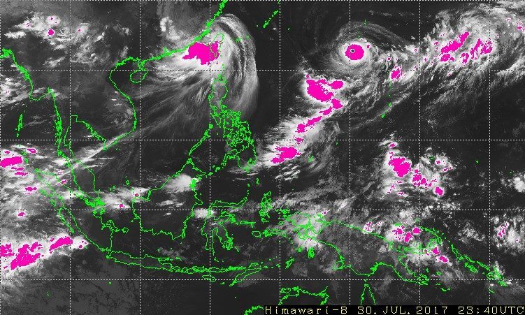
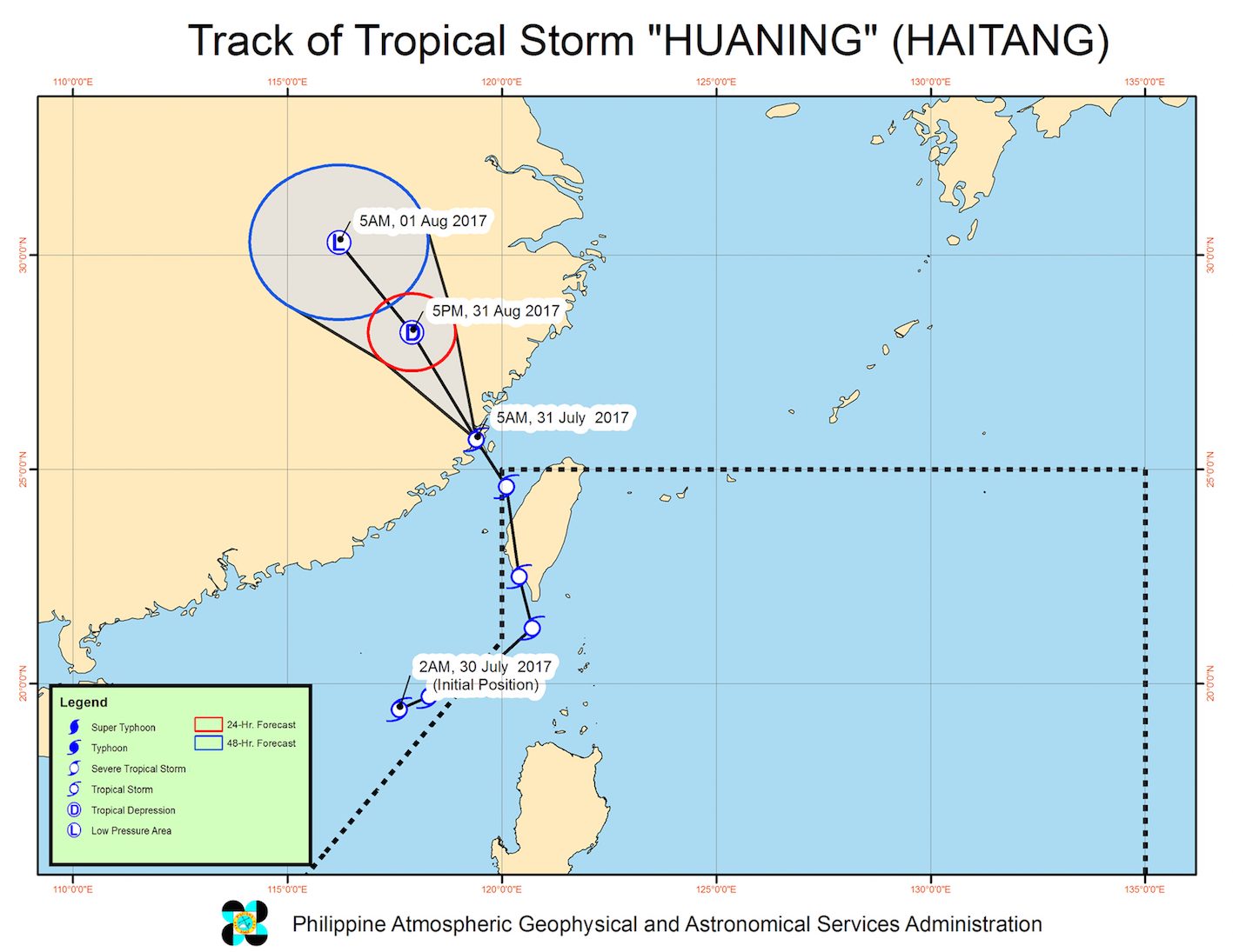
MANILA, Philippines – Tropical Storm Huaning (Haitang) left the Philippine Area of Responsibility (PAR) early Monday morning, July 31, after enhancing the southwest monsoon.
In a bulletin issued 8 am on Monday, state weather bureau PAGASA said Huaning is already 750 kilometers north northwest of Basco, Batanes, moving north northwest at 24 kilometers per hour (km/h).
Huaning slightly weakened as it left PAR and now has maximum winds of 65 km/h and gustiness of up to 80 km/h.
With its exit, there are no more areas under tropical cyclone warning signals.
But sea travel remains risky in the seaboards of Northern Luzon and the western seaboard of Central Luzon. Fishing boats and other small seacraft are advised not to venture out into these areas, while large sea vessels should watch out for big waves.
Huaning was the 8th tropical cyclone to hit the Philippines this year, coming right after Typhoon Gorio (Nesat). Both Huaning and Gorio did not make landfall in the Philippines, but enhanced the southwest monsoon, causing heavier monsoon rain.
PAGASA expects 2 to 3 tropical cyclones for August. The next ones to enter PAR would be named Isang, Jolina, and Kiko. (READ: LIST: PAGASA’s names for tropical cyclones in 2017) – Rappler.com
Add a comment
How does this make you feel?


There are no comments yet. Add your comment to start the conversation.