SUMMARY
This is AI generated summarization, which may have errors. For context, always refer to the full article.

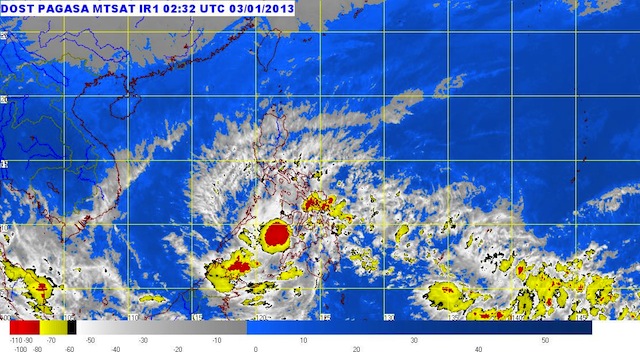
MANILA, Philippines – The low pressure area that has traversed northern Mindanao has developed into a tropical depression, and has been named Auring, state weather bureau PAGASA said Thursday midday, January 3.
As of 10 am, Auring was located 50 km west of Dipolog City (8.5°N, 122.9°E), or over the Sulu Sea, carrying maximum winds of 55 km/h near the center.
The following areas are under public storm warning signal number 1, where winds between 30-60 km is expected within the next 36 hours:
- Palawan
- Southern part of Negros Island
- Siquijor
- Lanao del Norte
- Lanao del Sur
- Misamis Occidental
- Zamboanga del Norte
- Zamboanga del Sur
- Zamboanga Sibugay
Moderate to heavy rainfall (5-15 mm/h) is expected within the 250 km diameter of Auring, the bureau said, and flashfloods or landslides are possible in the areas under signal number 1.
The tropical depression is moving west at 28 km/h, and is expected to be 180 km southwest of Puerto Princesa City Friday morning. It will be outside the Philippine Area of Responsibility (PAR) by Friday evening.
PAGASA will issue its next bulletin on Auring at 5pm Thursday. – Rappler.com
Add a comment
How does this make you feel?
There are no comments yet. Add your comment to start the conversation.