SUMMARY
This is AI generated summarization, which may have errors. For context, always refer to the full article.

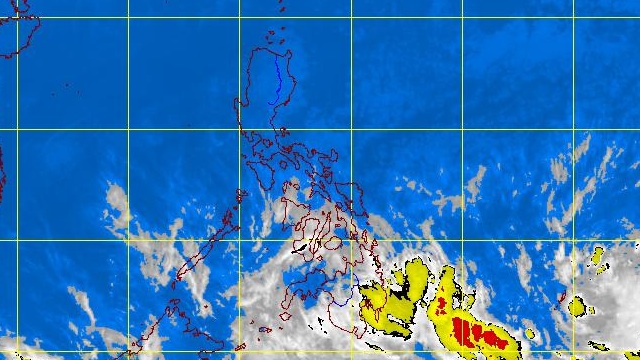
MANILA, Philippines (UPDATED) – A low pressure area has been spotted east of southern Mindanao on Sunday, February 17, and will bring rain to the area in the next few days.
The LPA was first spotted Sunday afternoon, 1,210 km east of southern Mindanao. As of 4am Monday, February 18, it was spotted 1,120 km southeast of the island.
For Monday, state weather bureau PAGASA forecasts Caraga, Davao, and Soccsksargen regions to have cloudy skies accompanied by moderate to heavy rain and thunderstorms. Landslides and flashfloods can occur, the bureau said.
The remaining areas of Mindanao as well as Eastern Visayasa will have cloudy skies with light to moderate rain.
Going north, the northeast monsoon or “Amihan” will affect the weather in Luzon, particularly in Cagayan Valley, Mimaropa, and the provinces of Aurora and Quezon, which will have cloudy skies with light rain.
The rest of the archipelago will have partly cloudy skies with isolated rain or thunderstorms.
Prevailing winds will come from the northeast.
PAGASA 24-Hour Public Weather Forecast, 18 February 2013, 5am
– Rappler.com
Add a comment
How does this make you feel?
There are no comments yet. Add your comment to start the conversation.