SUMMARY
This is AI generated summarization, which may have errors. For context, always refer to the full article.

MANILA, Philippines (UPDATED) – Tropical depression Crising continues to traverse the southwestern part of the archipelago Wednesday, February 20, as a new low pressure area is spotted west of Palawan.
Crising was spotted 220 km northwest of Zamboanga City as of 10 am, carrying maximum winds of 45 km/h near the center and moving at a slower pace of 19 km/h.
The tropical depression continues to move west northwest, and is currently over the Sulu Sea.
State weather bureau PAGASA, in its 11 am bulletin, has raised public storm warning signal number 1 over Southern Palawan, and Zamboanga del Norte, where rains and gusty winds, accompanied by moderate to rough seas, will be felt.
These areas are warned of possible landslides and flashfloods. Rainfall within Crising’s 300 km diameter is estimated to be moderate to heavy (5-15 mm/h).
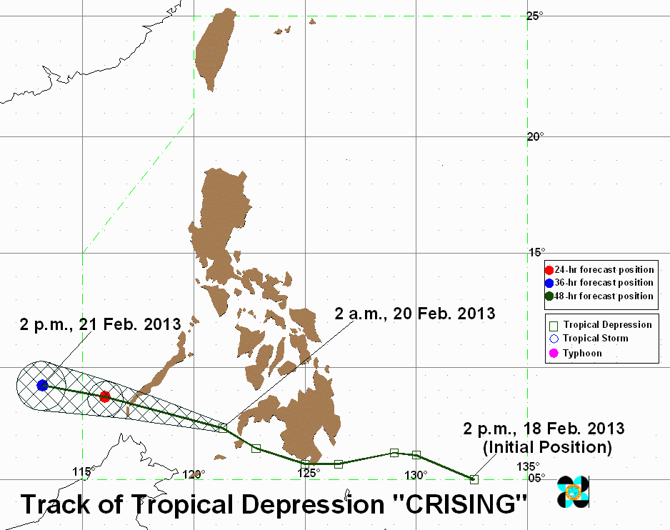
Storm signals in other areas have been lowered, and Crising is estimated to exit the Philippine Area of Responsibility by Thursday, February 21.
Another low pressure area was spotted 220 km northwest of Puerto Princesa City, the bureau said.
Wednesday weather
The rest of Palawan and Mindanao, as well as Bicol and the Visayas, will have cloudy skies with moderate to heavy rain and thunderstorms, also possibly causing flashfloods and landslides.
The Mindoro provinces, Marinduque and Romblon will have cloudy skies with light rain, while the rest of the country will experience partly cloudy skies with isolated rain.
PAGASA 24-Hour Public Weather Forecast, 20 February 2013, 5am
– With reports from KD Suarez/Rappler.com
Add a comment
How does this make you feel?
There are no comments yet. Add your comment to start the conversation.