SUMMARY
This is AI generated summarization, which may have errors. For context, always refer to the full article.
What’s the weather like in your area? Tweet us the situation: Use #weatheralert and tag@rapplerdotcom.
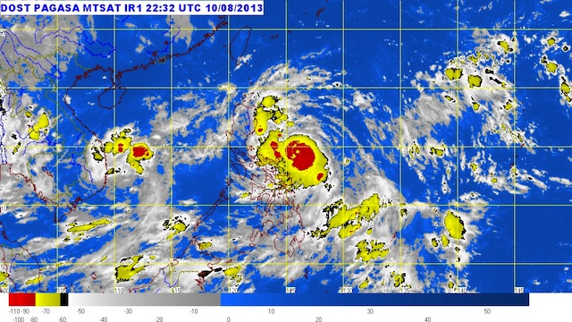
MANILA, Philippines – Typhoon Labuyo (international codename Utor) has intensified further as it moved closer to Luzon early Sunday, August 11.
Labuyo was spotted 375 kilometers east of Daet, Camarines Norte (14.3°N, 126.7°E) as of 4 am, carrying maximum sustained winds of 140 km/h and gusts of up to 170 km/h.
Catanduanes is now under public storm warning signal number 3, where winds of 101-185 km/h can be expected within the next 18 hours, state weather bureau PAGASA said in its 5 am severe weather bulletin.
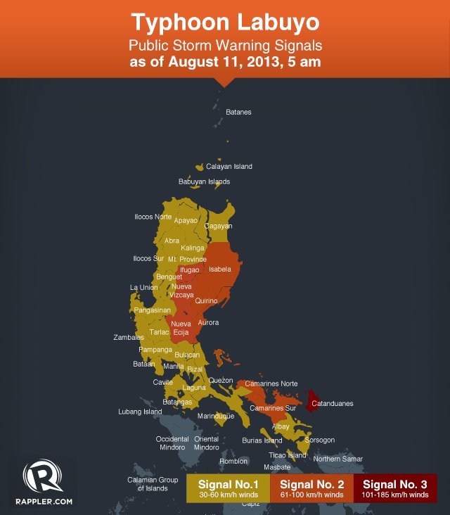
The following areas under storm signal number 2 can expect winds of 61-100 km/h within 24 hours:
- Isabela
- Ifugao
- Nueva Vizaya
- Nueva Ecija
- Aurora
- Quirino
- Camarines Norte
- Camarines Sur
- Polilio Island
Storm signal number 1, meanwhile, was raised over the following areas:
- Cagayan including Calayan and Babuyan group of islands
- Ilocos Norte
- Apayao
- Abra
- Kalinga
- Ilocos Sur
- Mountain Province
- La Union
- Benguet
- Pangasinan
- Tarlac
- Zambales
- Pampanga
- Bulacan
- Bataan
- Rizal
- Quezon
- Cavite
- Laguna
- Batangas
- Marinduque
- Albay
- Sorsogon
- Burias and Ticao Islands
- Metro Manila
Areas under storm signal number 1 can expect winds of 45-60 km/h within the next 36 hours.
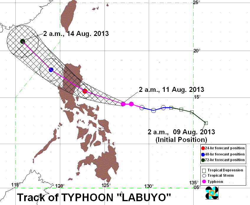
Labuyo is moving west northwest at a speed of 19 km/h, and is expected to be 80 km southeast of Casiguran, Aurora by Monday morning, August 12; Landfall is still forecast to be in the said area.
Labuyo can still intensify before it makes landfall as it is still over water.
The weather bureau warned residents in low lying and mountainous areas under the storm signals to be on alert against possible landslides and flash floods, while residents near the coasts should be on the lookout for storm surges.
The typhoon is estimated to carry heavy to intense rainfall (7.5-25 mm/h) within its 600 km diameter, the bureau said.
The typhoon will also enhance the southwest monsoon, bringing moderate to occasionally heavy rain over the rest of Southern Luzon, Visayas, and Mindanao.
PASAGA will issue its next bulletin at 11 am, August 11. – Rappler.com
Add a comment
How does this make you feel?
There are no comments yet. Add your comment to start the conversation.