SUMMARY
This is AI generated summarization, which may have errors. For context, always refer to the full article.
What’s the weather like in your area? Tweet us the situation: Use #weatheralert and tag @rapplerdotcom.
 MANILA, Philippines — After weakening and slowing down slightly, typhoon Labuyo (international codename Utor) has intensified a bit and accelerated on its way out of the Philippine Area of Responsibility (PAR) Monday afternoon, August 12.
Labuyo was located 230 km northwest of Baguio City, or 200 km west of Sinait, Ilocos Sur (17.5°N, 118.5°E) as of 4 pm Monday, with maximum sustained winds of 150 km/h near the center and gusts of up to 185 km/h.
The eye of the typhoon is now over the West Philippine Sea, state weather bureau PAGASA said.

Click here for PAGASA’s Severe Weather Bulletin No. 13 on Typhoon Labuyo
Moderate to heavy rainfall (4-15 mm/h) is expected within the typhoon’s 600 km diameter.
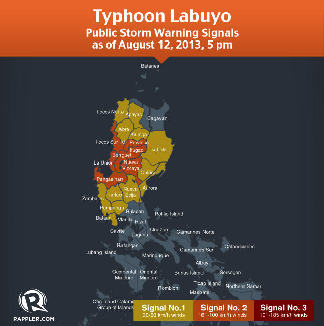
Storm signal number 2 is in effect over the following provinces:
- Nueva Vizcaya
- Ifugao
- Mountain Province
- Ilocos Sur
- Benguet
- La Union
- Pangasinan
Signal number 1, meanwhile, is in effect over the following provinces:
- Abra
- Kalinga
- Apayao
- Isabela
- Aurora
- Quirino
- Nueva Ecija
- Tarlac
- Ilocos Norte
- Pampanga
- Bataan
- Zambales
Storm warning signals elsewhere have been lifted, state weather bureau PAGASA said in its 5 pm severe weather bulletin for Labuyo.
People in areas under public storm warning signals are still warned to watch out for possible landslides and flash floods, as well as for storm surges.
Labuyo will continue to enhance the southwest monsoon, bringing rain to western sections of southern Luzon, Visayas, and Mindanao.
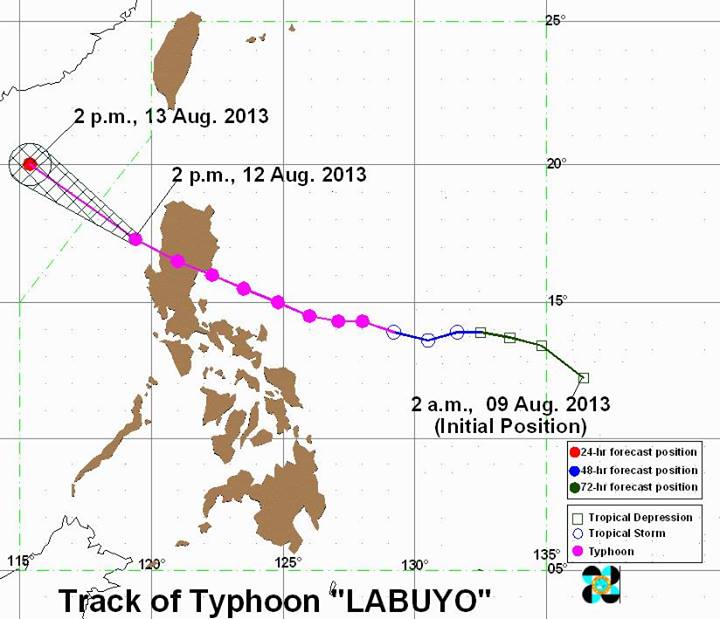
The typhoon is moving at a pace of 24 km/h, toward the northwest. The typhoon is expected to be outside the Philippine Area of Responsibility (PAR) by Tuesday, August 13.
Labuyo will then move towards the general direction of southeastern China after crossing the South China Sea.
The next PAGASA bulletin on Labuyo will be out at 11 pm. – Rappler.com
Add a comment
How does this make you feel?
There are no comments yet. Add your comment to start the conversation.