SUMMARY
This is AI generated summarization, which may have errors. For context, always refer to the full article.

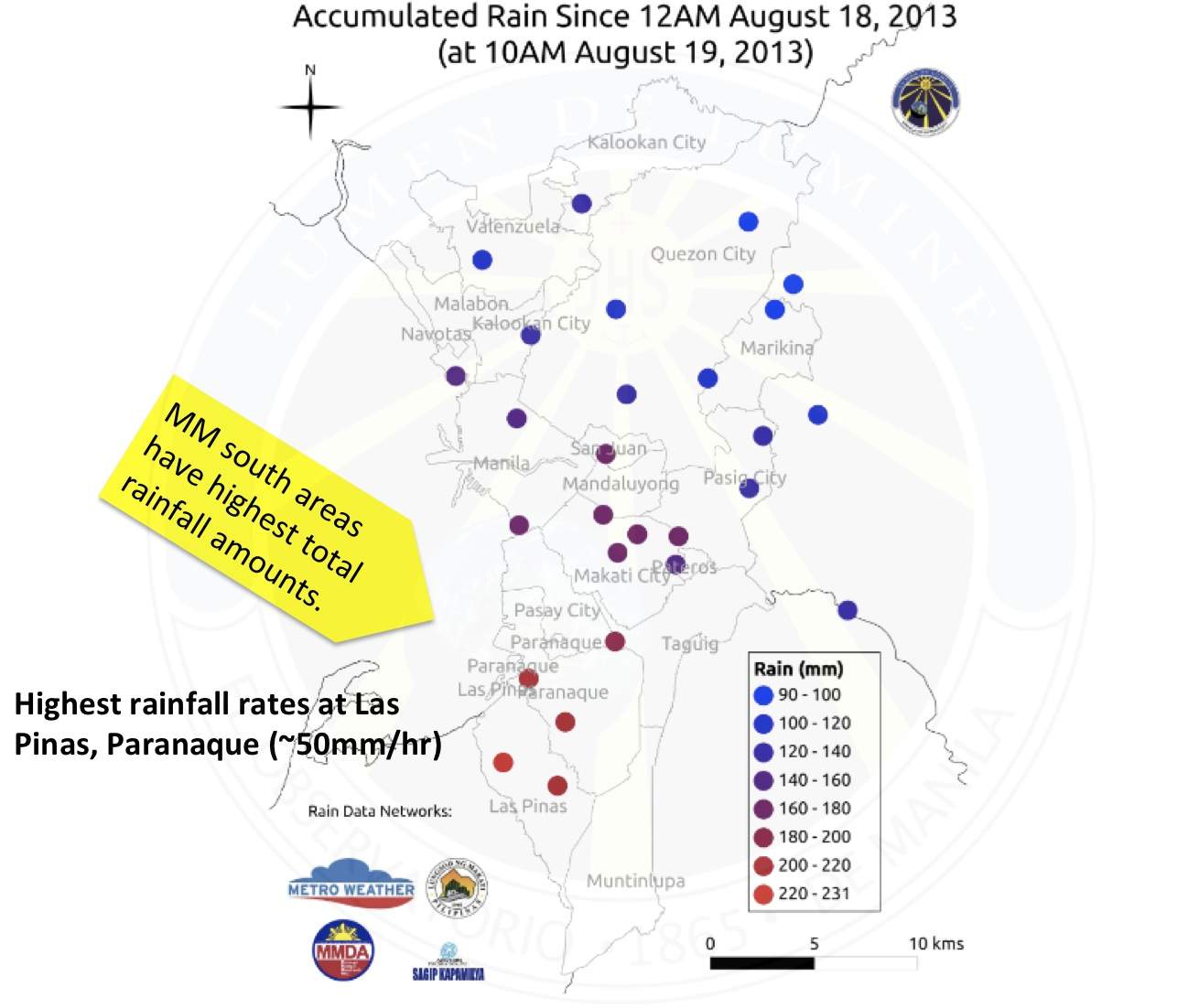
MANILA, Philippines (2nd UPDATE) – Southern parts of Metro Manila bore the brunt of the overnight torrential rains in the metropolis Sunday, August 18, according to data released by the Manila Observatory late morning Monday, August 19.
The data came from 22 selected weather stations in the National Capital Region (NCR) owned by the Observatory, as well as from Automated Weather Stations (AWS) that are part of the Metro Weather network, managed by the office, and the Makati City AWS Network.
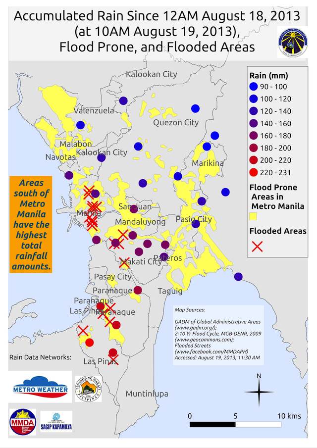
From 12 am Sunday to 10 am Monday, most rain fell over the southern areas of the National Capital Region, particularly in Las Piñas and Parañaque.
Out of the 22 stations, those located at Las Piñas and Sucat, Parañaque accumulated more than 200 mm of rainfall, while at least 8 others have accumulated rainfall of more than 150 mm.
Eight other stations have more than 100 mm rainfall accumulated over the same time frame.

During the same time period, 109 millimeters of rain was recorded at the weather station situated at the Manila Observatory grounds in Loyola Heights, Quezon City.
This figure is approximately 29.5% of the average August rainfall total for the month of August from 2007 to 2011, which is 371 mm.
In comparison, 370 mm of rain was recorded at the Observatory during 2009’s tropical storm Ondoy within a 24-hour period.
Also in comparison, the Loyola Heights station recorded the following accumulated rainfall during last year’s monsoon rains:
- August 5, 2012: 60 mm
- August 6, 2012: 110 mm
- August 7, 2012: 250 mm
- August 8, 2012: 140 mm
The observatory also noted that areas with reported flooding correspond to areas determined to be flood-prone.

The Metro Weather network, the observatory said, is a partnership among MO, Chevron, Globe Telecommunications, Ateneo de Manila University and the Metro Manila Development Authority (MMDA).
The heavy rain brought by the southwest monsoon, enhanced by the presence of tropical storm Maring (international codename Trami), has been pouring over large parts of Luzon, particularly Metro Manila, since Sunday.
Heavy rain and flooding in many parts of Luzon has forced schools, government offices, and business to close Monday.
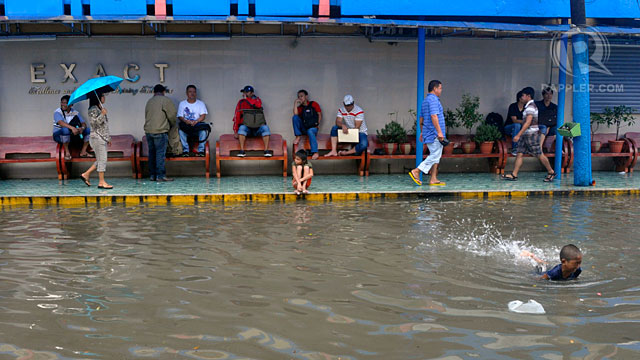
Waist-deep water in some parts of Manila made roads and highways unpassable.
READ: Maring-enhanced monsoon claims first casualty
Some commuters on public transport were left stranded, and had to wade waist-deep through muddy, trash-filled water.
PAGASA raised the Red rainfall advisory Sunday evening, August 18, as torrential rains pounded large parts of Luzon, but was later lowered to Orange. – With reports from the Agence France-Presse/Rappler.com
For more weather updates, visit the #WeatherAlert Microsite.
Related stories:
Add a comment
How does this make you feel?
There are no comments yet. Add your comment to start the conversation.