SUMMARY
This is AI generated summarization, which may have errors. For context, always refer to the full article.
What’s the weather like in your area? Tweet us the situation: Use #weatheralert and tag @rapplerdotcom.
The latest update on Typhoon Yolanda (5pm Thursday, November 7, 2013) is here.

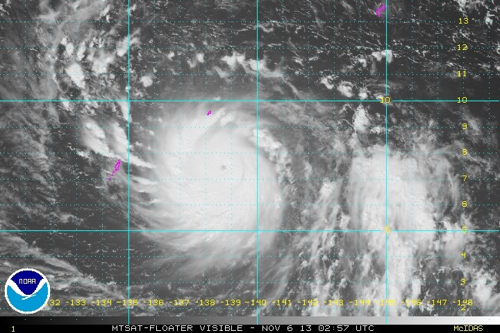
MANILA, Philippines (UPDATED) – Typhoon Haiyan continues to intensify as it traverses the west Pacific Ocean towards the Philippines Wednesday, November 6, and could be a very destructive super typhoon by the time it reaches land.
As of 10:30 am, PAGASA said Haiyan was located 1,411 kilometers east of Mindanao, with maximum sustained winds of 150 kilometers per hour near the center, and gusts of up to 185 km/h.
It is forecast to move west northwest at a speed of 30 km/h.
Haiyan is expected to enter the Philippine Area of Responsibility (PAR) early Thursday, November 7, and will continue towards the general area of the Visayas. It will be given the PAGASA codename Yolanda.
PAGASA said the typhoon will hit in the vicinity of Samar and Leyte Friday noon, November 8, between 11 am and 1 pm.
Forecast tracks show it could pass through the Visayas, and will affect southern Luzon, Bicol, northern Mindanao, Caraga, and Mimaropa.
Super typhoon status
 Warning #12 Issued at 06/0300Z, warning graphic issued by the US Navy Joint Typhoon Warning Center.")
The US Navy’s Joint Typhoon Warning Center has already designated Haiyan as a super typhoon, as it moves past Micronesia’s Yap island and the Republic of Palau.
The JTWC’s cone of uncertainty – the potential areas where the storm’s center can go – shows a wide area covering northern Mindanao, the entire Visayas, and southern Luzon.
After hitting the Philippines, it will traverse the South China Sea (West Philippine Sea) on its way to Vietnam.
Meteorological site Weather Philippines, in its latest update, said the typhoon is “similar in track and strength of Super Typhoon Mike (Ruping) which passed across the Visayas in November of 1991 and devastated much of Metro Cebu.”
Haiyan is still intensifying, and “could become an extremely dangerous Category 5 [Super Typhoon] on Thursday early morning just before it makes landfall,” the site said.
“Residents and visitors along Northeastern Mindanao, Visayas, Bicol Region and Eastern Luzon should closely monitor the development of Haiyan,” Weather Philippines added.
The typhoon’s outer rainbands are currently bringing rain and light, moderate to strong winds to the Yap and Palau.
NASA’s Tropical Rainfall Measuring Mission (TRMM) satellite measured rainfall rates of 50-60 mm/h near the center as of Monday, November 4, while rainfall rates outside the center was between 10-30 mm/h.
Haiyan/Yolanda is expected to exit the PAR early morning Sunday, November 10, the bureau said.
Bicol prepares
Meteorologist Jeff Masters said the typhoon could be the “most dangerous tropical cyclone to affect the Philippines this year.”
The effects of Haiyan, Masters wrote on his blog on Weather Underground, will be exacerbated in some areas, particularly in the Visayas, due to the rains previously dumped by tropical depression Wilma earlier this week.
It will also pass through areas that have been affected by the magnitude 7.2 earthquake last October 15 – Cebu and Bohol.
Disaster officials, particularly those potentially facing Haiyan’s wrath, are now preparing for the onslaught.
The Regional Disaster Risk Reduction and Management Council (DRRMC) in Region V (Bicol) is now under Red Alert.
The regional Interior and Local Government office has advised all provincial disaster councils to start preemptive evacuations by Thursday.
The next update on Haiyan/Yolanda will be issued Wednesday afternoon. – Rappler.com
Add a comment
How does this make you feel?
There are no comments yet. Add your comment to start the conversation.