SUMMARY
This is AI generated summarization, which may have errors. For context, always refer to the full article.
What’s the weather like in your area? Tweet us the situation: Use #weatheralert and tag @rapplerdotcom.
MANILA, Philippines (UPDATED) – Public storm warning signal number 1 is currently up in Cagayan and Batanes as Typhoon Henry (international codename Matmo) moves closer to the area Monday, July 20.
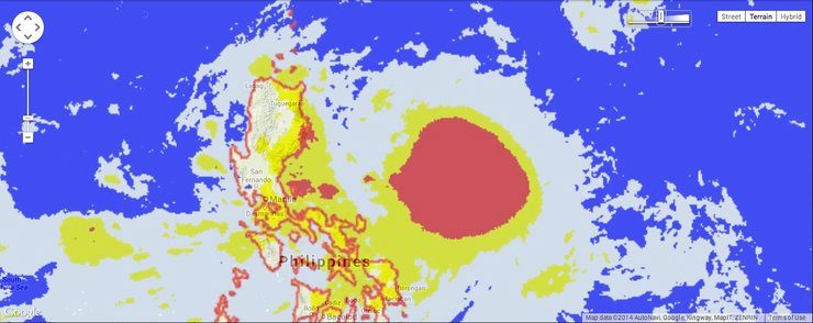
As of 10 am Monday, Henry was spotted 480 kilometers east of Casiguran, Aurora, with maximum sustained winds of 130 km/h near the center and gusts of up to 160 km/h.
People in Batanes and Cagayan can expect winds of 30-60 km/h within the next 36 hours, state weather bureau PAGASA said in its 11 am severe weather bulletin.
Moderate to heavy rain is expected within the typhoon’s 500 km diameter, the bureau said.
While it is still at some distance from Philippine landmass, it is expected to enhance the Southwest Monsoon (Habagat), causing moderate to occasionally heavy rain and thunderstorms over Cagayan Valley, MIMAROPA, Bicol, Southern Luzon, as well as the Visayas.
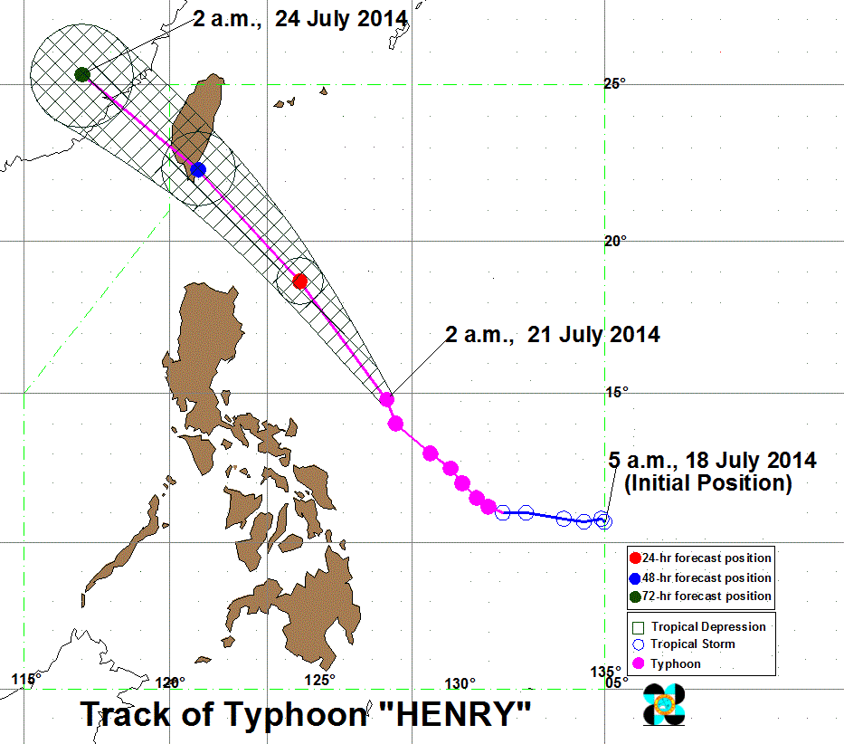
Henry continues to move northwest at a speed of 20 km/h, and is expected to move closer to Luzon’s northeast edge by Wednesday, July 23.
Both PAGASA and the Japan Meteorological Agency (JMA), the Regional Specialized Meteorological Centre (RMSC) for the western North Pacific, forecast Henry to move towards the Taiwan area, barely missing northeast Luzon.
It is expected to leave the Philippine Area of Responsibility (PAR) on Thurday, July 24.
The next bulletin on Henry will be released at 5 pm. – Rappler.com
Add a comment
How does this make you feel?


There are no comments yet. Add your comment to start the conversation.