SUMMARY
This is AI generated summarization, which may have errors. For context, always refer to the full article.
What’s the weather like in your area? Tweet us the situation: Use #weatheralert and tag @rapplerdotcom
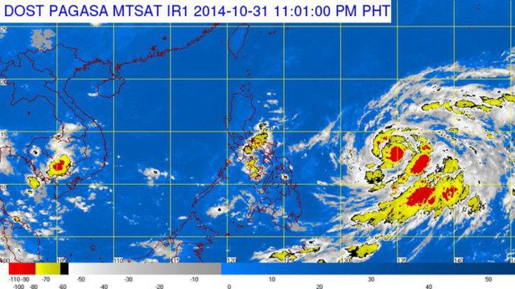
MANILA, Philippines (UPDATED) – Tropical storm Paeng (international name Nuri) has entered the Philippine Area of Responsibility (PAR) evening of Friday, October 31, according to state weather bureau PAGASA.
As of 4 am Saturday, November 1, PAGASA said the center of the storm was estimated 1,102 km east of Legazpi City, with maximum sustained winds of 75 km per hour near the center and gustiness of up to 90 km per hour.
Paeng is forecast to move west northwest at 15 km per hour.
PAGASA said on Friday evening that the storm is still too far to affect any part of the country, but it is expected to enhance northeasterly winds over the eastern seaboard of Central and Southern Luzon resulting to rough to very rough sea conditions over the aforementioned areas.

Estimated rainfall amount is from 7.5 – 30 mm per hour (heavy – intense) within the 300 km diameter of the tropical storm.
It is expected to be at 1,045 km east northeast of Daet, Camarines Norte Saturday evening, and at 1,075 km east southeast of Tuguegarao City by Sunday evening. By Monday evening, it is expected to be at 1,064 km east of Calayan, Cagayan. – Rappler.com
Add a comment
How does this make you feel?
There are no comments yet. Add your comment to start the conversation.