SUMMARY
This is AI generated summarization, which may have errors. For context, always refer to the full article.
What’s the weather like in your area? Tweet us the situation: Use #weatheralert and tag @rapplerdotcom
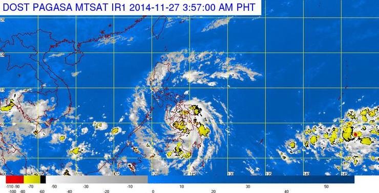
MANILA, Philippines (UPDATED) – Tropical depression Queenie continues to bring rain to large parts of the Visayas and Mindanao Thursday, November 27.
Queenie has maintained its strength as it crosses southern Visayas, and as of 10:30 am the center of the weather system was located 120 kilometers northwest of Dumaguete City, or already over the Panay Gulf, state weather bureau PAGASA said.
The system is carrying maximum winds of 55 km/h near the center, and moderate to heavy rainfall (7-15 mm/h) within the tropical depression’s 300-kilometer diameter.
Public storm warning signal #1 is in effect over these areas:
- Palawan including the Calamian Group of Islands and Cuyo Islands
- Bohol
- Southern Cebu
- Negros Oriental
- Southern Negros Occidental
- Siquijor
- Guimaras
- Iloilo
- Antique
- Zamboanga del Norte.
Storm warning signals in other areas have been lowered.
The tropical depression is moving west northwest at a speed of 24 km/h, and is expected to cross Cebu and Negros islands Thursday.
It will exit the Philippine Area of Responsibility (PAR) by Saturday, November 29.
Residents in low-lying and mountainous areas in affected areas are being warned by the bureau against possible flash floods and landslides.
The next bulletin on Queenie will be at 5pm. – Rappler.com
Add a comment
How does this make you feel?
There are no comments yet. Add your comment to start the conversation.