SUMMARY
This is AI generated summarization, which may have errors. For context, always refer to the full article.
What’s the weather like in your area? Tweet us the situation: Use #weatheralert and tag @rapplerdotcom
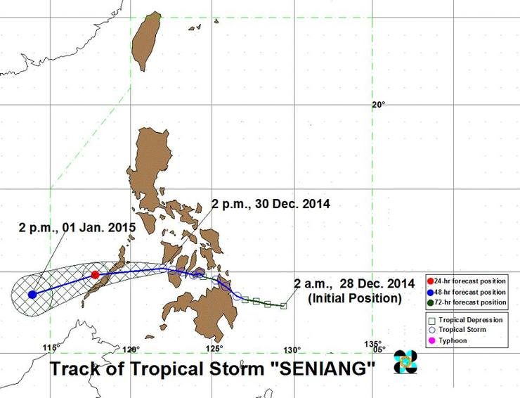
MANILA, Philippines – Tropical Storm Seniang (Jangmi) has accelerated and is now moving towards Cuyo Island with maximum sustained winds of 65kph near the center and gustiness of up to 80kph, state weather bureau PAGASA said.
In its 5pm weather bulletin Tuesday, December 30, PAGASA reported that the center of Seniang was at 108 km southwest of Iloilo City. The tropical storm is forecast to move west at 19kph.
Public Storm Signal no 2 is raised in the following areas:
Luzon:
- Cuyo Island
- Palawan
Visayas:
- Guimaras
- Southern Antique
- Southern Iloilo
These areas are expected to have winds of 61-100 kph in the next 24 hours. Travel by all types of sea vessels and aircrafts are risky.
Meanwhile, Public Storm Signal no 1 is raised in these provinces:
Luzon:
- Calamian Group of Islands.
Visayas:
- Negros Occidental
- Aklan
- Capiz
- Rest of Iloilo
- Rest of Antique

Residents in low lying and mountainous areas of the provinces with storm signals are alerted against possible flashfloods and landslides. Moderate to heavy rainfall can be expected within the 300 km diameter of Seniang.
The tropical storm is expected to be 110 km west of Puerto Princesa City on Wednesday afternoon, and 500 km southwest of the city by Thursday. – Rappler.com
Add a comment
How does this make you feel?
There are no comments yet. Add your comment to start the conversation.