SUMMARY
This is AI generated summarization, which may have errors. For context, always refer to the full article.
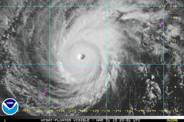
MANILA, Philippines – Typhoon Maysak has strengthened further overnight Wednesday, April 1, as it moves closer to the eastern edge of the Philippine Area of Responsibility (PAR).
Maysak, carrying maximum sustained winds of 215 km/h near the center and gusts of up to 250 km/h, was located 1,410 km east of Surigao City as of 4 am Wednesday, state weather bureau PAGASA said in its 5 am daily weather forecast.
Meanwhile, the US Joint Typhoon Warning Center puts Maysak’s winds at 140 knots (260 km/h) near the center, with gusts of up to 170 kt (315 km/h), as of 5 am Philippine time. The JTWC already classifies the system as a super typhoon.
The Japan Meteorological Agency (JMA), meanwhile, classifies Maysak as a “violent” typhoon as of 5 am Philippine time.
PAGASA forecasts the typhoon to move west northwest, with its traveling speed now a slower 17 km/h.
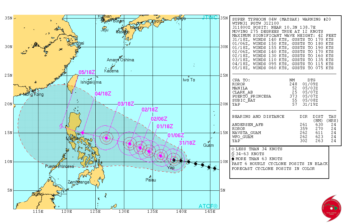
JMA and JTWC both forecast the storm to weaken as it moves closer toward Philippine landmass.
The system could enter the PAR by Wednesday, or early Thursday, April 2, the weather bureau earlier said, and will be assigned the codename Chedeng.
It is still too far to affect weather in any part of the archipelago.
The system is currently passing dangerously close to Yap island, independent weather organization Weather Philippines said.
Maysak’s current strength has put it as the 3rd most intense recorded Super Typhoon to ever form in the early part of the year (January-April), Weather Philippines noted in its Wednesday bulletin.
It noted that two other systems that had similar strengths were Super Typhoon Ophelia (January 1958) and Super Typhoon Mitag (March 2002).
Meanwhile, for Wednesday, partly cloudy skies will be experienced in the northern Luzon regions of Cagayan Valley, Cordillera, and Ilocos, while the rest of the country will have partly cloudy to cloudy skies accompanied by isolated rain or thunderstorms.
The bureau is set to give an update on Maysak at 11 am. – Rappler.com
Add a comment
How does this make you feel?
There are no comments yet. Add your comment to start the conversation.