SUMMARY
This is AI generated summarization, which may have errors. For context, always refer to the full article.
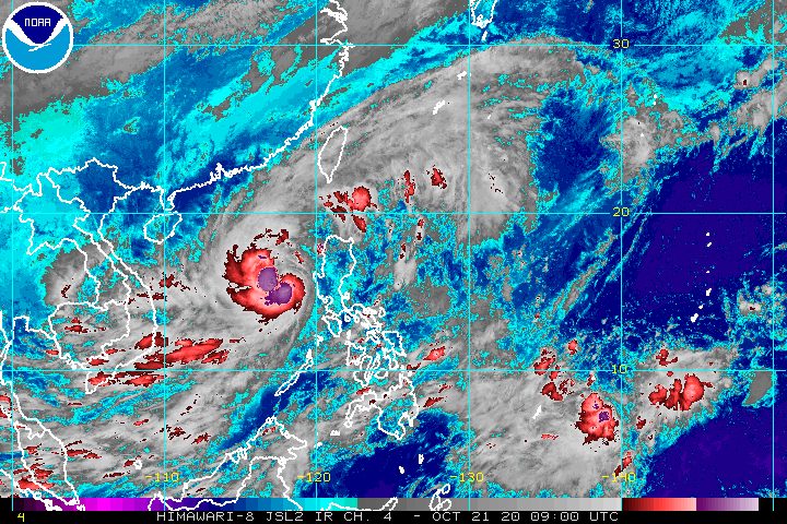
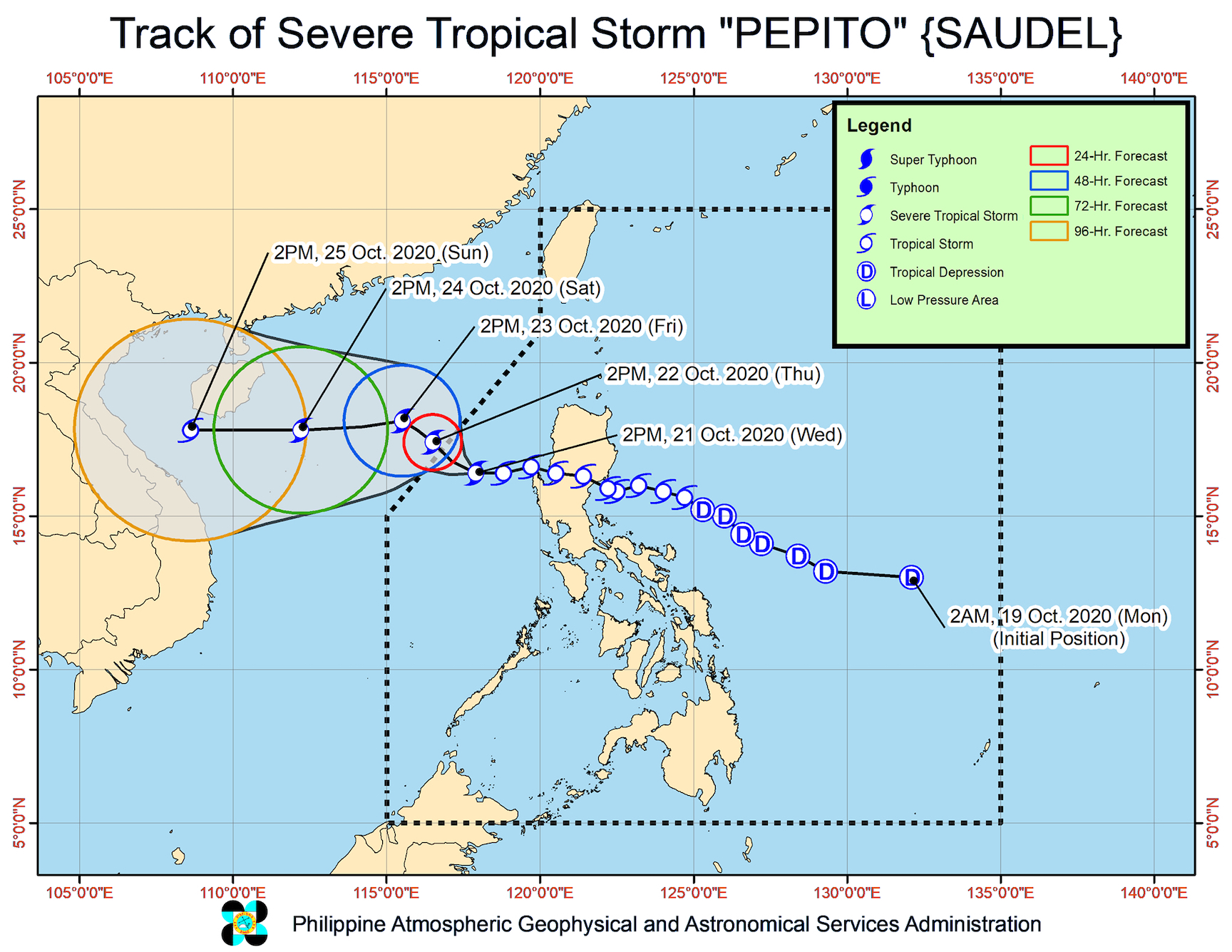
Pepito (Saudel) strengthened from a tropical storm into a severe tropical storm at 2 pm on Wednesday, October 21, as it continued to make its way out of the Philippine Area of Responsibility (PAR).
The Philippine Atmospheric, Geophysical, and Astronomical Services Administration (PAGASA) said in its 5 pm bulletin on Wednesday that Pepito is now 295 kilometers west of Dagupan City, Pangasinan.
The severe tropical storm continues to move west over the West Philippine Sea, but its speed halved to 15 kilometers per hour (km/h).
It is expected to leave PAR on Thursday morning or afternoon, October 22. By Friday, October 23, it will be heading for the central part of Vietnam, said PAGASA.
As of Wednesday afternoon, Pepito’s maximum winds increased from 85 km/h to 95 km/h, while its gustiness is now up to 115 km/h from the previous 105 km/h.
The state weather bureau said Pepito will continue gaining strength over the West Philippine Sea, and may reach its peak intensity on Friday or on Saturday, October 24. (READ: FAST FACTS: Tropical cyclones, rainfall advisories)
There are no more areas under tropical cyclone wind signals as of 5 pm on Wednesday.
But PAGASA said “high to gale-force winds” due to the northeasterly surface windflow will still be experienced in Northern Luzon, especially in coastal and mountainous areas.
Rain – mostly light to moderate, but possibly heavy at times – will also persist in some areas until Thursday morning. These are the affected regions and provinces:
- Western Visayas
- Zamboanga Peninsula
- Batanes
- Babuyan Islands
- Zambales
- Bataan
- Occidental Mindoro
- Palawan
The heavy rain from Pepito had triggered floods in parts of Luzon. It earlier crossed Northern Luzon after making landfall in San Ildefonso Peninsula in Casiguran, Aurora, at 9 pm on Tuesday, October 20.
As of Wednesday afternoon, a gale warning remains in effect for areas with rough to very rough seas, where waves are 2.5 to 5.5 meters high. Travel remains risky, especially for small vessels, in these seaboards:
- entire seaboards of Northern Luzon and Central Luzon
- seaboard of northern Quezon including Polillo Island
- western seaboards of Batangas, Occidental Mindoro (including Lubang Islands), and Palawan (including Calamian and Kalayaan Islands)
Moderate to rough seas, with waves 1.5 to 3 meters high, prevail in the eastern seaboards of the following:
- southern part of Quezon
- Bicol
- Eastern Visayas
- Caraga
- Davao Region
PAGASA reminded small vessels to take precautionary measures. It added that “inexperienced mariners should avoid navigating in these conditions.”
Meanwhile, PAGASA continues to keep an eye on the tropical depression outside PAR.
The tropical depression is now 1,865 kilometers east northeast of extreme Northern Luzon, moving south southwest at 10 km/h.
It still has maximum winds of 55 km/h and gustiness of up to 70 km/h.
PAGASA said the tropical depression remains unlikely to enter PAR.
But the state weather bureau spotted a new low pressure area (LPA) that formed, also outside PAR.
The LPA is located 1,935 kilometers east of Mindanao. In the next 24 to 48 hours, the chances of it developing into a tropical depression are slim, according to PAGASA Weather Specialist Ariel Rojas.
Beyond that period, however, Rojas said there is still a high degree of uncertainty. PAGASA will continue monitoring the LPA.
Pepito is the Philippines’ 16th tropical cyclone for 2020, and the 3rd for October.
An average of 20 tropical cyclones form within or enter PAR each year. (READ: LIST: PAGASA’s names for tropical cyclones in 2020)
PAGASA gave the following estimates for the number of tropical cyclones inside PAR in the next 6 months:
- October 2020 – 2 or 3
- November 2020 – 1 or 2
- December 2020 – 1 or 2
- January 2021 – 1 or 2
- February 2021 – 0 or 1
- March 2021 – 0 or 1
Last October 2, the state weather bureau warned Filipinos to expect more rain in the coming months due to the onset of La Niña. – Rappler.com
Add a comment
How does this make you feel?


There are no comments yet. Add your comment to start the conversation.