SUMMARY
This is AI generated summarization, which may have errors. For context, always refer to the full article.

MANILA, Philippines – Satellite images are bringing a clearer picture of the devastation brought by Super Typhoon Yolanda (Haiyan) across the Visayas.
The United Nations Institute for Training and Research (UNITAR) and the Copernicus Emergency Management Service (EMS) of the European Commission since Monday, November 11, have been releasing maps of the disaster zone, particularly Tacloban City and parts of Leyte. These were particularly hard-hit by the extreme weather event, which saw winds of upward of 235 kilometers per hour and storm surges reportedly as high as 5 meters.
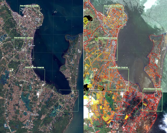
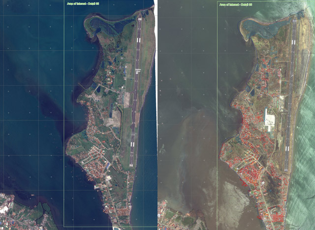
In the maps from the Copernicus EMS, at least “70% of the built-up area” in the areas around Tacloban City’s downtown and airport are either fully or partially destroyed.
The UNITAR also released maps, this time showing the destruction in Tabontabon and Dulag towns in Leyte.
It showed that parts of Dulag was “almost completely eradicated by Typhoon Haiyan,” the UNITAR said.
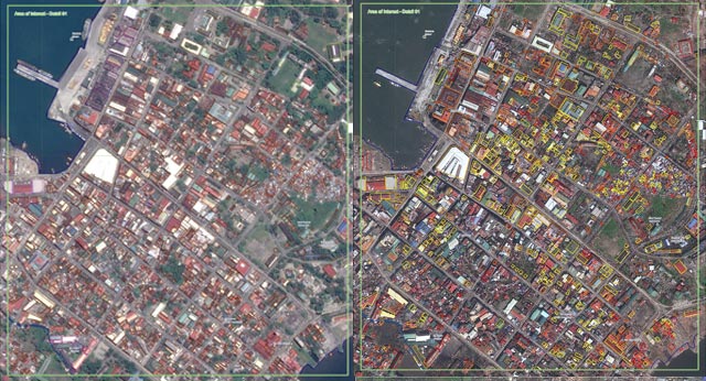
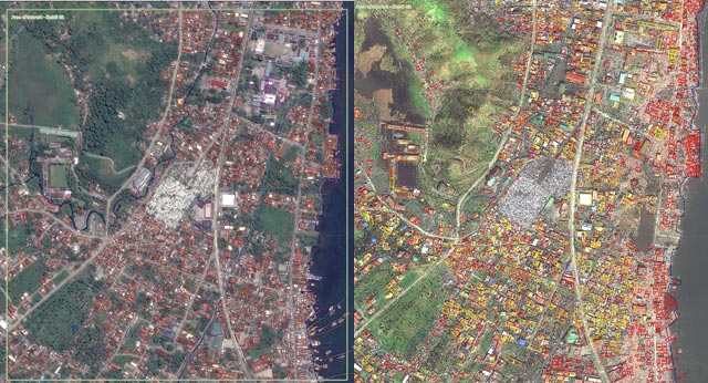
Side-by-side comparisons of the reference and grading maps released by Copernicus show massive damage to structures, mostly to those located near the coasts.


Comparing pre- and post-event satellite images, the Copernicus EMS showed the following information:
- 70% of the built-up area affected, with at least 58% “either destroyed or highly affected”
- 5 industrial facilities destroyed
- 7 educational buildings destroyed
- 65% of affected area is residential
- 18 major roads blocked, with blockages at 113 different locations
The EU Emergency Response Coordination Centre requested for the images, to help in the assessment of the extent of damage.
“The damage assessment maps are expected to support response activities and, in the longer term, reconstruction efforts,” the European Commission Joint Research Centre said Monday.
The satellite images were released separately by the two agencies starting last Saturday, November 9.
The maps can be accessed here:
- Copernicus EMS: http://emergency.copernicus.eu/mapping/list-of-components/EMSR058
- UNITAR: http://www.unitar.org/unosat/maps/PHL
– Rappler.com
Add a comment
How does this make you feel?
There are no comments yet. Add your comment to start the conversation.