SUMMARY
This is AI generated summarization, which may have errors. For context, always refer to the full article.

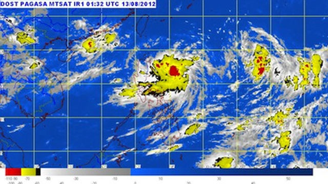
Less than a week after the southwest monsoon brought about non-stop rains and massive flooding to Metro Manila and some parts of northern Luzon, PAGASA reports of a tropical depression moving closer to northern Luzon. “Helen” was last seen 630km east northeast of Casiguran, Aurora in the eastern section of the country. Storm signal number 1 has been raised over Batanes, Isabela, Kalinga, Apayao and Cagayan. Metro Manila will have mostly cloudy skies with scattered rain showers and/or thunderstorms.
Read more on Rappler.
Read more on Rappler.
Add a comment
How does this make you feel?
Loading
There are no comments yet. Add your comment to start the conversation.