SUMMARY
This is AI generated summarization, which may have errors. For context, always refer to the full article.
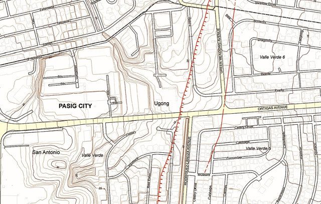
Should a magnitude 7.2 earthquake strike Metro Manila and surrounding provinces – something likely to happen, given a major fault’s 400-year cycle of activity – residential buildings will suffer the most damage, according to the Philippine Institute of Volcanology and Seismology. Based on maps recently released by the agency, Rappler compiled a list of subdivisions or residential villages that appear to have been built on top or around the active West Valley Fault and East Valley Fault.
Read the full story and see the maps on Rappler’s #ProjectAgos page.
Add a comment
How does this make you feel?
Loading


There are no comments yet. Add your comment to start the conversation.