SUMMARY
This is AI generated summarization, which may have errors. For context, always refer to the full article.
MANILA, Philippines – Archaeologists from the University of Sydney, led by Dr Damian Evans, used laser imaging to map central Angkor in a project meant to help identify how unstable climate change had damaged the city and potentially ushered its end.
Professor Roland Fletcher, who leads the Greater Angkor Project in Cambodia, noted that the international effort to map Angkor – a pre-industrial city covering an area of 1000 square kiometers – aimed to not only show how the city’s water system worked, but also how the unstable climate change damaged its water network.
Fletcher said, “The main discoveries of the Greater Angkor Project have been to identify the huge extent of Angkor and its character as a giant low-density city, to show how its water management network functioned and to show that the demise of Angkor was related to extremely unstable climate change causing severe damage to the water network.”
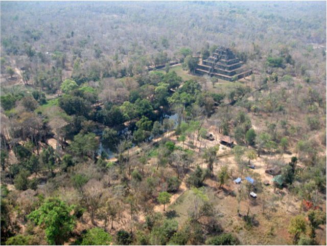
To map Angkor, the archaeologists surveyed the area using light detection and ranging (LiDAR) technology. LiDAR is a remote sensing technology carried on a plane or helicopter, where a light beam is aimed at the ground, mapping everything in 3D – whether it be the tops of trees to the ground.
The mapping process would reveal the form of the ground surface under the dense forest cover, and is crucial for surveying central Angkor and the densely-forested Kulen hills.
“The LiDAR survey has now also shown that central Angkor was arranged around a road grid and that the Kulen Hills to the north of Angkor were the location of an extensive low-density urban area in the early ninth century, just as Angkor was beginning to expand,” Fletcher said.
Fletcher also noted that the 15-year project was significant because the results had “global relevance” and “relate to contemporary issues such as low-density urbanism and the risks of climate change.”
The team’s discovery of roads, canals and urban landscape – which would rewrite Angkor’s story – will be detailed in a two-part SBS One documentary titled Angkor Wat’s Hidden Megacity. – Rappler.com
Add a comment
How does this make you feel?
There are no comments yet. Add your comment to start the conversation.