SUMMARY
This is AI generated summarization, which may have errors. For context, always refer to the full article.
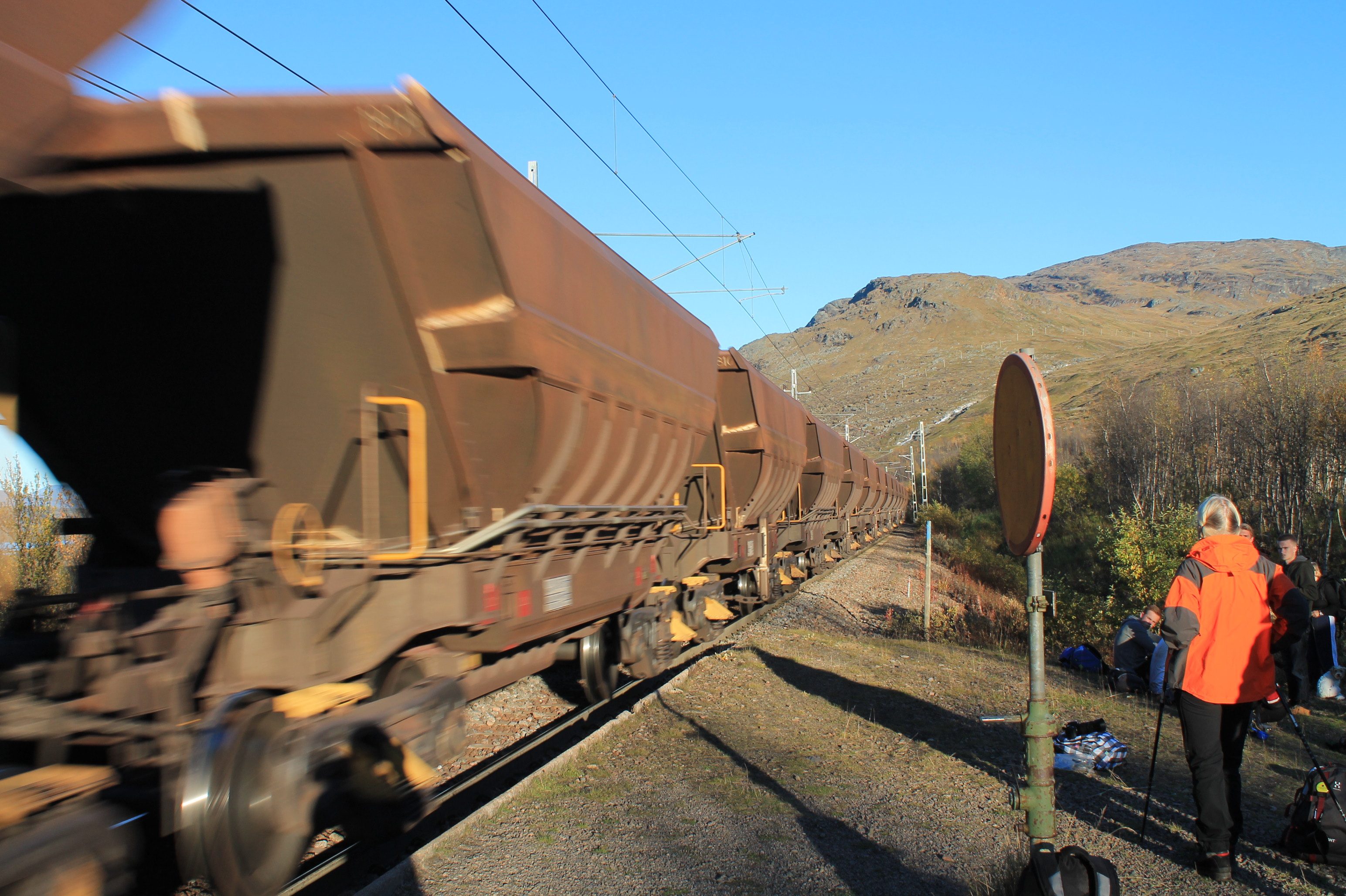
I looked up at the train schedule monitor, and the next trip out of this station of Låktatjåkka, which had no platform much less facilities, would depart the following afternoon. I was not keen on sleeping on the station benches.
Over the train tracks and into the brush, I followed a small procession of hikers, many decked in their Fjallravens and Jack Wolfskin jackets, with 50-liter packs and trek poles. We came out to the lonely two-lane road that connects the frontier town of Kiruna, a mining hub deep in the Swedish arctic circle, to Narvik, another frontier town across the border in Norway. From where I stood at the edge of the road, Kiruna was somewhere east, 122 kilometers away. Narvik was 56 kilometers the other way. I looked up and down the road, unsure where to go.
“Why is there no bus stop?”
“Eh, the bus will stop for you. It is so remote out here, eh, and people die if they get stranded,” said the elderly Swedish hiker. She was one half of a pair of silver-haired grandmothers I had spotted roaming the nearby trails over the previous days.
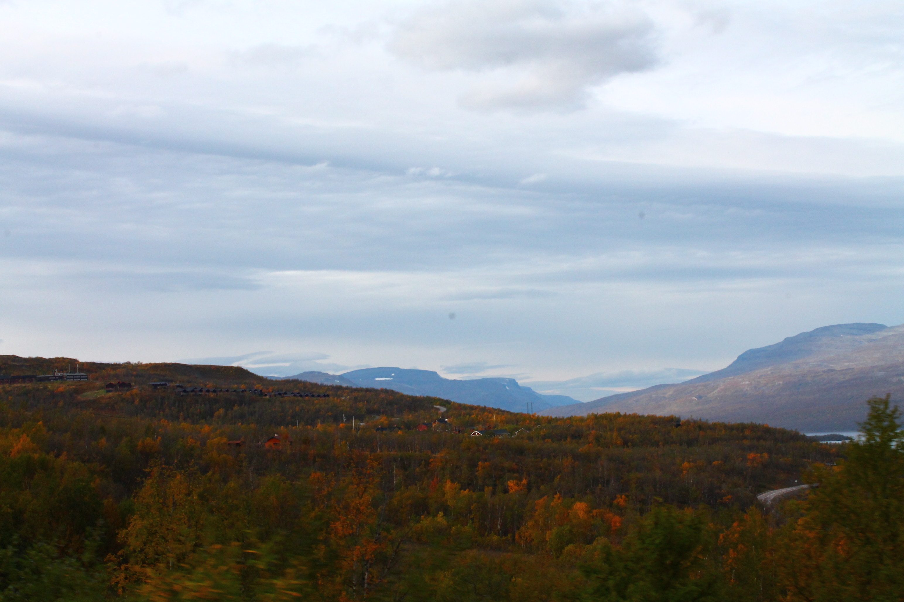
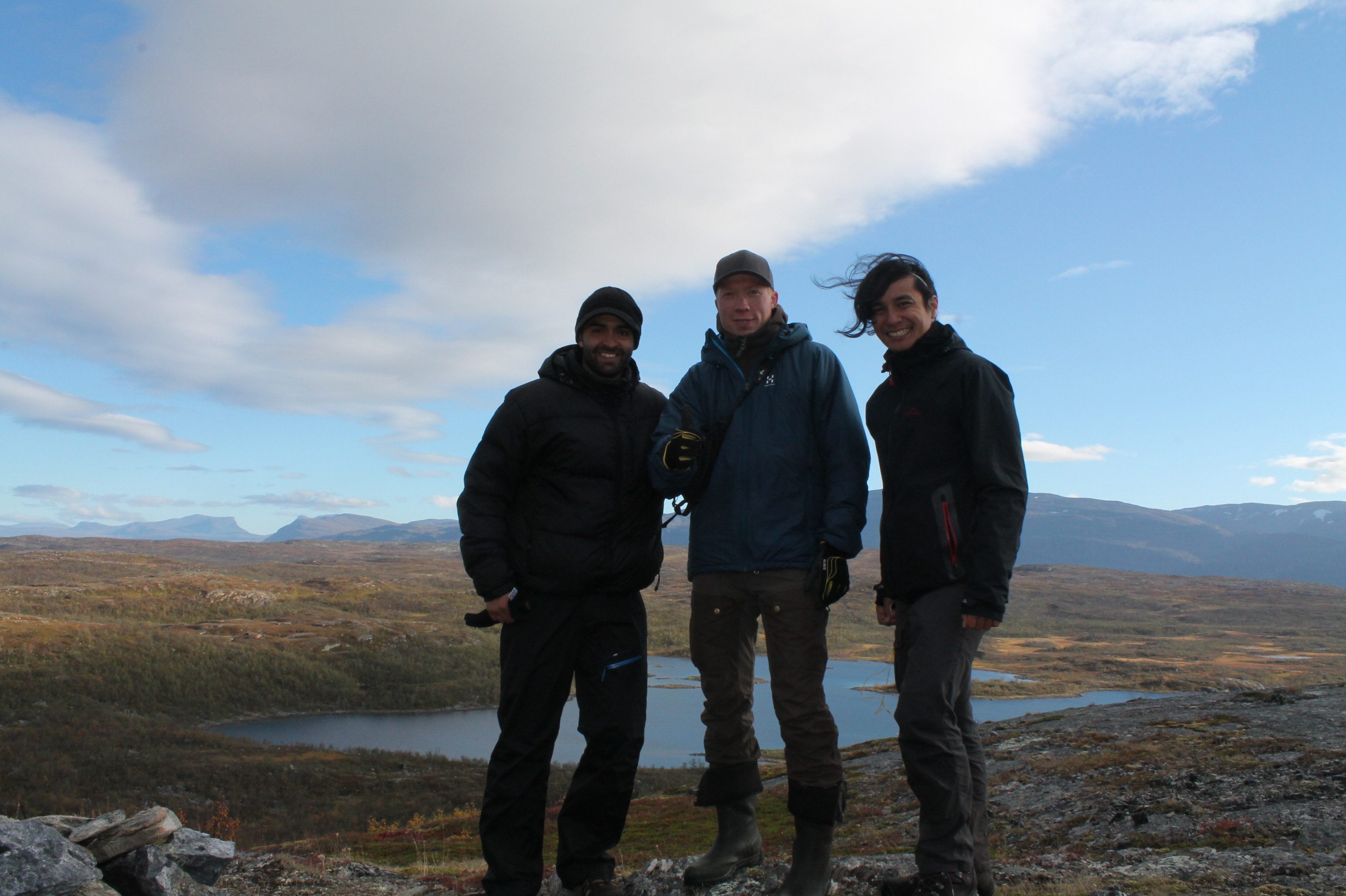
I had been hiking in the desolate alpine swamplands of the Swedish Lapland with my Colombian colleague, Daniel. We were a pair of tropical adventurers so far out of our comfort zone. All around us was the Fall in the arctic circle, 68.42 degrees north from the equator and 1,356 kilometers north of the capital, Stockholm. It was only September, but the Fall this far north had reached its deep red and fading yellow colors. In a matter of weeks, the low sun would bring the first ice and snow that grips this landscape for at least half the year, year on year. Most fauna will begin the exodus south; all flora will meet its temporary death soon.
As we plotted our own exit from the wilderness, I pondered how we had even gotten this far. Two seasons earlier, while hiking solo in Hoga Kusten (The High Coast), one of Sweden’s UNESCO World Heritage sites, I met brothers Emil and Magnus. I joined them clambering over boulders, negotiating the coastal cliff face, and chewing on this sour plant locally called harsyra.
Harsyra, or sorrel, is a sour perennial herb that just grows everywhere in the northern forests. It is eaten fresh, off the ground.
High fives and an exchange of email addresses as we parted ways turned into an invitation weeks later, when Magnus told the tale of the northernmost national park of Sweden. And so we hatched a plan to explore the Vadvetjåkka National Park.
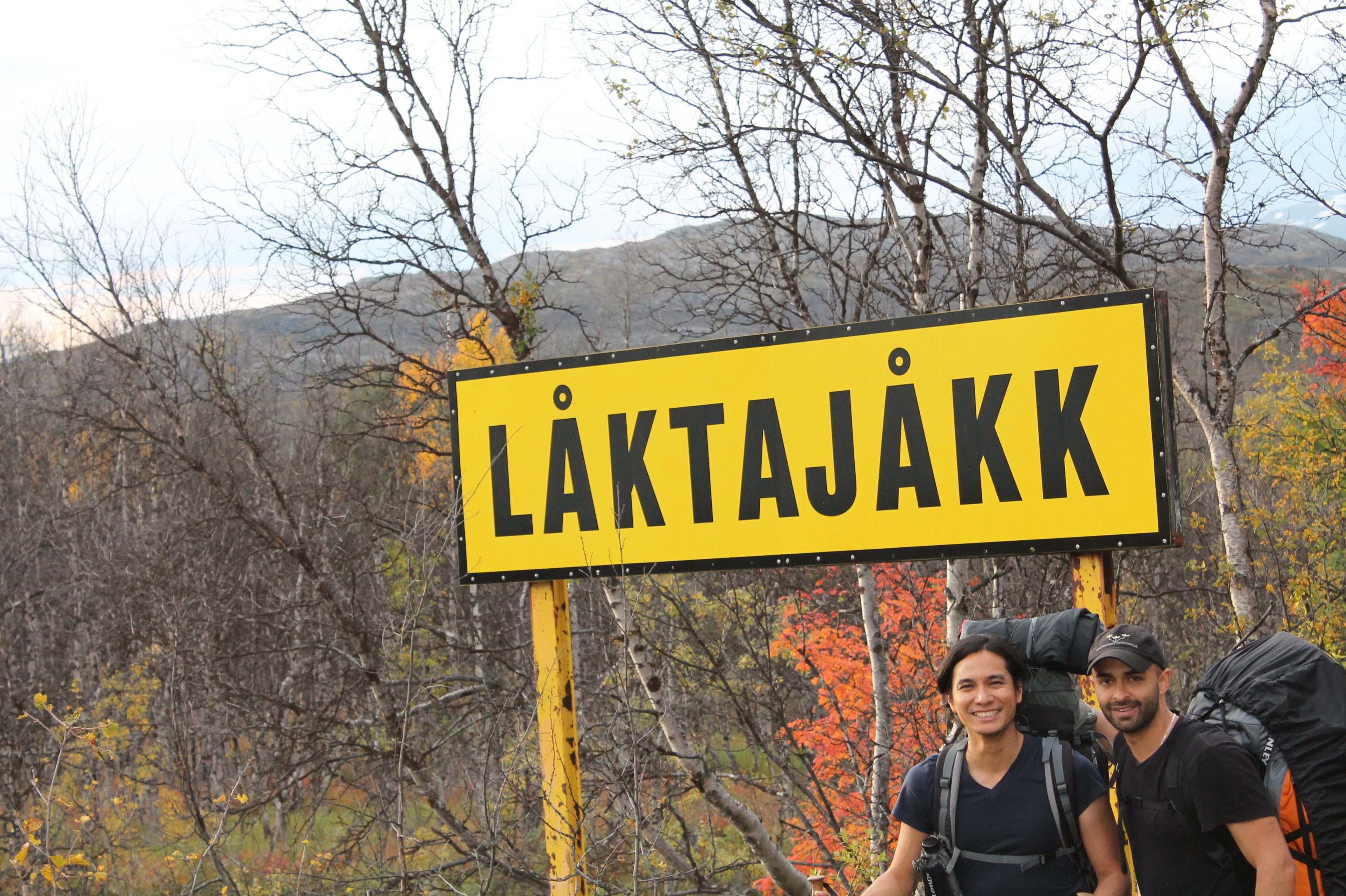
Magnus never came around to making the trip, but he had left me with an intrepid plan and scanned topographic maps of the northern border region between Sweden and Norway. In the desolate alpine region lay a small mountain called Vadvetjåkkajakka. It rose over the traditional summer grazing lands of the reindeer, and towered over a protected delta of meandering rivers, home to arctic birds, moose, bears, and lynx. The plan was to jump off a train at Laktajakka, 18 hours away from Stockholm, navigate even farther north through the marsh to Mt Vadvetjåkkajakka, circumnavigate the mountain through the Norwegian border, then back into Sweden on the east side of the mountain. The topographic maps were vital because there were no trails that far north. Part of my equipment, I had printed copies of the maps, an orienteering compass and a pencil – the barebones of terrestrial navigation. Add a tent, camping stove, and a backpack, I was set to go.
“I don’t know what’s out there, but I want to find out,” I challenged Daniel’s unbridled latino machismo. “This is our chance. Are you in?”
Like most silly plans, this one was almost a dare. Two equatorial foreigners setting out for nearly the farthest point on the Swedish rail network, only to cover the remaining distance to the farthest border regions on foot. On foot but with no trails to follow, somehow I was satisfied with the pencil, compass, and a map printed on office bond paper. Looking back, I realize that at that point, Daniel was oblivious to the strange odds we faced. The dare worked.
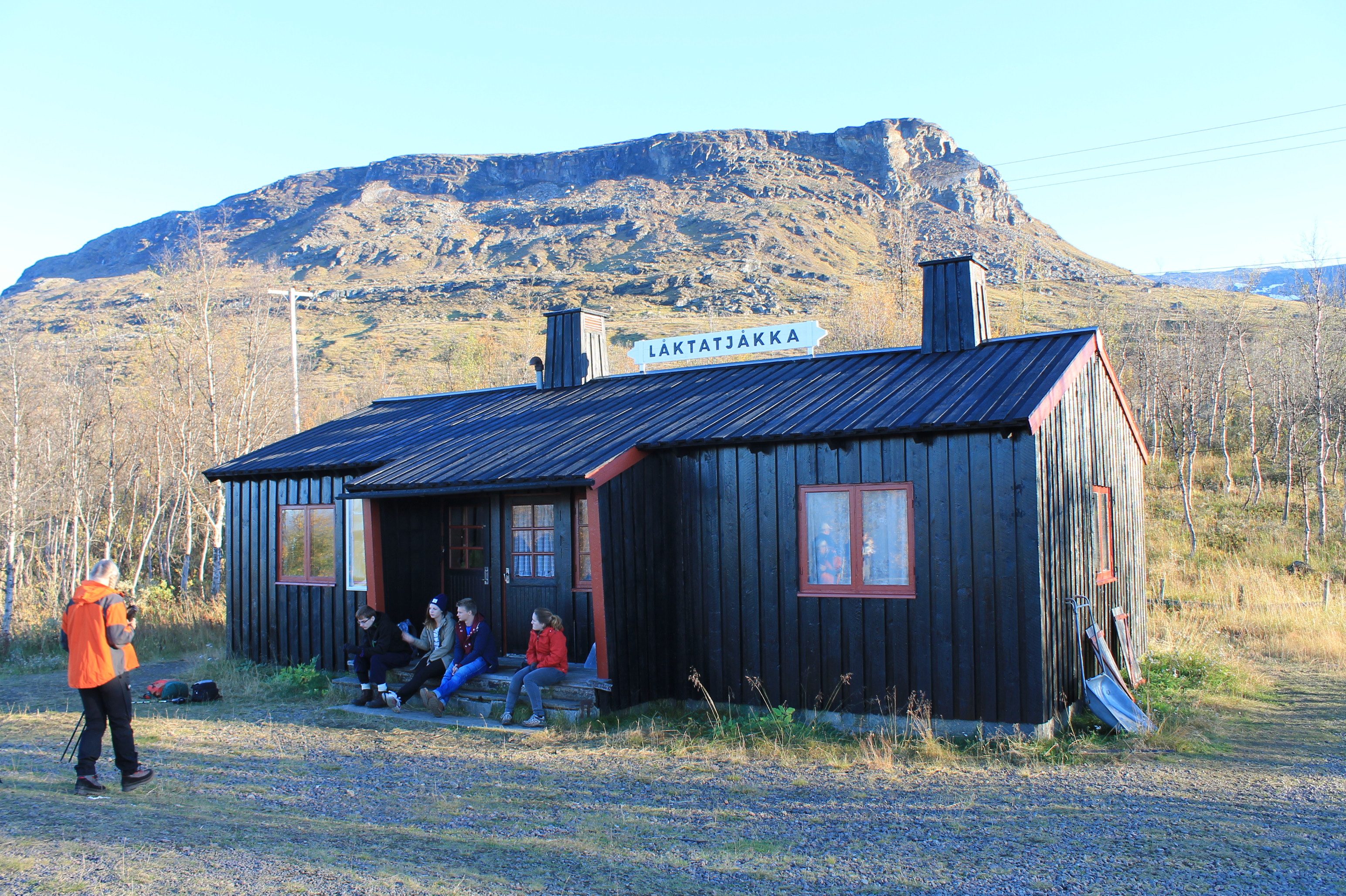
When I said jump off the train, I had not meant it literally until I actually saw what Låktatjåkkajakka station looked like. Daniel had stayed up for most of the 17-hour journey, alighting at every station (pronounced sta-hon in Swedish) to document the wooden red barnhouse architecture that distinguished itself from the more modern train stations farther south. At every station, save for this one, there was a platform. Here, there was gravel 1.5 meters below the door.
The PA announcement ordered all passengers alighting at Låktatjåkkajakka to head to a particular door in a specific train car. Like paratroopers, we fell in single file behind the pneumatic door waiting to jump out. Unlike paratroopers, we didn’t jump out of a moving vehicle. Still, it did not stop me from executing a PLF (parachute landing fall). Dusting my clothes, I set off into the wilderness.
The sun comes down very early in the arctic Fall, much earlier than I would have liked. As soon as we crossed the train tracks north, and the only road for hundreds of kilometers around, the footpaths disappeared into the bush. The willow forests in the marsh reached and snagged at my face and arms, and I frequently stepped into mossy carpets that collapsed into pockets of black water beneath. I looked up to the higher ground on the east, the peaks in the distance towards the south, and stared at my bond paper map in the fading light. I took compass bearings, drew triangulation lines, and authoritatively marked a spot on the map.
“I don’t know where we are,” I declared. Daniel did not seem to mind, firing away at random things with his SLR camera.
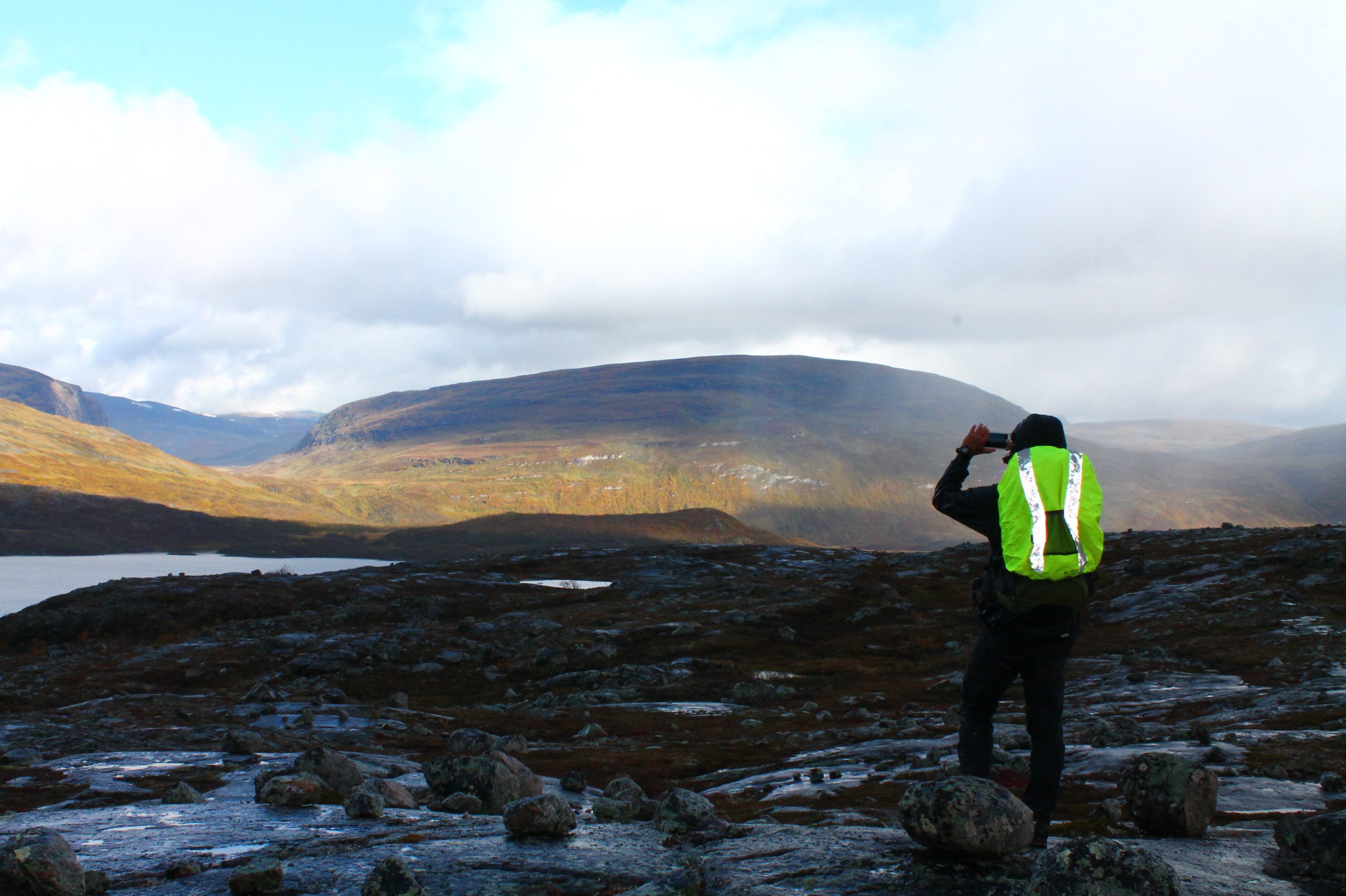
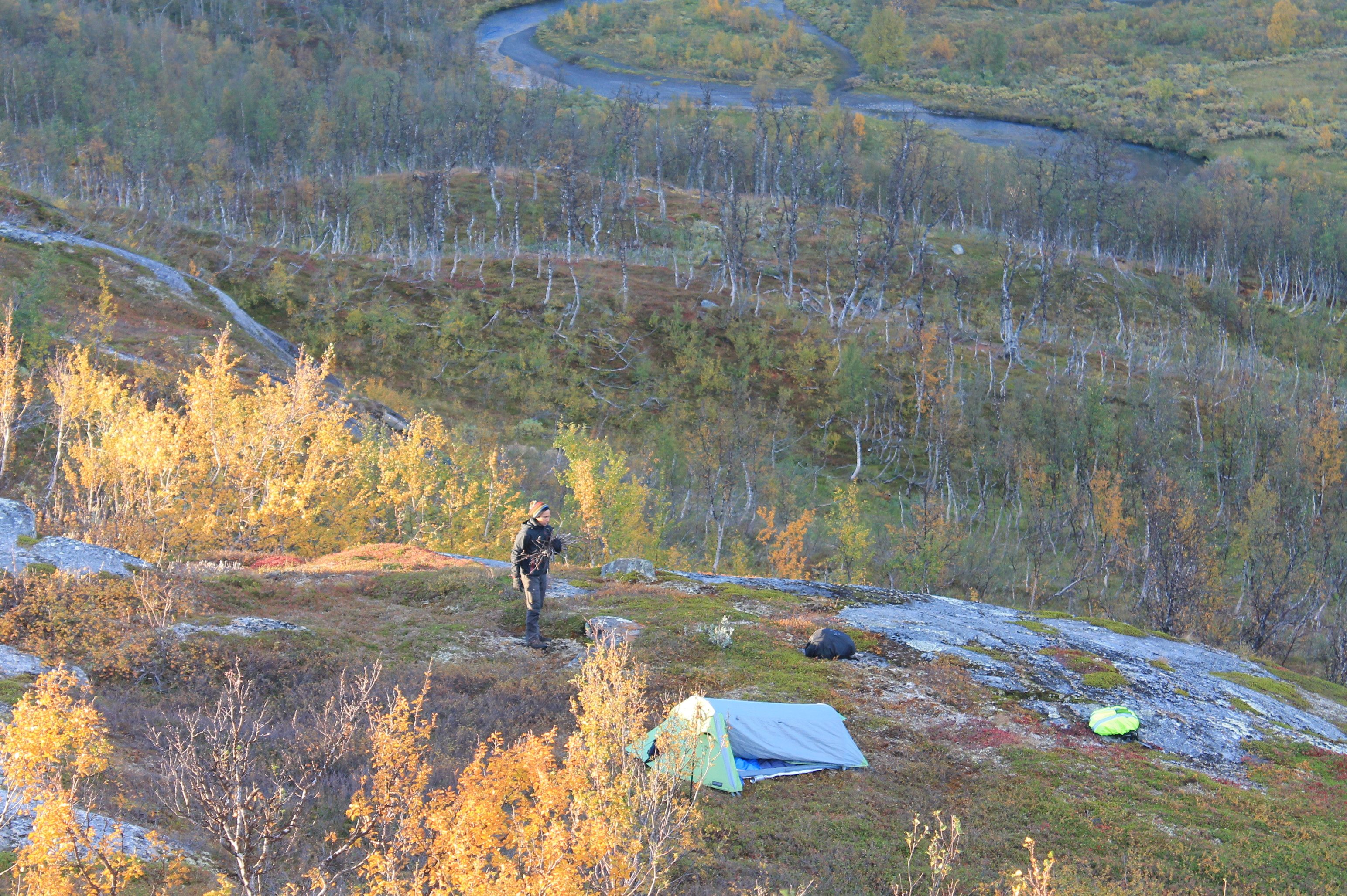
We pitched a tent in a clearing in the willow forest up on a ridge, well above the boggy ground below. I had acquainted myself with the weather patterns, and I worried that Vadvetjåkkajakka National Park was exposed to the North Sea weather system that blows forcefully and unimpeded inland over the flat terrain. The low mountains south from where our camps stood are described as the “rain shield” that protects the nearby Abisko National Park from the North Sea’s fury. We were well beyond that shield. That night, the wind howled and the rain fell sideways as we lay dry and toasty inside the tunnel tent.
Daylight came and the land was drenched underneath low ashen clouds. The spray of rain left beads on my jacket and kept my brow dripping. Beneath our boots woven into the grass grew blueberries, unpicked through the summer and fall. Entire hillsides were covered in berries, and my boots were awash in its juice.
“To stay hydrated, you have to eat the blueberries,” I coaxed Daniel.
Like a true citizen of the global south, he was suspicious of eating off the soil. “No way,” he replied.
At the top of the ridge, exposed to the wind and rain, we found the remains of a stone foundations of a shelter. From its perch we saw in the distance to the north, Mt. Vadvetjåkkajakka.
“It’s smaller than I thought.”
“That’s bigger than it looks.”
Carved into its western flank was a gully and a pass. I pointed to the pass and muttered to Daniel, “That is where we are going, through to Norway and back.”
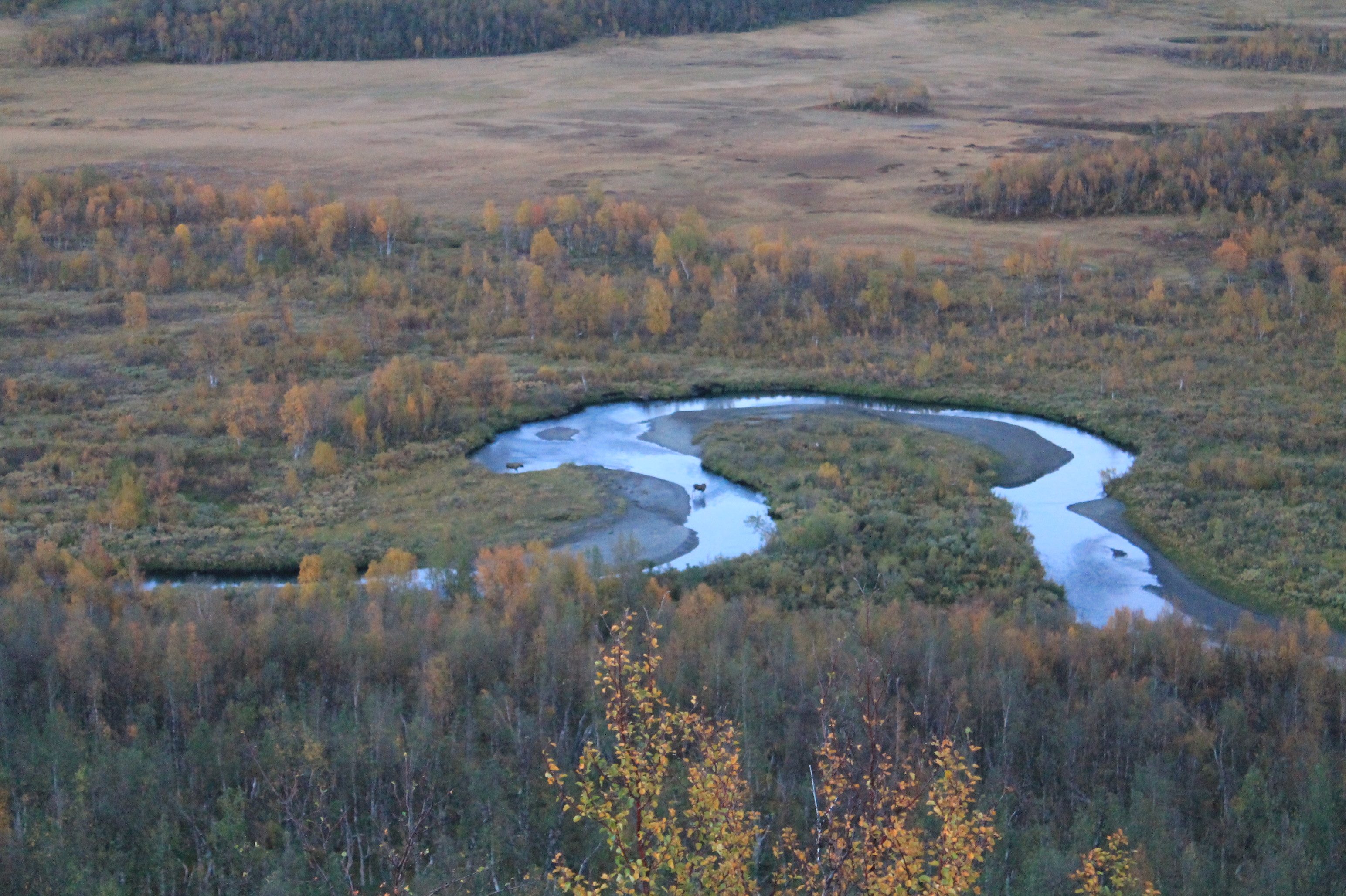
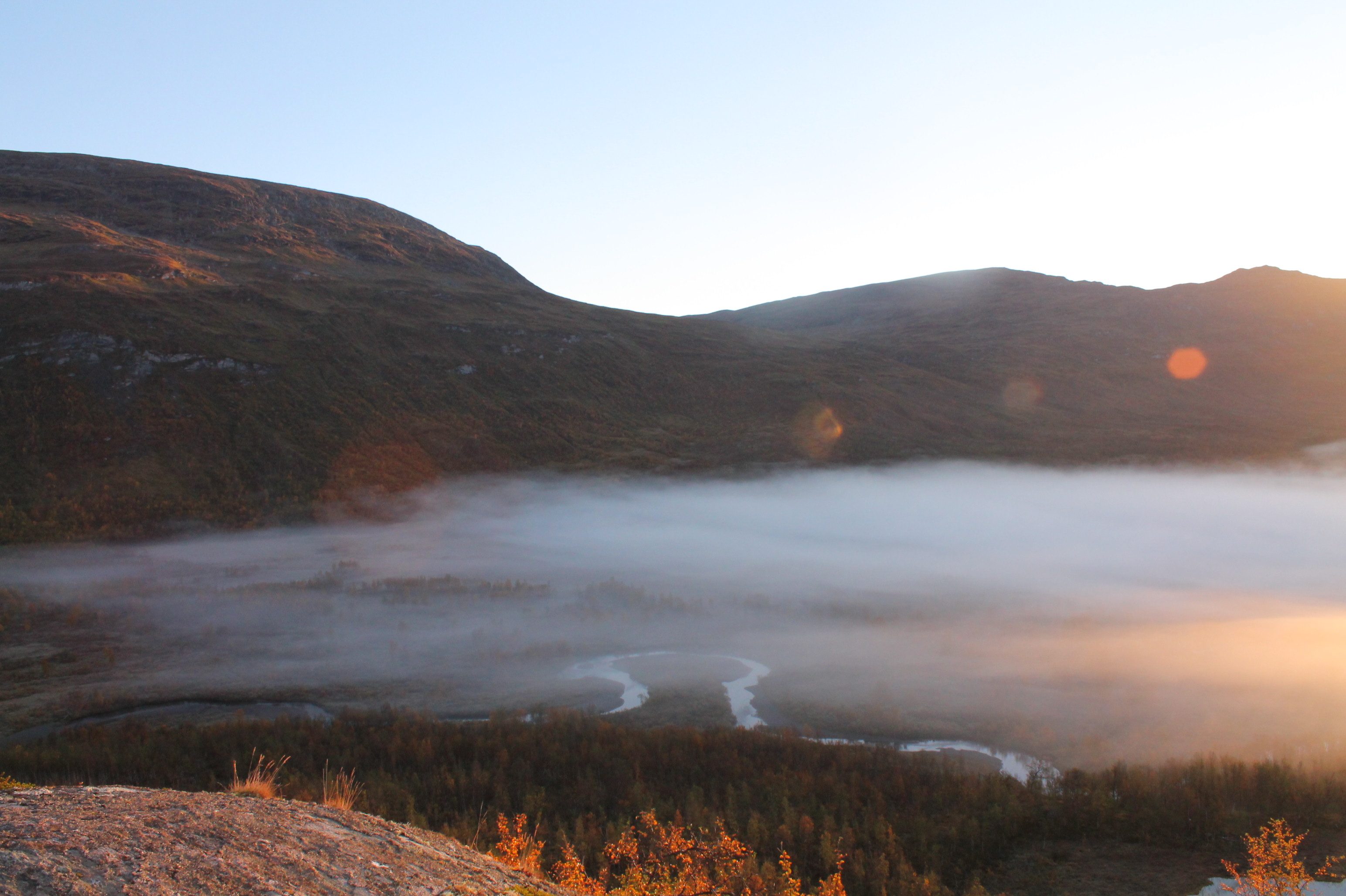
 Of course, we never made it that far. In fact, from the original itinerary laid out by Magnus, we did not even set foot on the mountain much less circumnavigate it, and complete an international border crossing twice over. After hours of walking, guided by the pencil-paper navigation, we had gone far enough though to a hill overlooking the fabled river delta marshlands. I had thought to set camp there and give it one more day to get to the border crossing. For that day, it was enough to take in the magnificent landscape of the arctic marshes.
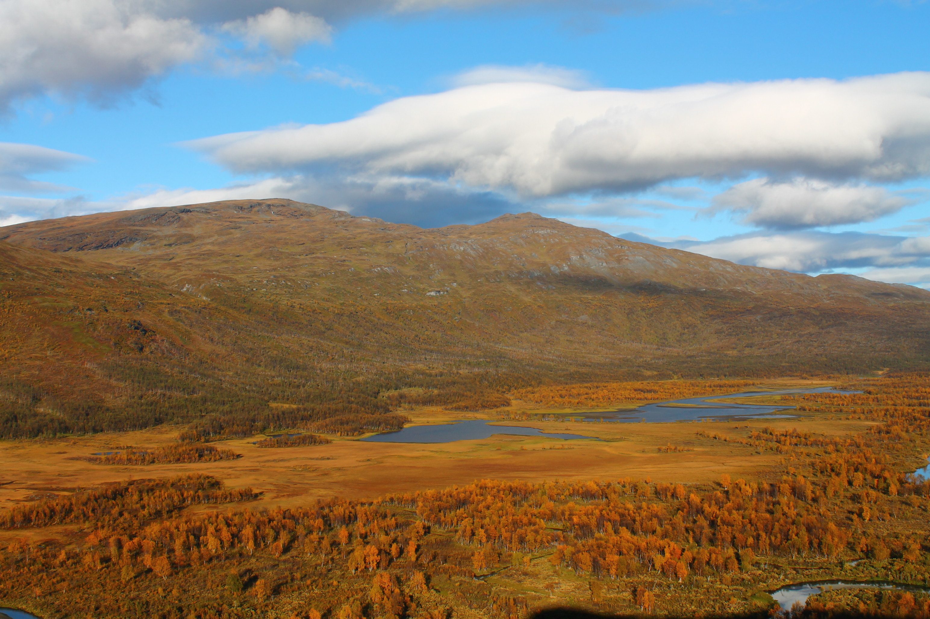
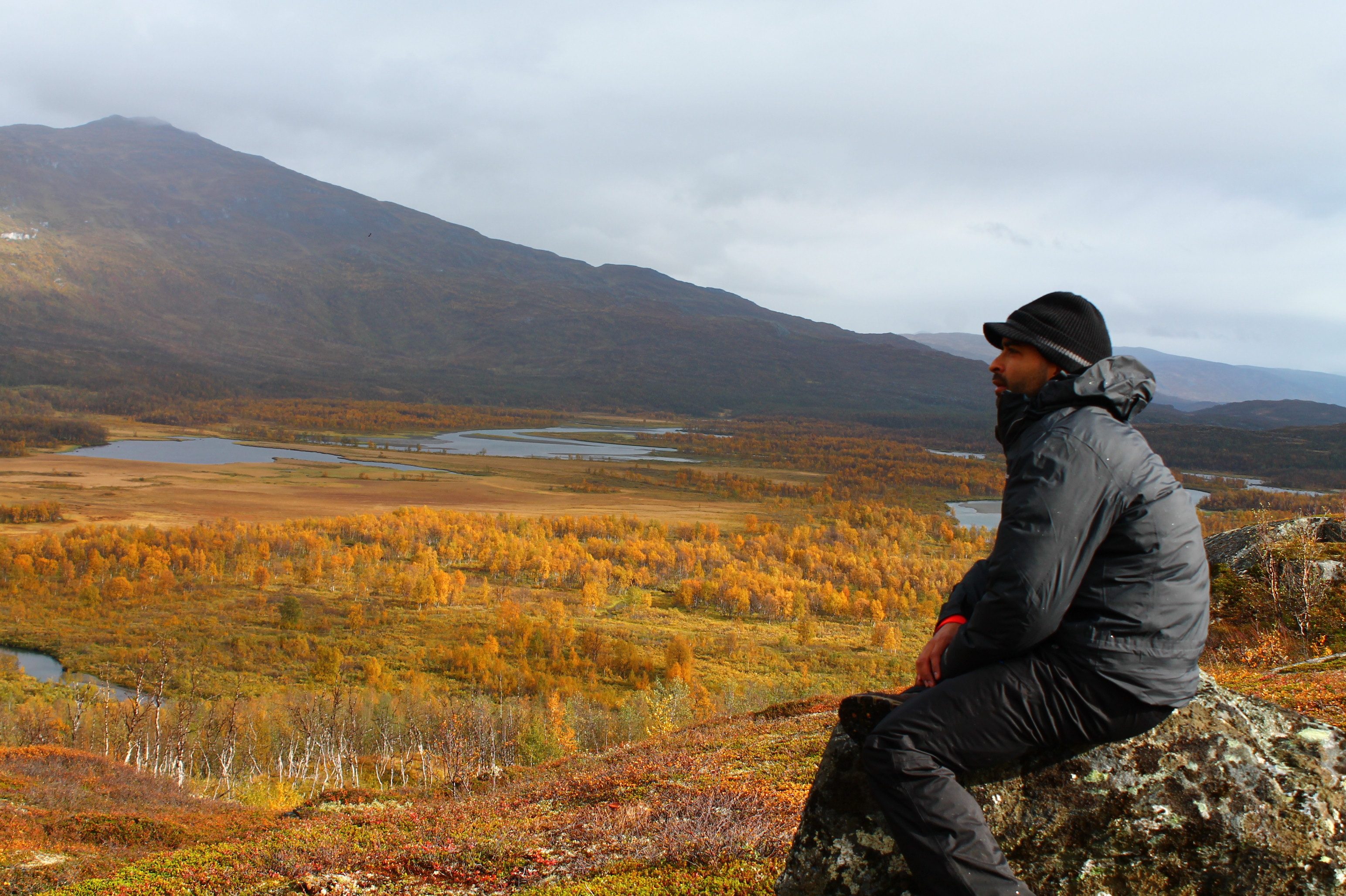
Over great distances, we could spot the moose. They emerged from the trees in the marsh below, their antlers splayed and formidable. The moose were the size of small trucks, but nevertheless made seemingly miniature amid the vast wilderness that enveloped us.
Behind us, higher up the hill, a dog barked. Where there are dogs, there are people and we had not seen another person save for a pair of fit elderly ladies roaming the trails days ago, several kilometers south and near the train station. Yet at the top of the hill, the dog scurried away into the brush where we spotted a teepee. And up from behind us, a man bellowed, “What are you doing here?”
Daniel and I looked at each other. “What are you doing here?” the stranger repeated.
“We are tourists, from very far away.”
Turned out, we were probably the last hikers that year to venture so far off from the Låktatjåkkajakka. The tall man explained that he was of the Sami, the indigenous people of Lapland. This area is where he raises reindeer the whole year, save for September, the month of his moose-hunting concession.
“This whole area is my concession. Good to know that you two are here, so that I do not accidentally shoot you!” He brandished a bad-ass hunting rifle. I remember thinking that I had a puny hand ax fashioned from Finnish steel, but strapped to my pack halfway down the hill.
 I can’t remember if I asked perfunctory questions like the make, caliber, maximum range. Instead, I recall more interesting things, like how he leaves giant blocks of salt just past the river that demarcates the extent of the wildlife protected delta. The moment a moose braves the river below for a lick, a bullet hurtles from about 800 meters from exactly where we stood at the top of the hill. And since the nearest solitary road is so far away, he calls for a helicopter to winch the carcass to the nearest town.
“Amazing!”
“I stay for the whole month, living in there,” he gestured to his teepee. “Sometimes my girlfriend comes out to live with me here. Otherwise, it is just me this far out.” I looked around, and our new Sami friend assured us there was no one else around as far as our eyes can see.
Over the campfire that night near our tent, Daniel complained that we had no coffee.
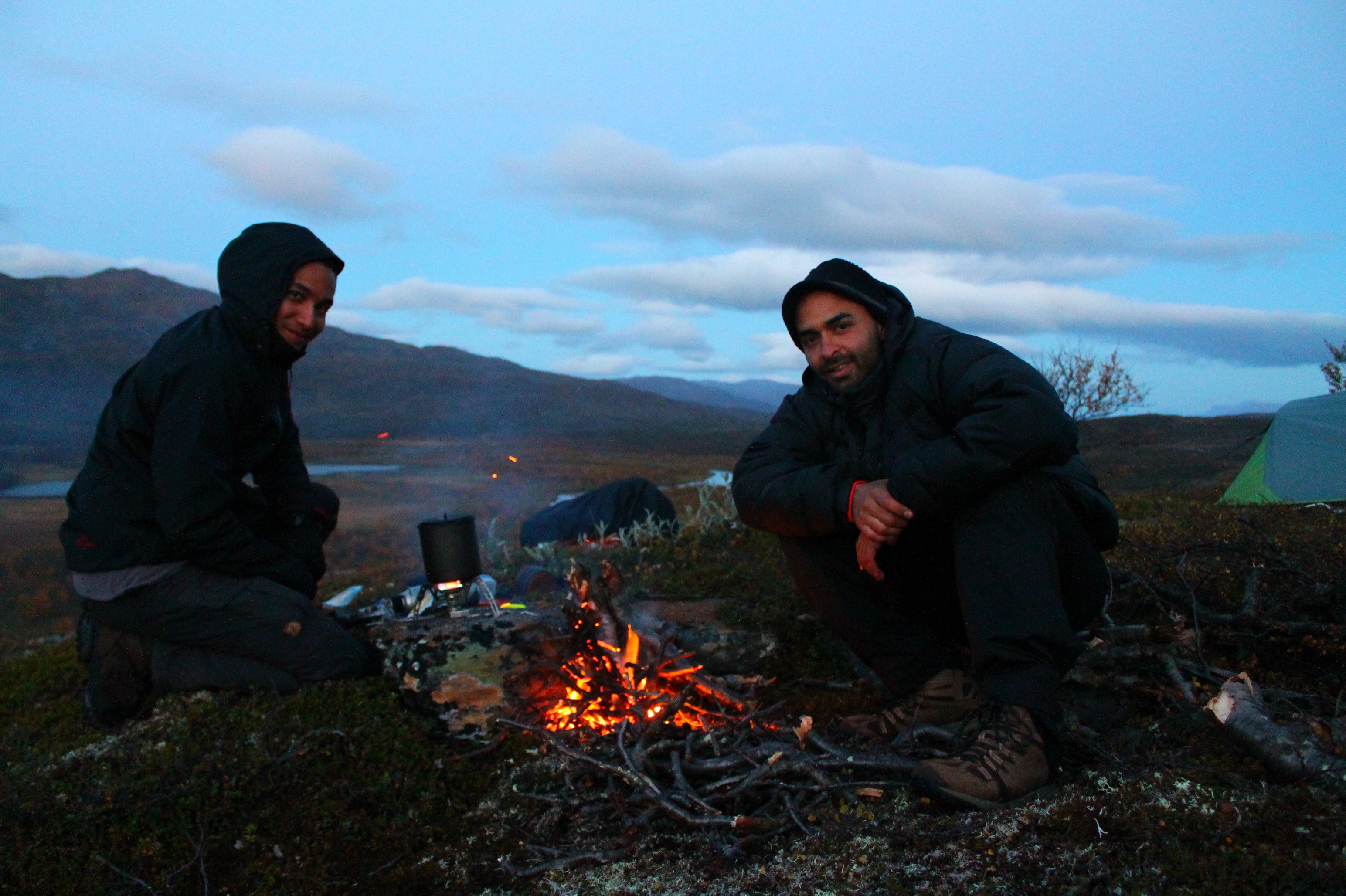 “You’d think the one who grew up drinking Colombian coffee would remember to bring some,” I shot back in jest. It was cold though, and the glow of the fire could barely keep our fingers warm as the temperatures dropped to near freezing. I did wish we had a cup of instant coffee at the very least.
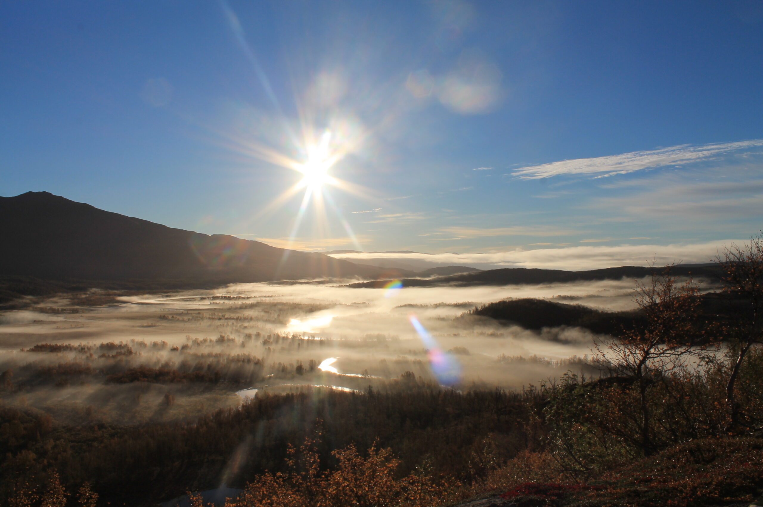
I stirred at dawn and found Daniel outside. He decided to take these incredible shots of sunrise over the delta, mostly because he could not sleep. “Every night out here, it feels like an ice river is flowing under my back.”
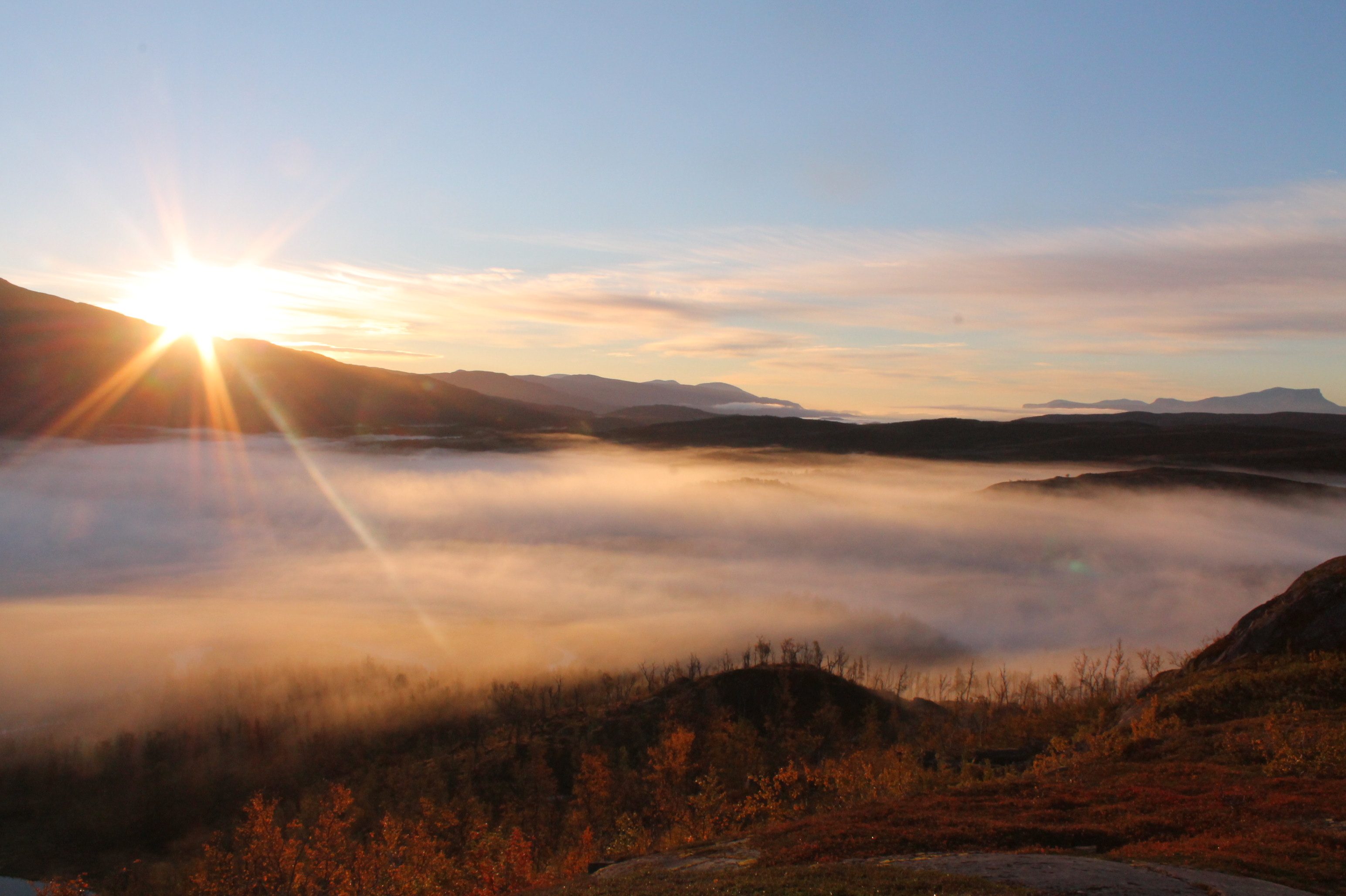
I stared longingly to the gully on the west flank of Mt Vadvetjåkka and imagined the Norwegian border just past it. “But we are almost there,” I pleaded to myself. I knew it was time to haul ourselves back from the depths of the wilderness. To pull off Magnus’ plan, we needed to cross the marsh to get to the gully, stay a day on the other side of the mountain, before heading back south to catch a train in Låktatjåkka. As I ate my breakfast, the mist hovered like an immense ghost over the marsh delta below and the infinite landscape in front of us. It was all beautiful and it seemed endless in all directions. We packed up, took one last look at the mountain, the delta, birds of prey circling above, and we decided to walk home.
At the road, a bus eventually came. In a place without bus stops, without marked trails, and a vast emptiness of wilderness, there was some certainty at least that a bus would drive through once a day.
On the bus to Kiruna, we sat silently. No one before, or since, I hiked Vadvetjåkka could tell me what the name means. Most Swedes had never heard of it, and those that had, instantly knew that it was probably a word from the indigenous Sami’s Uralic language. I should have asked the hunter when I had a chance. Thinking about it now, from thousands of kilometers away, I should have braved the marsh, the lurking moose in the trees, the pass into Norway with just a compass, a paper map, and a pencil when I had a chance. – Rappler
Add a comment
How does this make you feel?
There are no comments yet. Add your comment to start the conversation.