SUMMARY
This is AI generated summarization, which may have errors. For context, always refer to the full article.
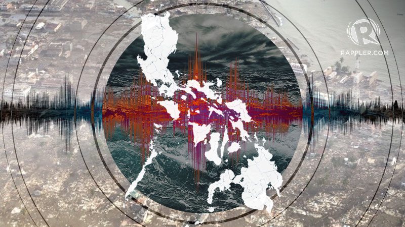
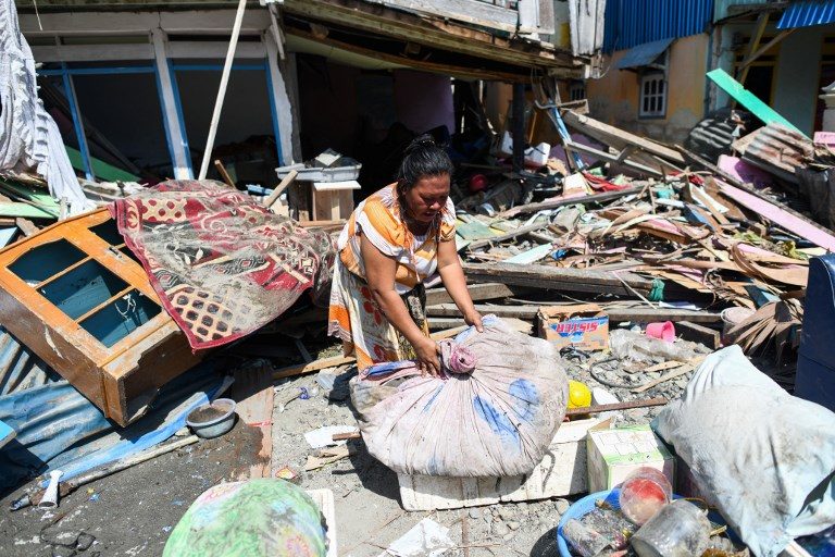
MANILA, Philippines – The tsunami in Palu, Indonesia, took more than 1,500 lives. Several factors – including the country’s topography, vulnerable communities, and a less-than-robust early warning system – make tsunamis in Indonesia especially deadly.
Like Indonesia, the Philippines sits on the Pacific Ring of Fire which includes about 90% of the world’s volcanoes and where plate movements frequently occur – making the country as prone to earthquakes and tsunamis as Indonesia. (READ: MAP: Strongest earthquakes in the Philippines)
To many, what took place in Indonesia serves as a reminder for the Philippines to ensure that preparations for such disasters are continuously being implemented and improved to avoid similar devastating impacts. This begs the question: How is the Philippines preparing for the likelihood of a destructive tsunami along our coasts?
In a phone interview, Department of Science and Technology (DOST) Undersecretary Renato Solidum Jr shared 4 major components of preparedness for earthquake and tsunamis: near real-time integrated monitoring system, hazard maps, communication of information, and timely and appropriate response.
Ishmael Narag, Officer-in-Charge of the Seismological Observation and Earthquake Prediction Division of the Philippine Institute of Volcanology and Seismology (Phivolcs)-DOST, referred to this as an end-to-end warning system: from preparations to response.
Near real-time integrated monitoring system
Having a near real-time integrated monitoring system is vital because tsunami warnings are based on earthquake parameters. At present, the country has 100 seismic or earthquake-monitoring stations installed across the country, and 15 more are to be added before end of the Duterte administration.
According to Solidum, the reason behind having many instruments is because there are times when some of the stations won’t function and will need to be maintained.
“You don’t need 100 stations to record a large-scale earthquake event,” he said. “But we try to maintain it as much as possible at the highest level. It’s part of our work.”
Narag said that Phivolcs implements regular preventive maintenance to make sure that failures in the monitoring stations are immediately fixed. They have also allotted a budget for acquiring spare parts which are purchased in advanced based on their typical failure time, shortening the time for repair.
“We have a team that maintains the instruments,” he added.
“You don’t need the operation to be at a hundred precent,” said Solidum. This is because of the level of redundancy that the instrumentations installed in the country have.
“Data comes in 24/7 from the remote stations to our main system in Quezon City,” said Narag. If for some reason they don’t get data from a station, data will still come from the other installed monitoring stations.
Their main system in Quezon City also has a back-up mirror station in Tagaytay.
Narag said: “We saw that in a Valley Fault scenario, Tagaytay is among those that could possibly be affected, so we are now currently establishing cluster centers in Davao and Lapu-Lapu. If the Quezon City data-receiving center fails, we go to Tagaytay. If both fails, Davao will take over.”
Sea-level monitoring
Aside from the location and time, large-scale earthquake monitors called broadband seismometers also determine the magnitude of an earthquake. This is necessary for an accurate prediction about the tsunami that may follow.
In addition to the earthquake monitoring stations, Narag said that another system that must be in place are sea-level monitoring sensors located either offshore or onshore, so the displacement of water after an earthquake could be detected.
At present, Narag said there are only around 17 sea-level monitoring stations located onshore in strategic areas across the country, which according to him is nowhere near complete. “Currently, we have this idea of putting up sea-level monitoring stations in islands closer to the source that would be able to detect the wave before it reaches populated areas,” he said.
He said that for Manila Bay, for instance, there’s a sea-level monitoring station in Lubang Island and Corregidor Island.
“If ever the one in Lubang Island detects any event that would come from the Manila trench even before it reaches Manila Bay, we would also detect it in Corregidor Island,” Narag said.
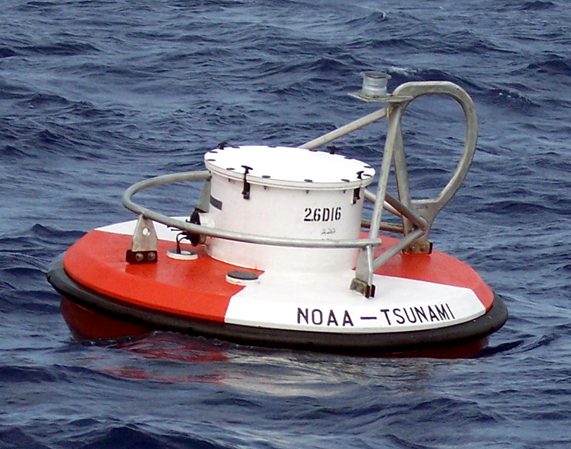
He also mentioned US-controlled tsunami buoys placed all over the Pacific Ocean where one can draw information from online for waves that would come from distant places.
Beyond the tools
Aside from the tsunami warning systems, Solidum added that hazard maps have also been made available since 2007 to aid in the proper identification of areas that will be affected in various disaster scenarios.
Rappler, through its Agos powered by eBayanihan campaign and in partnership with Phivolcs, published multihazard maps created under the government agency’s READY Project. It covered 28 of the most vulnerable provinces in the country and included risks associated with hazards such as earthquakes and tsunamis.
The maps are available on the Phivolcs website and have been replicated and distributed by the Department of the Interior and Local Government to local government units. In case of a threat, Solidum said that Phivolcs acts as a warning agency and coordinates with different government agencies including the DILG, Office of Civil Defense, and LGUs.
According to Narag, these are the “decision support tools” or applications and sets of protocols that help Phivolcs decide whether they should release a warning or a cancellation.
But more than having the right tools, Solidum and Narag agreed that it is as important to ensure that communities would know what to do in case of a threat.
For both disaster scientists, the next questions that need to be addressed are these: How can we make these tools work for the vulnerable communities? How are we preparing them to respond to extreme weather events like tsunamis and earthquakes? – Rappler.com
Add a comment
How does this make you feel?
There are no comments yet. Add your comment to start the conversation.