SUMMARY
This is AI generated summarization, which may have errors. For context, always refer to the full article.
MANILA, Philippines – 4 years since its last eruption, Mount Bulusan erupted again.
In a span of one week, Mount Bulusan in Sorsogon province had two consecutive steam-driven eruptions, prompting Philippine Institute of Volcanology and Seismology (Phivolcs) to raise its alert status to Alert 1. (READ: Mount Bulusan erupts again)
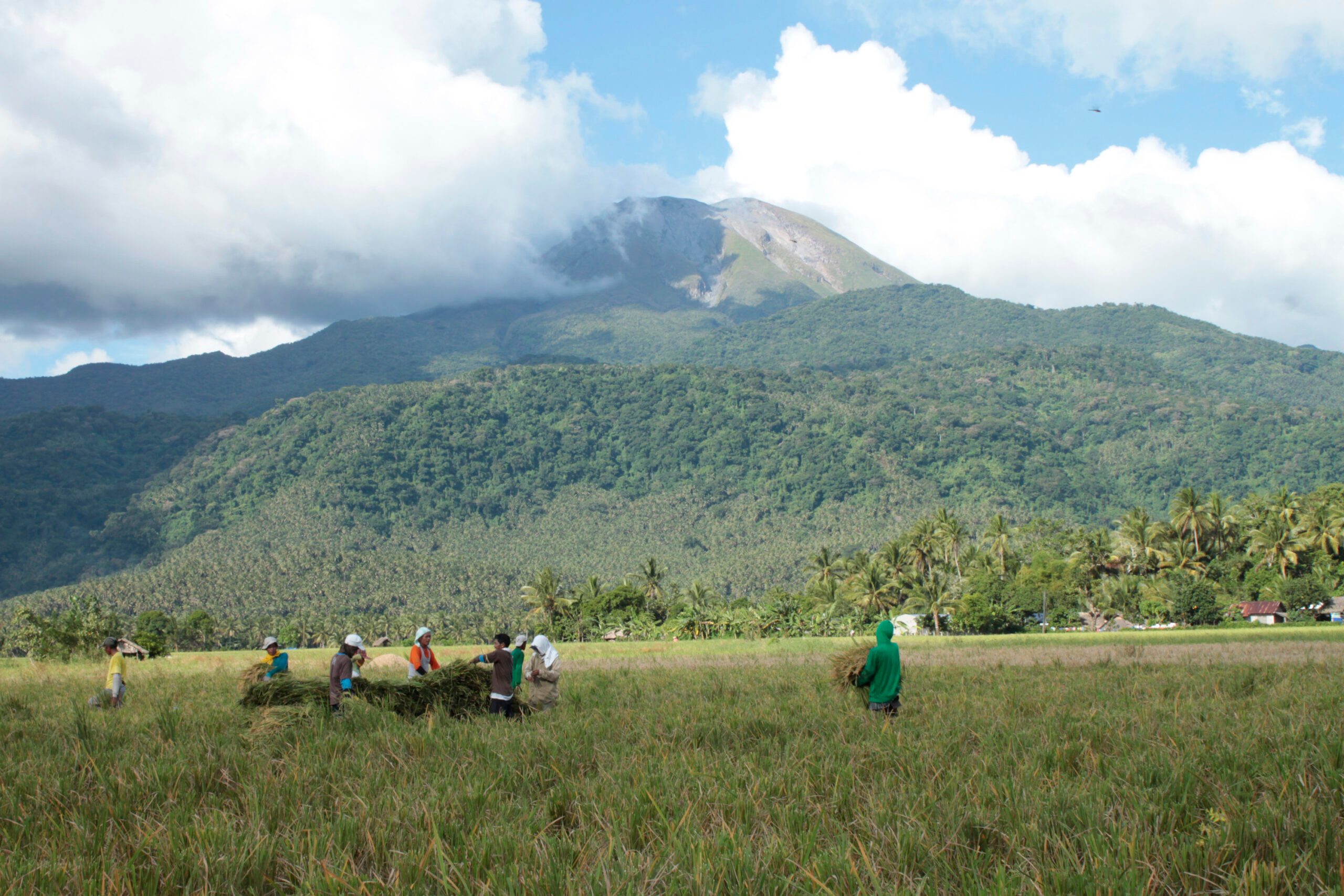
Mount Bulusan is a stratovolcano, a cone-shaped volcano which has one or several summit craters. It has a base diameter of 15 kilometers (km). Located in Sorsogon province, it is about 70 km away from Mayon Volcano in Albay, Bicol.
In the east, it is bounded by San Bernardino Strait, while in the north, by Sorsogon Bay. Volcanic mountains surround its western and southern portions.
Here are some fast facts on Mount Bulusan, one of the most active volcanoes in the Philippines.
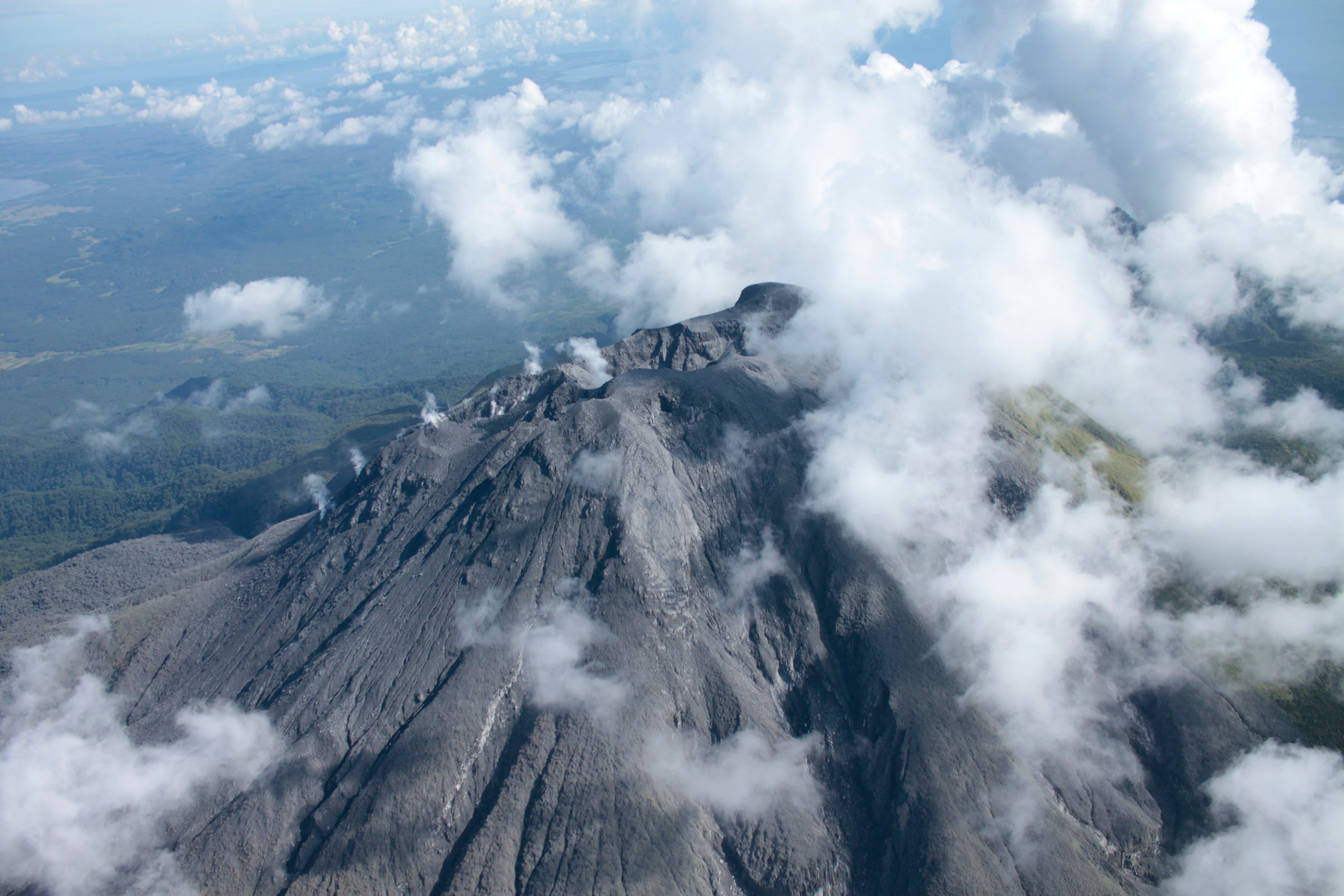
1. It has four craters.
The mouth of a volcano found at its summit is called the crater. Mount Bulusan has not only one, but 4 craters in its summit.
The first crater (also called Blackbird Lake) and the second one are both 15 meters deep. The third crater is 90 meters deep.
During Mount Bulusan’s eruption in 1981, a fourth crater was formed. According to Phivolcs data, this is Mount Bulusan’s most active crater.
2. Its edifice has different features
There are different volcanic edifices found around Mount Bulusan’s body. These are: Mt Homahan, Mt Binitacan, Mt Batuan, Mt Calungalan, Mt Calaunan, Mt Tabon-Tabon, Mt Juban and Mt Jormajan.
Four springs – San Benon Springs, Mapaso Springs, San Vicente Springs, and Masacrot Springs – can also be found on it.
3. It is the Philippines’ fourth most active volcano
Mount Bulusan has had 16 recorded significant eruptions, so far. Its first was in 1852. (READ: MAP: Active volcanoes in the Philippines)
After 1852, the next significant eruption was in January 1916. For 5 days that month, Mount Bulusan had a series of minor eruptions, followed by “earthquakes, rumblings and subterranean noises,” according to data from Phivolcs.
After 1916, there was a series of years (from 1918-1922) when Mount Bulusan was recorded to have emitted ash. In December 1918, lava started pouring down, light shocks were felt, and rumblings were heard, causing alarm in nearby towns and barrios.
However, it was not until May 1919 that Mount Bulusan had one of its worst eruptions. According to data from Phivolcs, “the eruptive force was so great that the vertical column was unaffected by the prevailing wind… cloud was then slowly carried towards the west where it caused so much darkness….”
After 1919, succeeding eruptions usually occurred for 15-30 minutes. Its greatest eruptions, according to Phivolcs data, occurred from 4 pm to 5 pm.
Significant eruptions also occurred in 1933, 1978, 1980, 1981, 2006, 2007 and 2010. The last eruption was in 2011.
4. Sudden eruptions are common for Mount Bulusan
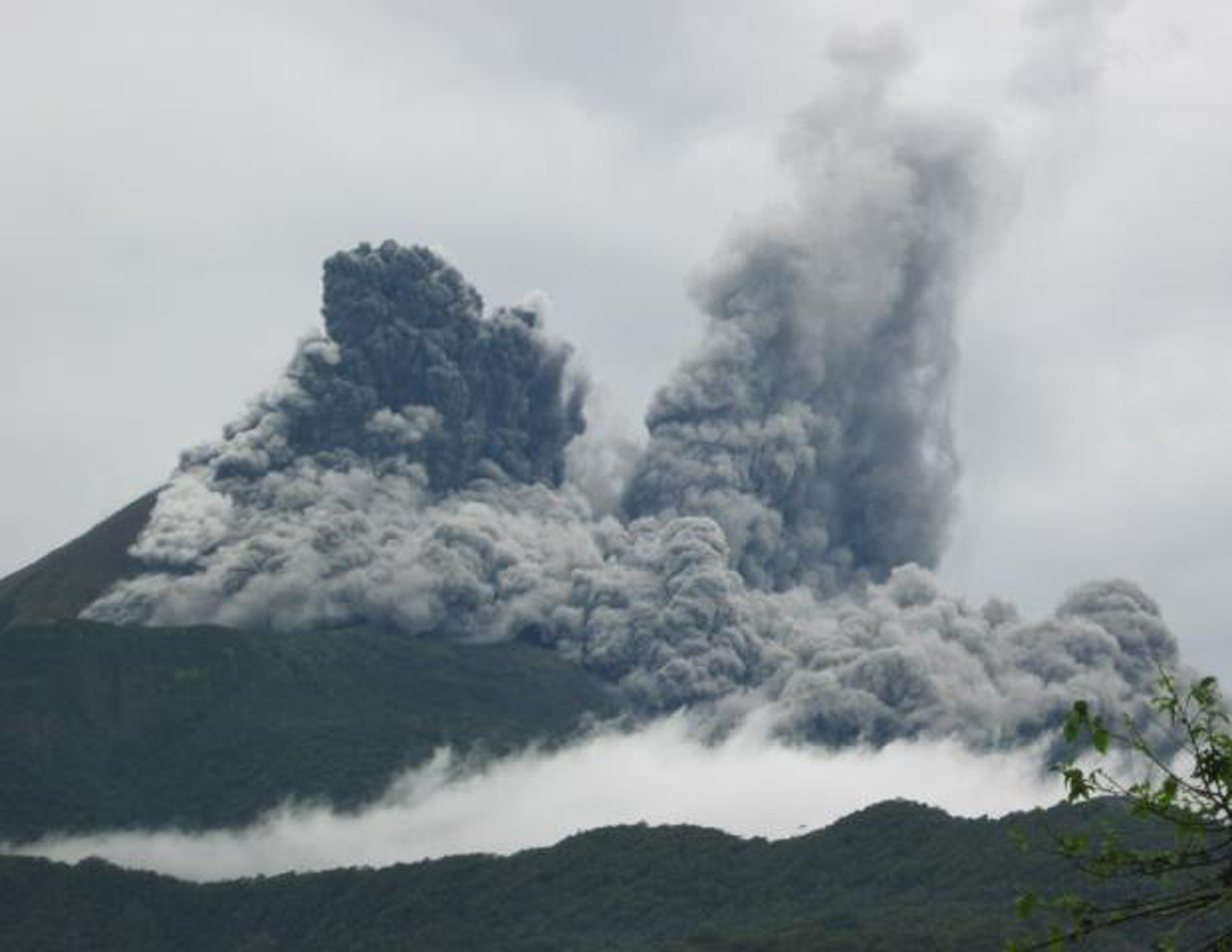
Based on Phivolcs’ records, majority of past activities of Mount Bulusan have been “phreatic” eruptions.
Phreatic or steam-generated explosions occur when water makes contact with hot rocks inside the volcano, producing steam.
This type of eruption often comes without warning, skipping the usual alert levels issued by Phivolcs before an eruption. Such type is “hard to predict”, according to Phivolcs director Renato Solidum, unlike other types of eruptions that are preceded by volcanic earthquakes or detectable rising magma.
5. It has a 4-km Permanent Danger Zone (PDZ)
A PDZ is an area around a volcano where human settlement is not allowed. Mount Bulusan is among the 5 volcanoes with a permanent danger zone, along with Mayon, Taal, Kanlaon and Hibok-Hibok. (READ: MAP: Active volcanoes in the Philippines)
Towns surrounding the 4km PDZ of Bulusan are Barcelona, Bulusan, Casiguran, Irosin, Juban and Gubat. These areas may be affected by lahar or pyroclastic flows from the volcano.
Check the hazard maps here.
6. ‘Operation Bulusan’
Operation Bulusan was an action plan initiated by the predecessor of Phivolcs, the Commission on Volcanology (ComVol), in 1978 should Mount Bulusan erupt. This includes potential volcanic hazards, potential affected areas and possible evacuation zones.
During Mount Bulusan’s eruption in July 1978, the first time the plan was implemented, only residents of areas recommended for evacuation, in the event of an eruption, were actually evacuated – resulting in lower cost for the government.
According to Phivolcs’ latest bulletin, steam-driven eruptions from Mount Bulusan can still happen.
Meanwhile, disaster management authorities in the towns of Irosin and Juban in Sorsogon province evacuated more than 1,000 people on Thursday, May 7, amid the twin threats of a pending volcanic eruption and an approaching typhoon. (READ: Sorsogon towns evacuate residents ahead of multi-hazards) – Rappler.com
Sources: Bulusan Volcano Profile from Phivolcs, Phivolcs official website, various news websites
Add a comment
How does this make you feel?
There are no comments yet. Add your comment to start the conversation.