SUMMARY
This is AI generated summarization, which may have errors. For context, always refer to the full article.
TUBBATAHA, Philippines — Chugging along on a chase boat, we lower a curious contraption into the crystal waters of Tubbataha’s North Atoll. Though it looks like what you would get by crossing a farm plow with a bunch of GoPro cameras, it will change the you look at coral reefs.
With the dedicated scientists and engineers of the Automated Rapid Reef Assessment System (ARRAS) team, I’ve returned to Tubbataha to check how last year’s back-to-back ship grounding scars are healing. Earlier, we dove into the “Highway of Death” – the main scar wreaked by the F/V Min Long Yu, a Chinese poaching vessel that smashed 3902 square meters of North Atoll’s reefs in April 2013. A year on, the site looked the same – barren, with crushed corals, rocks and a light coating of hair algae kept at bay by fidgety shoals of herbivorous surgeonfish and rabbitfish. New life is sprouting, but recovery will take decades.
“This camera array has 5 GoPro cameras, each taking a continuous video of the seafloor,” explains ARRAS Engineer Francis Corpuz. “Since they’re spaced a meter apart, the videos overlap, allowing us to stitch the images and rapidly generate a large picture of the damage.” We’re done in 3 hours – far more efficient than jumping in with measuring tools and slates.
Low cost, high returns
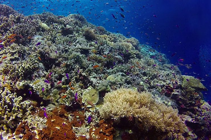
Anchoring the northern tip of the Coral Triangle, the Philippines hosts 27,000 square kilometers of coral reefs. No one’s sure what the exact figure is because like forests, coral cover fluctuates yearly. After the 1998 El Niño, when surface temperatures rose an average of 1.5 degrees Celsius, 16% of the world’s coral reefs died. Up to 49% of Philippine reefs suffered from bleaching episodes – with hard corals expelling the life-giving symbiotic algae which give them color.
Beset by half a century of overfishing, coastal development and pollution, 40% of Philippine reefs are in poor condition, with just 1% rated excellent. Ever dynamic, monitoring their year-on-year status has been difficult.
“We developed ARRAS in 2010 to make marine fieldwork faster and more cost-effective,” explains ARRAS head Dr Maricor Soriano. “We needed tools that were inexpensive, easy to build and durable. The recent surge of sturdy sports cameras like GoPros have greatly accelerated our work – allowing us to study reefs at a fraction of the cost. Images can be reviewed to minimize observer errors.”
Dr Soriano’s passion is image processing, her pursuits ranging from digitally cleaning-up old paintings to analyzing the movement patterns of sports players.
ARRAS was instrumental in assessing Tubbataha’s twin grounding scars last 2013.
ARRAS is collaboration between the Department of Science and Technology, Department of Environment and Natural Resources, Bureau of Fisheries and Aquatic Resources, National Institute of Physics, UP Marine Science Institute, UP Computer Science Department, Mapua Institute of Technology, De Lasalle University, Tubbataha Management Office and the World Wide Fund for Nature (WWF).
WWF has been working to protect the Tubbataha Reefs since 1996. While a typical square kilometer of healthy coral reef annually generates 65 metric tons of fish biomass, Tubbataha generates over 200 and constantly seeds the Sulu Sea with fish and invertebrate spawn.
A brand-new Ranger Station, featuring a research facility for scientists and researchers to conduct fieldwork for months at a time, is slated for groundbreaking in September. Barring unforeseen delays, the soft-launch is slated for the summer of 2015.
Says WWF-Philippines Tubbataha Project Manager Marivel Dygico, “Technology-based tools like ARRAS give us an unprecedented glimpse of the state of coral reefs. This provides science-based data to guide our conservation efforts.”
Bird’s-eye to fish-eye
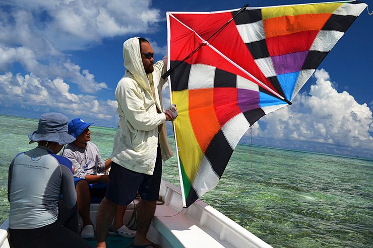
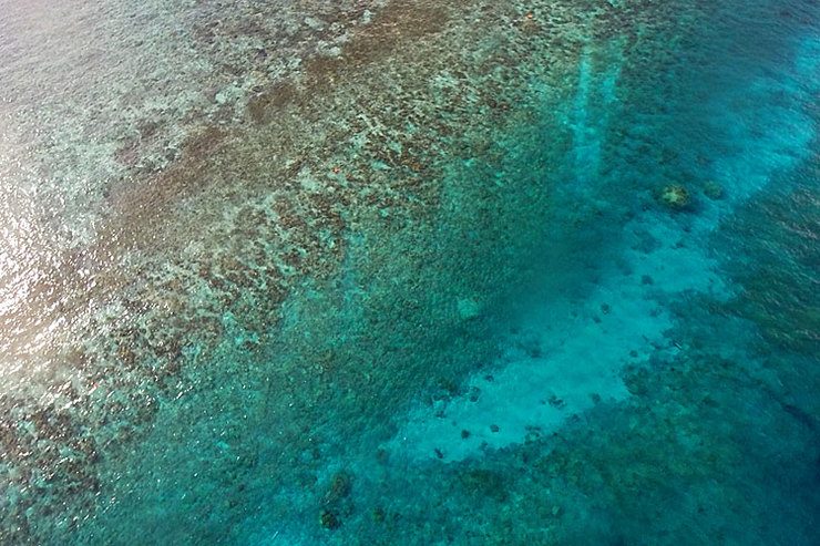
ARRAS currently uses 3 reef monitoring systems: the first uses protocol perfected by the team of Dr. Cesar Villanoy of UP MSI, using a sports kite to provide bird’s-eye images of sites – perfect for damage assessments. A GPS unit, stabilizer and GoPro camera are rigged 50 feet below the kite, which is towed by a boat or led by a ground team. The camera shoots high-resolution pictures each half-second and needs just one perfect shot – right above target, with minimal glare or obstruction.
“The kite needs enough wind to lift the camera payload. Without wind, we need to run the boat at 12 kilometers per hour so the kite can fly. We’ve used weather balloons to operate in areas with weak winds. We’re also considering drones,” says ARRAS researcher and physicist Laurice Jeanette Dagum.
The second system is called the “teardrop,” from the shape of its plexiglass camera housing. Built by Mapua engineers led by Engineer John Judilla, it is slowly pulled along by a boat. It sports a GPS unit plus a GoPro camera, which takes 6-second video clips that are stitched to form a reef mosaic. Used for spots about 5 meters deep, teardrops have been used to survey at least 22 sites around the country.
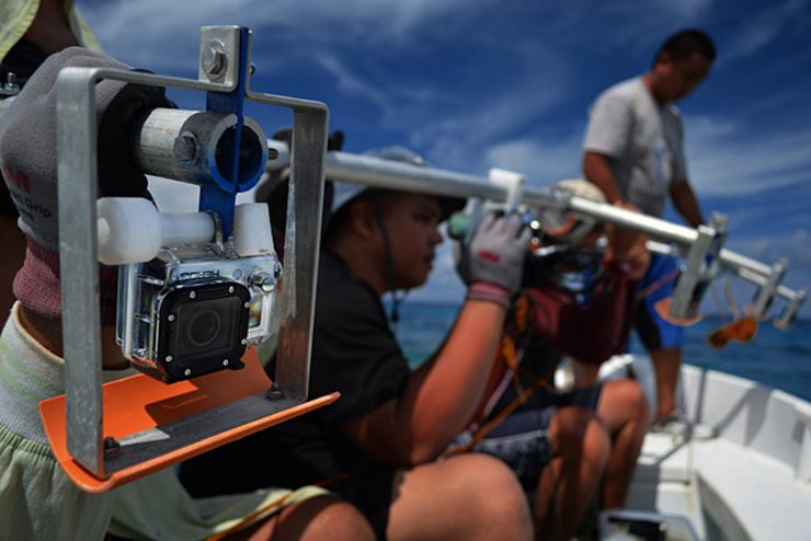
The third and most impressive is the camera array – a 4-meter aluminum rig featuring a GPS and 5 downturned GoPros spaced a meter apart. Each GoPro continuously shoots video, all stitched together to provide a comprehensive, easily-reviewable image of the sea floor.
The key to ARRAS is the ability to stitch and deduce data from images. This is where Engineer Francis Corpuz comes in. For his Master’s thesis, Corpuz developed software to automatically stitch videos of coral reefs far better than existing programs like Microsoft ICE and Autostitch. The stitched videos can be geotagged and directly uploaded on Google Earth.
A race against time
The day’s work done, we review images aboard WWF’s research vessel, the M/Y Navorca. Dr Soriano and I chat over a cup of brew.
“Our dream is to create an atlas of Philippine coral reefs by surveying 10,000 of the 27,000 square kilometers of Philippine reefs. Since 2010, we’ve covered about 400 square kilometers – but since many coastal habitats are in decline, it’s a race against time,” Dr Soriano says.
One solution is to share ARRAS technology and skills to all 21 Philippine universities with marine science programs. “It will take us 1000 days to do this alone. With each school participating though, just 47 working days are needed. This is what we call citizen science – empowering schools, local governments and communities to both study and steward their own reefs. We can key in our maps directly onto Google Earth – meaning anyone can see how our reefs are doing. It is freeware – and a whole new way of looking at our seas.”
On her laptop, we study the grounding sites, each image worth a thousand words. The scars from both the F/V Min Long Yu and the USS Guardian (which destroyed 2345 square meters of South Atoll in January 2013) are still fresh. The Philippines filed a $1.3-million request for compensation from the US government on June 13, 2014. The Chinese government has been mum about its grounding incident.
I ask Dr Soriano what she thinks of the damage. “Just give them time. Leave them alone, the way we let a damaged forest heal itself. Remember that the human timeframe is far different from the ecological timeframe. With protection, Tubbataha will recover. Nature is more resilient than we think.”
Research is a never ending process. The time series data files that the Tubbataha Management Office maintains provides a rich source of information to give us vital clues on how best to keep our oceans productive in a climate-defined future.
– Rappler.com
Gregg Yann is the Communications Manager and Media Manager for World Wide Fund for Nature (WWF-Philippines).
Add a comment
How does this make you feel?
There are no comments yet. Add your comment to start the conversation.