SUMMARY
This is AI generated summarization, which may have errors. For context, always refer to the full article.

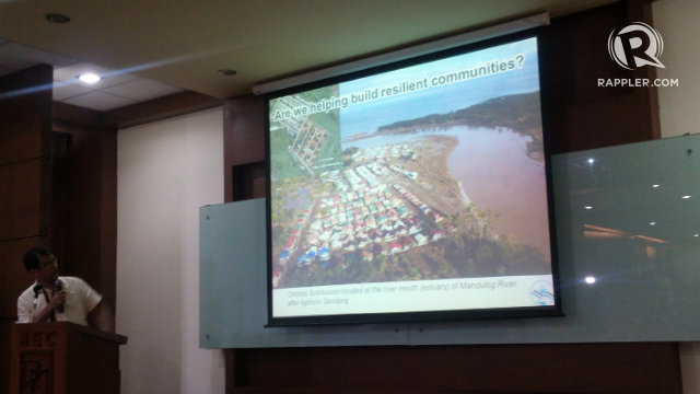
MANILA, Philippines – On December 2011, more than 1000 died in the province of Cagayan de Oro (CDO) City due to massive flooding caused by tropical storm Sendong (international codename Washi). A year later, typhoon Pablo entered Cagayan de Oro. This time, there were no casualties recorded in the city.
The local government of Cagayan de Oro was better prepared when typhoon Pablo hit their province.
This was shared by CDO Engr. Elpidio Paras in the University of the Philippines’ Disaster Risk and Exposure Assessment for Mitigation (UP DREAM) Program Report to the Stakeholders held on Thursday, October 17 at the UP National Engineering Center. Present at the program report were representatives from local government units across the country.
“Important yung information at `yung early warning,” Paras shared. (The information and early warning were important.)
Because the local government unit (LGU) was informed early about the route and the possible extent of flooding through the Light Detection and Ranging (LiDAR) mapping technology, they were able to warn their citizens to evacuate on time.
The city of Cagayan de Oro was one of the first local government units to test the flood hazard maps generated through LiDAR. (READ: DREAM LiDAR project to aid in disaster management)
LiDAR based 3D maps
Barely two years following its launch in December 2011, the DREAM team has already completed acquiring floodplain data for 17 of the total 18 critical river basins across the country.
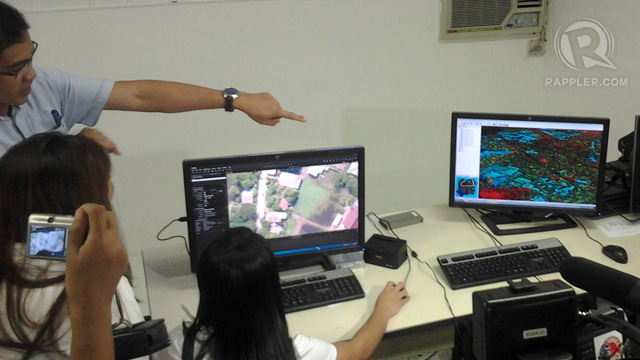
The team used LiDAR technology to create detailed 3D topographic maps of the river basins. In LiDAR, Laser scanners mounted on an airplane maps the surface landscape with pinpoint accuracy. This aids in determining areas prone to flooding and population density.
With the 3D flood hazard maps created through LiDAR, LGUs will know beforehand about the extent of flooding typhoons may bring. This will be integrated to the country’s flood early warning system.

The DREAM team started scanning the country’s river basins using LiDAR in November 2012. According to Lagmay, the flood model will be sourcing data from the 714 new weather sensors strategically installed around the country.
So far, they have generated 3D flood hazard maps for the flood plains of Marikina, Davao Oriental, Pamganga, Iponan, Mandulog, Cagayan de Oro and Compostella Valley.
Beyond its primary function to capacitate local government units to respond to typhoons and disasters, LiDAR technology may also be used for other purposes.
According to Enrico Paringit, program leader of UP DREAM, LiDAR technology can also be used for resource and inventory assessment, infrastructure planning, monitoring and governance. (READ: Are we ready for another Ondoy?)
Understanding the audience
However, Lagmay noted that information, such as the LiDAR-based maps, would be useless without the support of the people. (READ: Project Agos: A call to action)
“Hindi po lang po mga LGUs ang gumagawa ng trabaho. Lahat po ay may problema at lahat tayo ay dapat nagtutulungan,” Lagmay said. (It shouldn’t be the LGUs to do all the work. We all have concerns and we all should help address them.)
Lagmay recalled that when he tweeted information about the path of Typhoon Pablo, he only got a little over 20 retweets and only 2 favorites. This is a far cry from Mario Maurer’s “good afternoon” tweet which was posted around the same time. It got a total of 480 retweets and favorites.
“Hindi lang siyensa ang kailangan intindihin, kailangan din intindihin pati ang kultura ng mga tao,” Lagmay said. (We shoudn’t just understand the science, we should also understand the culture of the people.)
In order to further educate and engage citizens, Lagmay said they are considering finding a “disaster ambassador.” – Rappler.com
Add a comment
How does this make you feel?
There are no comments yet. Add your comment to start the conversation.