SUMMARY
This is AI generated summarization, which may have errors. For context, always refer to the full article.

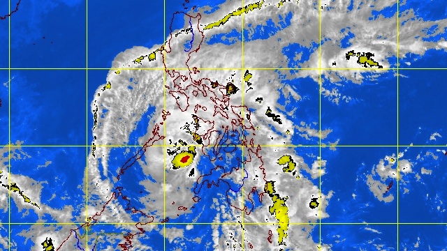
MANILA, Philippines – Typhoon “Pablo” weakened further and storm signal #3 was lifted over affected areas in Mindanao as the storm moves over the Sulu Sea toward northern Palawan, weather bureau PAGASA said on Tuesday, December 4.
In its 11 pm update, PAGASA noted that as of 10 pm “Pablo” was located 145 km Southwest of Iloilo (9.9°N, 121.4°E), with maximum sustained winds of 140 km/h and gusts of up to 170 km/h.
The typhoon is moving Northwest at 24 km/h and by Wednesday morning it is expected to be 355 km West of Coron, Palawan.
“Pablo” will be 750 West of Metro Manila and outside of the Philippine Area of Responsibility by Thursday morning.
At least 73 people have been reported dead and almost 60,000 have fled their houses after the worst typhoon to hit the Philippines this year.
Storm signal #3 lifted over Mindanao
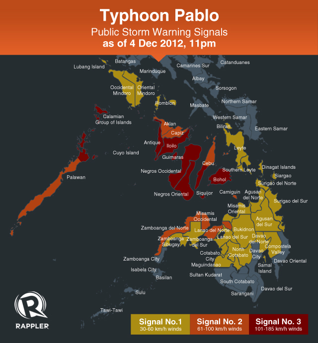
Areas in Mindanao are no longer under public storm signal warning #3 (101-185 km/h winds in the next 18 hours):
- Northern Palawan including Calamian group of islands
- Antique
- Iloilo
- Guimaras
- Bohol
- Siquijor
- Southern Cebu
- Negros Oriental
- Negros Occidental
Storm signal #2 (61-100 km/h winds in the next 36 hours) is in place for:
- Rest of Palawan
- Aklan
- Capiz
- Rest of Cebu
- Lanao del Norte
- Misamis Occidental
- Zamboanga del Norte
- Camiguin
Finally, storm signal #1 (45-60 km/h winds in the next 48 hours) applies to:
- Occidental Mindoro including Lubang Island
- Oriental Mindoro
- Romblon
- Leyte including Biliran
- Southern Leyte
- Camotes Island
- Zamboanga del Sur including Sibugay
- Surigao del Norte
- Surigao del Sur
- Dinagat
- Agusan del Sur
- Agusan del Norte
- Bukidnon
- Misamis Oriental
- Lanao del Sur

Big waves, storm surges
The estimated rainfall within the 400 km diameter of the typhoon is 10-18 mm/h (heavy-intense) and residents living in low-lying and mountainous areas in affected regions are alerted against possible flash floods and landslides.
PAGASA warned people in coastal areas under storm signals #3 and #2 to expect big waves and storm surges generated by “Pablo.”
Fishing boats and other small vessels should still not venture out in the eastern seaboards of Mindanao and Visayas. – Rappler.com
Add a comment
How does this make you feel?
There are no comments yet. Add your comment to start the conversation.