SUMMARY
This is AI generated summarization, which may have errors. For context, always refer to the full article.

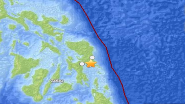
MANILA, Philippines – A 5.4 magnitude quake was recorded at 9:48 pm in parts of Samar and Leyte on Saturday, January 19, according to the US Geological Survey (USGS).
It was felt 18 km north northeast of Lawaan and 35 km south southwest of Borongan in Samar, as well as 38 km east of Panalanoy and 39 km east of Tacloban in Leyte.
The quake, which had a depth of 81.3 km, was likewise felt 599 km southwest of Manila, according to the USGS. – Rappler.com
Add a comment
How does this make you feel?
There are no comments yet. Add your comment to start the conversation.