SUMMARY
This is AI generated summarization, which may have errors. For context, always refer to the full article.
CEBU CITY, PHILIPPINES – Local government units should make use of geohazard maps available for free to better prepare for disasters, the Central Visayas’ geosciences head reminded mayors again.
According to a 2018 data, over 250 barangays in Cebu are prone to landslides.
Geosciences chief for Central Visayas Al Berador said they have “more than enough” data to help local officials prepare for disasters.
The Mining and Geosciences Bureau is an agency under the Department of Environment and Natural Resources (DENR).
“These hazard maps are available online and free to use. I encourage our LGU chiefs to come to our office so we can map out where they are in your respective towns,” Berador said during a press conference on Wednesday, March 11.
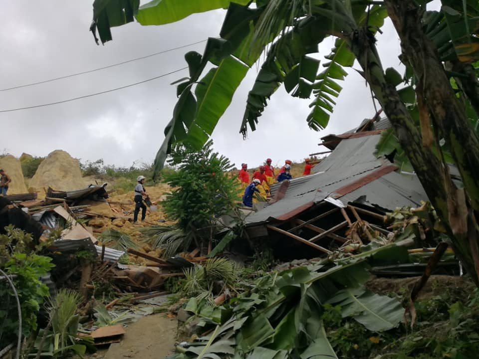
In September 2018, Naga City was hit by a landslide which resulted in the death of over 56 residents. This occured after continuous rain poured on the heavily-mined mountain in the southern Cebu town. (READ: Naga, Cebu landslide death toll jumps to 56)
These maps had already been available long before the landslide. The bureau had been reminding LGUs to use the hazard maps to prepare as early as 2012.
The maps went online in 2015.
But there have been problems in loading the maps from computers with slow internet connections or the maps being offline.
“If they bring a USB to our office, we can
give them a soft copy for free or a printed copy for a fee,” berador said.
Berador said data and planning during the dry season should help LGUs prepare for disasters when rainy season comes around in June.
Residents of Naga City filed a class suit against the company operating in that hillside, APO-Cemex after the landslide. That suit was junked in November, according to a report in SunStar Cebu.
According to Mining and Geosciences Bureau chief Armando Malicse, Central Visayas is home to at least 10 large surface or open pit mines.
While permits for new surface mining operations have been suspended since the term of former President Benigno Aquino III, those existing have not been revoked or suspended.
He said the bureau is focusing now in ensuring compliance with environmental regulations and protection.
“This means involving the community, LGUs and NGOs,” the mining chief added.
To prevent future disasters and environmental damage, he encouraged the public to report illegal mining to the LGUs, the provincial government or the DENR.
“Although the problem is not as big here as it is in Mindanao, we want to control it and need the public’s help to do that,” Malicse said in Cebuano. – Rappler.com
Add a comment
How does this make you feel?
There are no comments yet. Add your comment to start the conversation.