SUMMARY
This is AI generated summarization, which may have errors. For context, always refer to the full article.

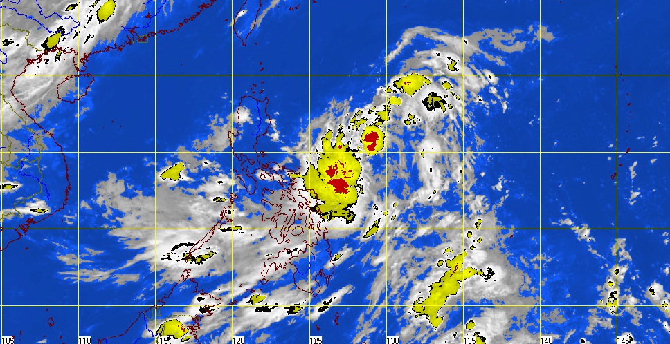
MANILA, Philippines — “Dindo” has intensified into a tropical storm, state weather bureau Pagasa said on Tuesday, June 26.
Pagasa said “Dindo” will aggravate the Southwest Monsoon, bringing occasional rains over Southern Luzon. Visayas and Mindanao can expect frequent rains over the Western sections.
No public storm warning signals were raised in the mentioned areas.
The state weather bureau, however, warned residents to watch out for possible flashfloods and landslides. Fishing boats and small seacrafts were also cautioned to stay away from the Eastern Seaboards of Luzon and Visayas because of big waves caused by “Dindo” and the Southwest Monsoon.
As of 10pm Tuesday, “Dindo” was estimated to be 540 km East Northeast of Virac, Catanduanes.
Pagasa reported maximum sustained winds of 65 kph near the center and gustiness of up to 80 kph. The tropical storm is expected to move West Northwest at 19 kph.
Rainfall is expected to range from 10-15 millimeters per hour inside the 400 km diameter of the storm.
It is expected to be 370 km East Northeast of Casiguran, Aurora by Wednesday evening. By Thursday evening, it is expected to be 130 km Southeast of Basco, Batanes. On Friday, it is expected to be 320 km North Northwest of Basco, Batanes.
The next bulletin on “Dindo” will be released tomorrow, June 27, at 11am. -Rappler.com
Click on the links below for related stories:
- ‘Dindo’ dumping heavy rain over N. Luzon
- ‘Dindo’ maintains strength, moves towards N. Luzon
- ‘Dindo’: Signal No. 2 over Cagayan, Isabela
- Tropical depression ‘Dindo’ threatens Luzon
Elsewhere in Rappler:
Add a comment
How does this make you feel?
There are no comments yet. Add your comment to start the conversation.