SUMMARY
This is AI generated summarization, which may have errors. For context, always refer to the full article.
What’s the weather like in your area? Tweet us the situation: Use #weatheralert and tag @rapplerdotcom
MANILA, Philippines – A slightly weaker Typhoon Hanna (international name Soudelor) is likely to enhance monsoon rains in different parts of the country, said the Philippine Atmospheric, Geophysical, and Astronomical Services Administration (PAGASA).
Hanna remains at sea and is not expected to make landfall in the Philippines.
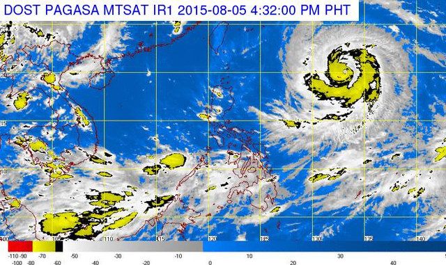
The typhoon was spotted 1,235 kilometers east of Calayan, Cagayan in Northern Luzon at 4 pm on Wednesday, August 5.
It was packing maximum sustained winds of 195 kilometers/hour and gusts of up to 230 km/h. These are weaker winds compared to the typhoon’s winds recorded earlier on Wednesday.
But the weather system as a whole has maintained its speed. It continues to move west northwest at 20 km/h.
Hanna is expected to enhance the rains of the Southwest Monsoon. This means stronger rains will be felt in Mindanao, Western Visayas, and Palawan – areas currently experiencing monsoon rains.
These stronger rains can trigger landslides and flashfloods, warned PAGASA.
Metro Manila and other parts of Luzon may experience rains starting on Friday, due to Typhoon Hanna.
Hanna is expected to exit the Philippine Area of Responsibility on Saturday morning.
PAGASA has not raised public storm warning signals anywhere in the country.
Disaster officials are advised to monitor Hanna’s movements. The next bulletin on the typhoon will be released at 11 pm. – Rappler.com
Add a comment
How does this make you feel?
There are no comments yet. Add your comment to start the conversation.