SUMMARY
This is AI generated summarization, which may have errors. For context, always refer to the full article.
What’s the weather like in your area? Tweet us the situation: Use #weatheralert and tag @rapplerdotcom
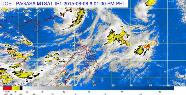
MANILA, Philippines – State weather service PAGASA reported Saturday afternoon, August 8, that the eye of Typhoon “Hanna” (international codename Soudelor) was 445 km north-northwest of Itbayat, Batanes, carrying maximum sustained winds of 130 km/h near the center and gustiness of up to 160 km/h. Hanna is forecast to move northwest at a rate of 20 km/h.
Meanwhile, a southwest monsoon is affecting the western sections of Northern and Central, Luzon, Southern Luzon, and the western section of Visayas.
PAGASA said gusty winds and rain will prevail over Batanes province. Monsoon rains, which can cause flashfloods and landslides, are expected over MIMAROPA and Western Visayas. Metro Manila, the rest of Luzon and Visayas should expect cloudy skies and light to moderate rains and isolated thunderstorms. Meanwhile, partly cloudy to cloudy skies with isolated thunderstorms will prevail over Mindanao.
Moderate to strong winds from the northwest blowing towards the west will prevail over the rest of Northern Luzon and Central Luzon. Moderate to strong winds coming from the southwest will prevail over the rest of the country. The coastal waters over the rest of the archipelago will be moderate to rough. – Rappler.com
Add a comment
How does this make you feel?
There are no comments yet. Add your comment to start the conversation.