SUMMARY
This is AI generated summarization, which may have errors. For context, always refer to the full article.
What’s the weather like in your area? Tweet us the situation: Use #weatheralert and tag @rapplerdotcom
MANILA, Philippines – A new typhoon is likely to enter the Philippine Area of Responsibility on Tuesday, August 18, according to the Philippine Atmospheric, Geophysical, and Astronomical Services Administration (PAGASA).
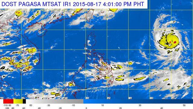
Typhoon Goni, currently over the northwestern area of the Pacific Ocean, was spotted 1,945 kilometers east of Luzon at 4 pm on Monday, said the agency in its bulletin.
It will likely be inside the PAR by Tuesday afternoon at which time it will be given the local name “Ineng” and will be the second typhoon in the country during the month of August.
But the typhoon will not be felt by any part of the country in the next 3 days, said PAGASA. Only the Intertropical Convergence Zone affecting Visayas and Mindanao will bring rains from Tuesday to Thursday.
Weather monitoring group Weather Philippines says that wind convergence along the trough of the typhoon may bring scattered rainshowers in Palawan, Visayas, and Mindanao.
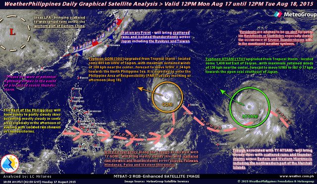
Goni currently packs maximum sustained winds of 170 kilometers/hour (km/h) and gusts of up to 205 km/h.
It is predicted to move west northwest at a speed of 20 km/h.
Another typhoon was spotted in the northwestern area of the Pacific Ocean, closely tailing Typhoon Goni. However, Typhoon Atsani is not expected to enter the PAR, according to US weather station Joint Typhoon Warning Center (JTWC).
It is likely to move toward the seas southeast of Japan, according to JTWC data. – Rappler.com
Add a comment
How does this make you feel?
There are no comments yet. Add your comment to start the conversation.