SUMMARY
This is AI generated summarization, which may have errors. For context, always refer to the full article.
What’s the weather like in your area? Tweet us the situation: Use #weatheralert and tag @rapplerdotcom
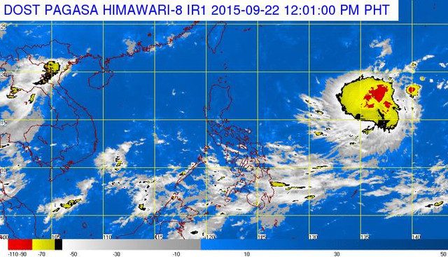
MANILA, Philippines – A tropical depression has been spotted outside of the Philippine Area of Responsibility (PAR) hovering over ocean waters east of Luzon.
This was reported by the Philippine Atmospheric Geophysical and Astronomical Services Administration (PAGASA) in their 11 am weather advisory on Tuesday, September 22.
The weather system is expected to enter the PAR on Thursday morning, September 24, when it is likely to be 1,450 km east northeast of Casiguran, Aurora. It will then be given the local name “Jenny.”
The tropical depression was spotted 2,020 kilometers east of Luzon at 11 am, Tuesday. It packed maximum sustained winds of 55 kilometers/hour (km/h). It is expected to move west northwest at a speed of 15 kilometers.
After entering the PAR early Thursday, it will likely be east of Basco, Batanes on Friday morning and then curve slightly northward on Saturday morning, says PAGASA.
The weather system is expected to exit the PAR on Sunday morning.
The next update on the tropical depression will be released at 5 pm today. – Rappler.com
Add a comment
How does this make you feel?
There are no comments yet. Add your comment to start the conversation.