SUMMARY
This is AI generated summarization, which may have errors. For context, always refer to the full article.
What’s the weather like in your area? Tweet us the situation: Use #weatheralert and tag @rapplerdotcom
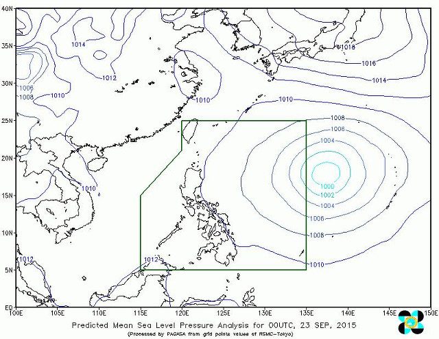
MANILA, Philippines – The tropical depression outside the Philippine Area of Responsibility has developed into a tropical storm, according to the state weather bureau.
It has been given the international name “Dujuan,” according to the Philippine Atmospheric Geophysical and Astronomical Services Administration (PAGASA) in its update released on Wednesday morning, September 23.
Dujuan now packs maximum sustained winds of 65 kilometers/hour with gusts of up to 80 km/h. But the weather system as a whole has retained its speed, moving west northwest at 15 km/h.
The storm was spotted 1,745 kilometers east of Northern Luzon.
PAGASA said on Tuesday that Dujuan is likely to enter the PAR on Thursday, September 24. It will then be given the local name “Jenny.”
The bureau had also forecasted that the storm would exit the PAR on Sunday. – Rappler.com
Add a comment
How does this make you feel?
There are no comments yet. Add your comment to start the conversation.