SUMMARY
This is AI generated summarization, which may have errors. For context, always refer to the full article.
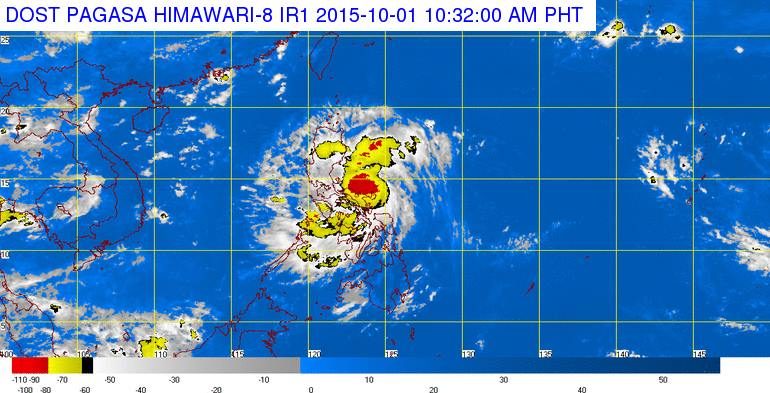
MANILA, Philippines – Parts of the country are warned of heavy rains and thunderstorms after the state weather bureau PAGASA upgraded a low pressure area in the country’s east to a tropical depression Thursday, October 1.
The low pressure area east of the country has been upgraded into a tropical depression by PAGASA, and has been given the name Kabayan, the bureau said in a bulletin late Thursday morning.
Kabayan was estimated to be 75 kilometers east of Virac, Catanduanes, with maximum winds of up to 45 km/h near the center, the bureau said.
Public storm warning signal number 1 has been raised over these areas:
- Catanduanes
- Camarines Sur
- Camarines Norte
- Aurora
- Northern Quezon including Polilio Island
The weather system is expected to bring moderate to heavy rain within its 200 km diameter, and will bring occasionally heavy rain and isolated thunderstorms in Bicol, Isabela, Aurora, Quezon, northern Palawan and Panay Island.
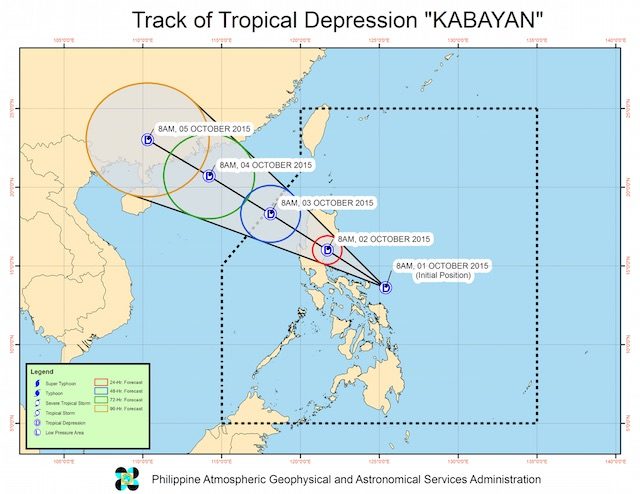
It is moving west northwest at a speed of 19 km/h, and is expected to be near Aurora by Friday morning, October 2. It is expected to cross mainland Luzon over the weekend, and will exit the Philippine Area of Responsibility by early next week.
The next bulletin on Kabayan will be issued at 5 pm Thursday. – Rappler.com
Add a comment
How does this make you feel?
There are no comments yet. Add your comment to start the conversation.