SUMMARY
This is AI generated summarization, which may have errors. For context, always refer to the full article.

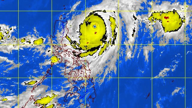
MANILA, Philippines – Typhoon “Lawin” gained strength as it advances toward northern Luzon and Batanes, weather bureau PAGASA said on Wednesday, September 26.
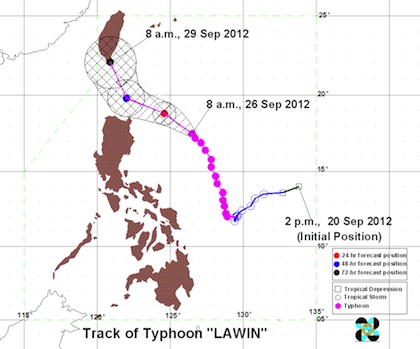
In its 11 am bulletin, PAGASA noted that as of 10 am Lawin (international codename: Jelawat) was located 435 km East of Tuguegarao (17.6°N, 126.4°E) with maximum sustained winds of 215 km/h near the center and gusts of up to 250 km/h.
The typhoon slowed down slightly and is now moving Northwest at 9 km/h and will be 290 km East of Aparri, Cagayan on Thursday morning.
Public storm signal warnings #2 (61-100 km/h winds) are in place over Batanes and Cagayan, including the Calayan and Babuyan groups of islands.
Meanwhile, public storm signal warnings #1 (30-60 km/h winds) apply to:
- Ilocos Norte
- Kalinga
- Apayao
- Abra
- Isabela

The weather bureau alerted residents living in low lying and mountainous areas under public storm warning signal #2 and #1 against possible flashfloods and landslides.
Likewise, those living in coastal areas under public storm warning signal #2 could experience against big waves or storm surges generated by the typhoon, PAGASA added.
The estimated amount of rain is 10-25 mm per hour (heavy-intense) within the 850 km diameter of Lawin. – Rappler.com
Add a comment
How does this make you feel?
There are no comments yet. Add your comment to start the conversation.