SUMMARY
This is AI generated summarization, which may have errors. For context, always refer to the full article.

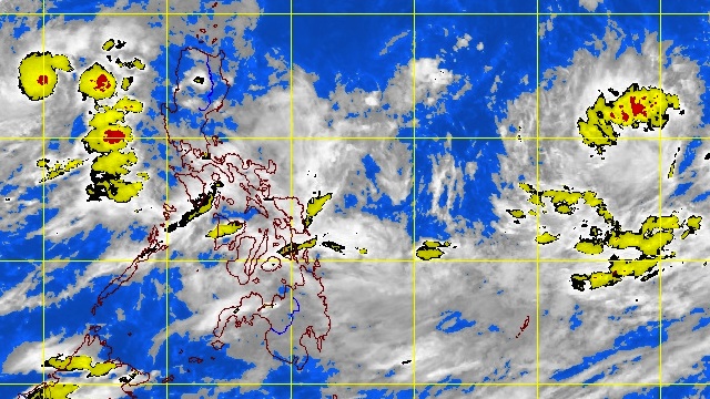
MANILA, Philippines – Two days after typhoon “Lawin” exited the Philippines, weather bureau PAGASA is closely monitoring another weather disturbance off Luzon.
In its 5 pm bulletin on Monday, October 1, PAGASA said that a Low Pressure Area (LPA) first spotted on Saturday was as of 2 pm located 530 km West of Aurora, Luzon (17.0ºN, 115.0ºE).
The weather bureau noted that the LPA may dissipate or develop into a tropical depression as it moves into the Philippine Area of Responsibility (PAR) in the next 24-48 hours.
If it does intensify into a tropical depression and enters the PAR, it will be called “Marce.”
Lawin (international codename: Jelawat) left at least two people dead and more than 180 injured in Japan over the weekend before passing out into the Pacific. – Rappler.com
Add a comment
How does this make you feel?
There are no comments yet. Add your comment to start the conversation.