SUMMARY
This is AI generated summarization, which may have errors. For context, always refer to the full article.
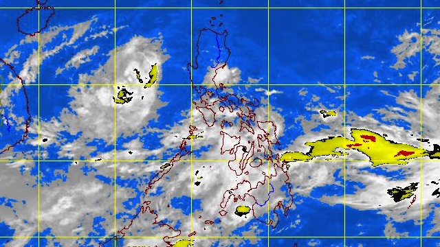
MANILA, Philippines – Tropical storm “Marce” started to move away from western Luzon and public storm signal warning #1 was lifted over Bataan and Zambales, weather bureau PAGASA said on Thursday, October 4.
In its 5 am bulletin, PAGASA noted that as of 4 am Marce was located 300 km West of Iba, Zambales (15.1°N, 116.8°E), with maximum sustained winds of 95 km/h and gusts of up to 120 km/h.
The tropical storm is moving West at 5 km/h and by Friday morning it is expected to be 420 km West of Iba and outside of the Philippine Area of Responsibility (PAR).
Storm signal #1 was lifted for Bataan and Zambales, although fishing boats and other small vessels are still advised to not venture out to sea along the western seaboard of Luzon due to big waves generated by Marce.
The estimated rainfall within the 400 km diameter is 10-25 mm per hour (heavy-intense).
Weather forecast
Although now farther away from the coast, the tropical storm is still enhancing the effects of the southwest monsoon and will bring moderate to heavy rain to Calabarzon, Mimaropa and Visayas.
Metro Manila, central Luzon, Bicol and the Zamboanga peninsula are expected to have occasional light to moderate rain, will the rest of the country will have party cloudy skies with brief thunderstorms.
Moderate to strong winds blowing from Northeast to East will prevail over the Cagayan Valley and Ilocos region, while in the rest of Luzon and western Visayas the wind is forecast to blow Southwest-South.
The coastal waters along these areas will be moderate to rough.
Elsewhere, winds sill be light to moderate blowing from Southwest to West, with slight to moderate seas, the weather bureau said
Here is PAGASA’s 24-hour public weather bulletin:
– Rappler.com
Add a comment
How does this make you feel?
There are no comments yet. Add your comment to start the conversation.