SUMMARY
This is AI generated summarization, which may have errors. For context, always refer to the full article.

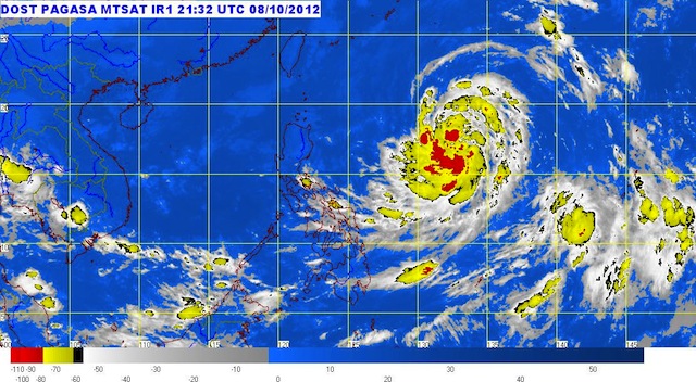
MANILA, Philippines (UPDATED) – Weather disturbance Nina (Prapiroon) has been upgraded into a typhoon but is still far to affect any part of the country, state weather bureau PAGASA said Tuesday, October 9.
Typhoon Nina was last located 1,015 km east of Cagayan (17.6°N, 132.4°E), carrying maximum sustained winds of 120 km/h near the center and wind gusts of up to 150 km/h.
It is currently moving west at a speed of 11 km/h. By Wednesday morning, it is forecast to be 770 km east of Aparri, Cagayan, and by Thursday, it will be 690 km east of Basco, Batanes.
Within the 600 km diameter of the typhoon, the bureau said heavy to intense rainfall (10-20 mm/h) is expected.
While Nina has yet to affect parts of the country, occasional light to moderate rain will be experienced in Bicol, Visayas, and the Davao region, with the occasional thunderstorm.
Metro Manila and the rest of the country, the bureau said, will have partly cloudy skies with brief rainshowers and thunderstorms.
Moderate to strong winds from the north to northwest will blow over Luzon, while winds will come from the northwest to west over the eastern sections of Visayas and Mindanao.
Here is the 24-hour public weather forecast, issued at 5 am.
PAGASA 24-Hour Public Weather Forecast, 9 October 2012, 5am
– Rappler.com
Add a comment
How does this make you feel?
There are no comments yet. Add your comment to start the conversation.