SUMMARY
This is AI generated summarization, which may have errors. For context, always refer to the full article.
What’s the weather like in your area? Tweet us the situation: Use #weatheralert and tag @rapplerdotcom.
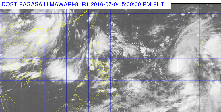
MANILA, Philippines – State weather bureau PAGASA continues to monitor a tropical storm with the international name Nepartak, which is still outside the Philippine Area of Responsibility (PAR).
As of 4 pm on Monday, July 4, Nepartak was located 1,765 kilometers east of Virac, Catanduanes, moving northwest at a much faster 30 kilometers per hour (km/h). It had been moving at just 7 km/h on Sundafy, July 3.
Nepartak will be given the local name Butchoy when it enters PAR on Tuesday, July 5.
The tropical storm now has maximum winds of 85 km/h and gustiness of up to 100 km/h. PAGASA told Rappler that Nepartak could still strengthen into a typhoon.
It is not expected to directly hit any province since it is moving upward in the direction of Taiwan, but would enhance the southwest monsoon. In the past, enhanced monsoon rains triggered floods in the country.
On Monday afternoon, newly appointed National Disaster Risk Reduction and Management Council (NDRRMC) executive director Undersecretary Ricardo Jalad called on the local government units to be on alert for possible floods and landslides due to heavy rainfall.
Jalad met with representatives of other agencies in Camp Aguinaldo, Quezon City on Monday to conduct a pre-disaster risk assessment (PDRA) meeting.
Tuesday weather forecast
Meanwhile, light to moderate rains and thunderstorms will persist on Tuesday, even before the tropical storm enters PAR.
In its bulletin issued 5 pm on Monday, PAGASA said the regions of Calabarzon, Mimaropa, and Western Visayas, as well as the provinces of Cagayan, Zambales, and Bataan will be affected.
The rest of the country, including Metro Manila, will have isolated rains or thunderstorms.
The rains are due to the intertropical convergence zone (ITCZ) affecting Southern Luzon and the Visayas.
PAGASA said the low pressure area (LPA) east of Catarman, Northern Samar already dissipated Monday morning.
| City | Forecast | Temperature Range |
|
| Metro Manila |  |
Partly cloudy to cloudy skies with isolated rainshowers or thunderstorms | 24°C-32°C |
| Tuguegarao |  |
Cloudy with rainshowers and thunderstorms | 25°C-34°C |
| Laoag | |
Partly cloudy to cloudy skies with isolated rainshowers or thunderstorms | 24°C-32°C |
| Baguio | |
Partly cloudy to cloudy skies with isolated rainshowers or thunderstorms | 16°C-23°C |
| Subic/Olongapo; Clark/Angeles | |
Cloudy with rainshowers and thunderstorms | 24°C-32°C |
| Tagaytay | |
Cloudy with rainshowers and thunderstorms | 23°C-28°C |
| Lipa | |
Cloudy with rainshowers and thunderstorms | 23°C-30°C |
| Legazpi | |
Partly cloudy to cloudy skies with isolated rainshowers or thunderstorms | 25°C-32°C |
| Puerto Princesa | |
Cloudy with rainshowers and thunderstorms | 25°C-32°C |
| Iloilo/Bacolod | |
Cloudy with rainshowers and thunderstorms | 24°C-31°C |
| Metro Cebu | |
Partly cloudy to cloudy skies with isolated rainshowers or thunderstorms | 25°C-31°C |
| Tacloban | |
Partly cloudy to cloudy skies with isolated rainshowers or thunderstorms | 25°C-30°C |
| Cagayan de Oro | |
Partly cloudy to cloudy skies with isolated rainshowers or thunderstorms | 24°C-33°C |
| Valencia | |
Partly cloudy to cloudy skies with isolated rainshowers or thunderstorms | 19°C-29°C |
| Metro Davao | |
Partly cloudy to cloudy skies with isolated rainshowers or thunderstorms | 25°C-34°C |
| Zamboanga | |
Partly cloudy to cloudy skies with isolated rainshowers or thunderstorms | 24°C-33°C |
– With a report from Voltaire Tupaz/Rappler.com
Add a comment
How does this make you feel?
There are no comments yet. Add your comment to start the conversation.